
Images


February 5, 2020 - Snow in Pennsylvania and New York
 Tweet
Tweet
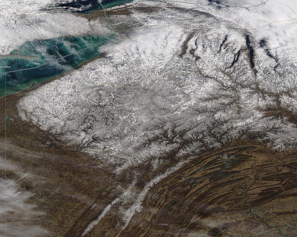
A wintery scene greeted NASA’s Terra satellite as it passed over New York and Pennsylvania on February 3, 2020. The Moderate Resolution Imaging Spectroradiometer (MODIS) on board Terra captured a true-color image that snowy scene on that same day.
A sweeping storm brought less than an inch of fresh snow to Buffalo, New York, on February 2, and light snow over much of New York and some parts of Pennsylvania. Buffalo sits near the northeastern tip of Lake Erie and is partially covered with clouds in this image. Snow surrounds the Finger Lakes of New York state in the northeast. A circular area near the center of the image marks the Adirondack Mountains. Further south snow drapes across part of the sweeping peaks of the Appalachian Mountains of Pennsylvania.
Additional snow is expected across this region over the next several days as a major winter storm rolls across the Midwest toward the Northeast. According to Weather Underground, Buffalo can expect about 2.6 inches of fresh snow on February 5, with an additional 2.7 inches of precipitation—potentially a wintery mix of rain and snow— on February 6.
Image Facts
Satellite:
Terra
Date Acquired: 2/3/2020
Resolutions:
1km (219.2 KB), 500m (668.3 KB), 250m (631.9 KB)
Bands Used: 1,4,3
Image Credit:
MODIS Land Rapid Response Team, NASA GSFC
