
Images


February 11, 2020 - Tropical Cyclone Uesi off Vanuatu
 Tweet
Tweet
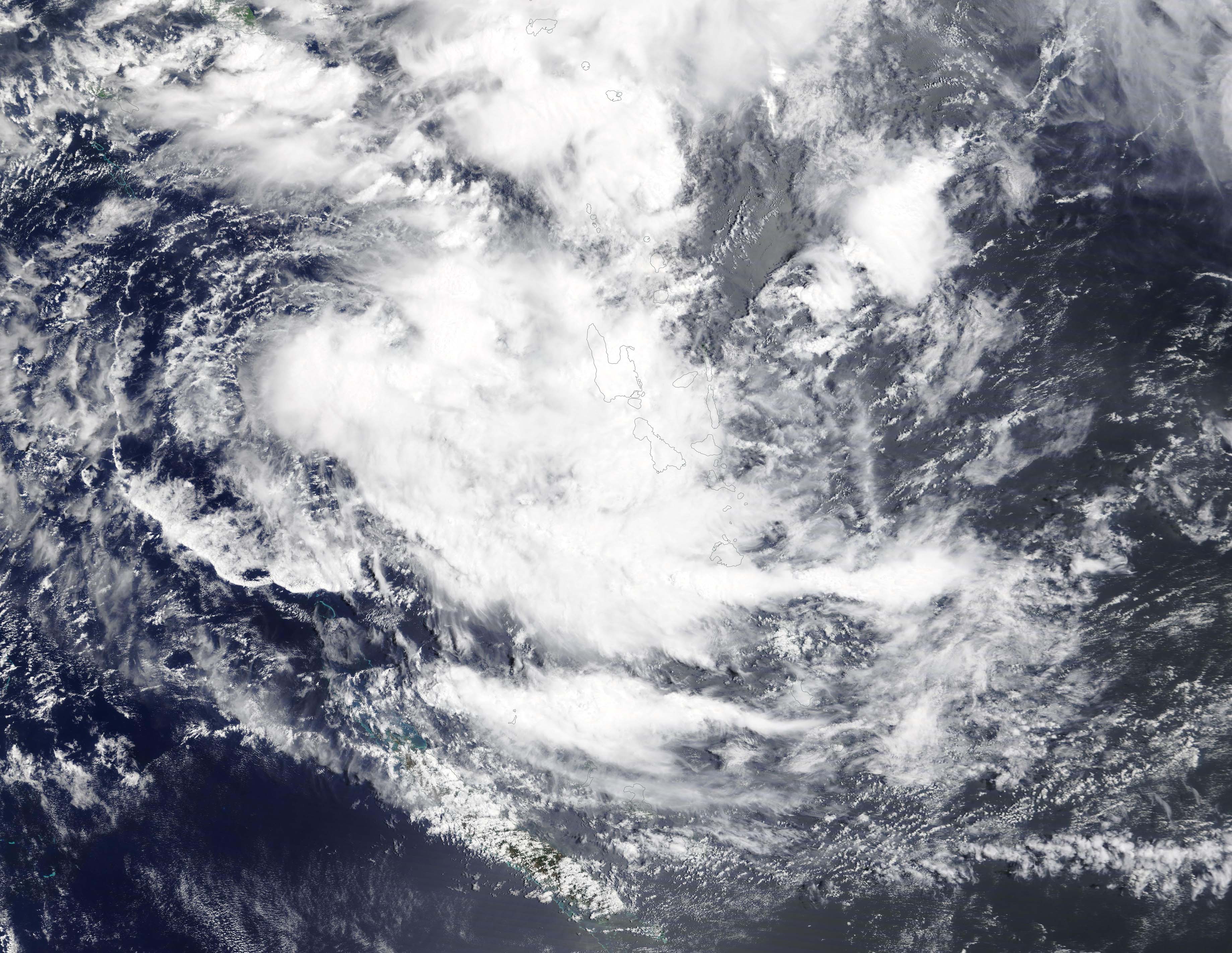
Tropical Cyclone Uesi was impacting Vanuatu on February 10, 2020, bringing rain and high winds to the island. The Moderate Resolution Imaging Spectroradiometer (MODIS) on board NASA’s Terra satellite acquired a true-color image of the storm on that same day.
The Vanuatu Meteorology and Geo-Hazards Department (VMGD), in Port Vila issued an update on Uesi at 7 a.m. EST (11 p.m. Vanuatu local time) on February 10. At that time, Tropical Cyclone Uesi was located at latitude 17.6 degrees south and longitude 162.4 east, or about 348 miles (560 km) west southwest of Malekula. Winds close to the center of the system were estimated near 55 mph (90 kph/50 knots) and Uesi was moving in a southwest direction. The forecast was for heavy rainfall with flash flooding over low-lying areas close to river banks, including coastal flooding in the islands in the northern and central provinces.
After leaving Vanuatu, Tropical Cyclone Uesi is expected to continue to intensify as it heads towards the coast of Australia. Although the Joint Typhoon Warning Center (JWTC) forecasts the center of the storm is expected to stay off the coast, the storm could bring high winds, rain, flooding, and high storm surge to parts of Queensland and New South Wales. These areas have been inundated from rain in recent days, making any impact from Uesi more difficult to deal with in already-flooded areas.
Image Facts
Satellite:
Terra
Date Acquired: 2/9/2020
Resolutions:
1km (345.8 KB), 500m (1 MB), 250m (4.2 MB)
Bands Used: 1,4,3
Image Credit:
MODIS Land Rapid Response Team, NASA GSFC
