
Images


March 22, 2020 - Tropical Cyclone Herold
 Tweet
Tweet
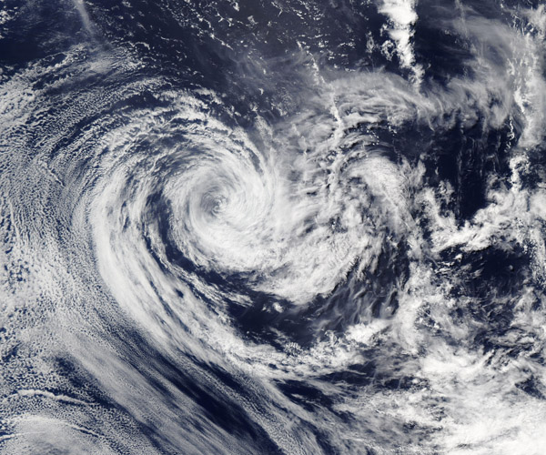
On March 19, 2020, the Moderate Resolution Imaging Spectroradiometer (MODIS) on board NASA’s Aqua satellite acquired a true-color image of a dissipating Tropical Cyclone Herold. Although Herold maintained a cloud-filled center of circulation, the convective bands associated with the storm had become thin and loosely associated with the center.
Herold formed in the Indian Ocean on March 13 as Tropical Cyclone 22S. Herold continued to strengthen as it passed close to the north-east coast of Madagascar between March 13-15. The storm brought heavy rain and flooding that affected more than 3,000 people in the Sava region. Herold reached peak strength on March 17 as it passed close to Rodrigues Island. Maximum sustained winds of 115 mph (185 km/h) were reported on that day. By March 18 the storm moved into less favorable conditions and began to weaken.
On March 19 at 4:00 p.m. EDT (2100 UTC), the Joint Typhoon Warning Center issued their final bulletin on Herold. At that time, Herold’s center was located near latitude 26.6 degrees south and longitude 73.0 degrees east, approximately 948 nautical miles east-southeast of Port Louis, Mauritius. Herold’s maximum sustained winds at the time were near 34.5 mph (55.5 km/h) making it a tropical depression.
Image Facts
Satellite:
Aqua
Date Acquired: 3/19/2020
Resolutions:
1km (675.2 KB), 500m (2 MB), 250m (5.1 MB)
Bands Used: 1,4,3
Image Credit:
MODIS Land Rapid Response Team, NASA GSFC
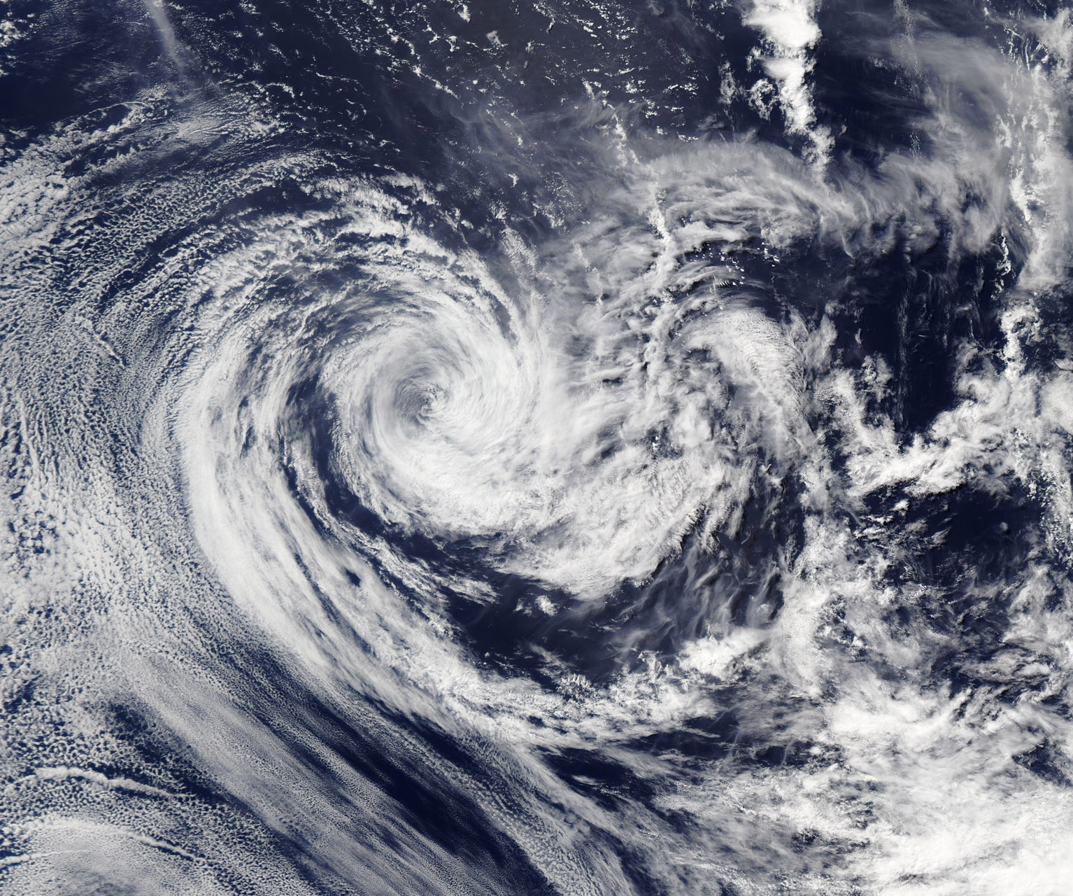
