
Images


May 13, 2020 - Localized Cloud over Hainan Island and Leizhou Peninsula, China
 Tweet
Tweet
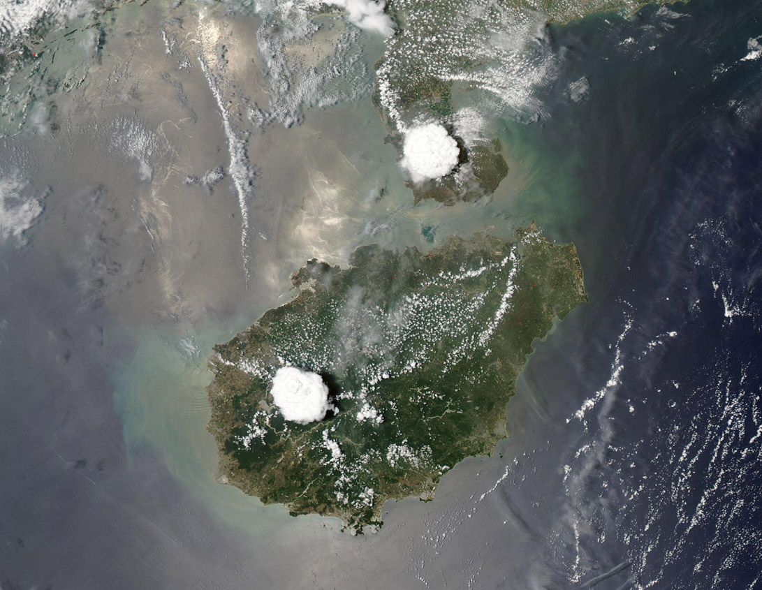
On May 11, 2020, NASA’s Aqua satellite passed over eastern China, allowing the Moderate Resolution Imaging Spectroradiometer (MODIS) on board to capture a stunning true-color image of two localized clouds over China’s Hainan Island and Leizhou Peninsula.
These isolated clouds are a type of convective cloud—clouds that form when warm, moist air rises and condenses at higher altitude. Convective clouds such as cumulus and cumulonimbus clouds, are often called “rain clouds” because they may bring substantial precipitation.
According to George J. Huffman, Ph.D., Chief of the Mesoscale Atmospheric Processes Lab at NASA Goddard Space Flight Center (GSFC) in Greenbelt, Maryland, “This is a good example of the convective storms that form during the afternoon over land areas, particularly peninsulas and islands in warm, humid climates, in response to the Sun’s heating of the land surface, compared to the temperature of the surrounding waters.”
Using the Integrated Multi-satellitE Retrievals for Global Precipitation Measurement (IMERG) half-hour data, Dr. Huffman was able to view the depiction of the rain falling out of these two vigorous convection cells on May 12. This initiated around 5:00 UTC (11:30 a.m. Local Sun Time or LST), then grew and merged over the next few hours, dissipating by 11:00 UTC (5:30 p.m. LST).
Image Facts
Satellite:
Aqua
Date Acquired: 5/11/2020
Resolutions:
1km (89.2 KB), 500m (265.9 KB), 250m (436.3 KB)
Bands Used: 1,4,3
Image Credit:
MODIS Land Rapid Response Team, NASA GSFC
