
Images


May 17, 2020 - Lakes of Manitoba
 Tweet
Tweet
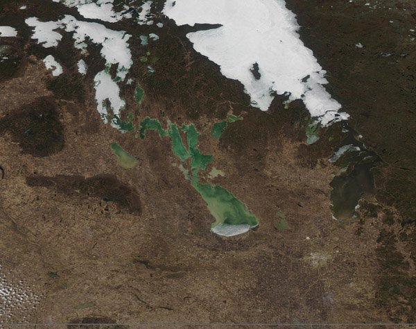
The province of Manitoba spans about 649,950 square kilometers (250,947 square miles), with nearly 15.6 percent of the surface area covered by lakes. According to World Atlas, Manitoba lays claim to 110,000 lakes.
On May 11, 2020, the Moderate Resolution Imaging Spectroradiometer (MODIS) on board NASA’s Aqua satellite acquired a true-color image focused on some of the largest lakes in Manitoba. Lake Winnipeg, the largest and longest lake, and Winnepegosis the second largest, both are still covered in ice, although snow has melted off all of the vegetation visible in the image. The southern-most part of Lake Winnepeg has cleared of ice. South of Lake Winnepegosis, sediment fills Lake Manitoba and a small crescent of ice lingers near the southern shore. Lake Manitoba is the third-largest lake in the province.
Image Facts
Satellite:
Aqua
Date Acquired: 5/11/2020
Resolutions:
1km (126.5 KB), 500m (389.1 KB), 250m (634.6 KB)
Bands Used: 1,4,3
Image Credit:
MODIS Land Rapid Response Team, NASA GSFC
