
Images


May 19, 2020 - Tropical Cyclone Amphan
 Tweet
Tweet
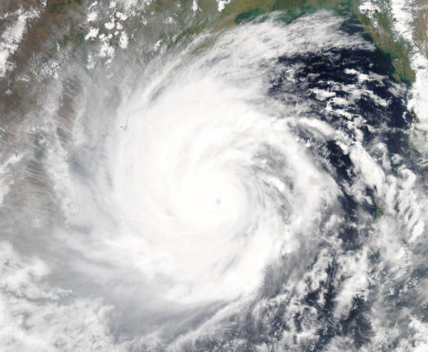
On May 18, 2020, the Moderate Resolution Imaging Spectroradiometer (MODIS) on board NASA’s Aqua satellite acquired a true-color image of Tropical Cyclone Amphan gathering strength in the Bay of Bengal as it was taking aim at India and Bangladesh. The very large storm stretched across much of the Bay of Bengal, sporting a rounded shape with convective bands spiraling into a distinct circular eye—all features of a very strong system.
Tropical Cyclone Amphan formed on Saturday, May 16 from a depression in the Bay of Bengal, quickly reached hurricane strength, and then achieved “super cyclonic storm” (wind speeds greater than 220 km/h or 136.7 mph) status on May 18. As described by WeatherUnderground, “Drawing on very warm sea surface temperatures of 31°C (88°F), high oceanic heat content, and light wind shear, Amphan bolted from minimal tropical storm strength (35 knots or 40 mph) to Category 5 equivalent strength (140 knots or 160 mph) in just 48 hours—and from minimal hurricane strength (65 knots or 75 mph) to Cat 5 equivalent strength in just 24 hours.” A Category 5 storm carries one-minute sustained winds of 252 km/h (157 mph) or higher. As of 11 am EDT on May 18, the Joint Typhoon Warning Center reported that Tropical Cyclone Amphan’s one-minute sustained winds had reached 265.5 km/h (165 mph).
According to the Joint Typhoon Warning Center (JTWC) advisory on May 19 at 0000 (May 18 at 8:00 p.m. EDT) Tropical Cyclone Amphan had weakened slightly as it began an eyewall replacement cycle, packing winds of 222.24 km/h (138 mph), keeping it as a super cyclonic storm but bringing it to Category 4 on the Saffir-Simpson Hurricane Wind Scale. Amphan was located about 430 nautical miles south-southwest of Kolkata, India and was traveling north-northeastward.
The storm is predicted to weaken slightly for the next 12 hours as the eyewall replacement is completed, then strengthen through May 19. It may weaken again before making landfall over southern West Bengal, India and southern Barisal Division, Bangladesh on May 20.
According to ReliefWeb, about 1.5 million people in Bangladesh are expected to be displaced by the storm, with about 0.7 million houses damaged or destroyed by winds, floods, or heavy storm surge. In India, the National Disaster Response Force has reportedly been deployed to help evacuate nearly 1.1 million people.
Image Facts
Satellite:
Aqua
Date Acquired: 5/18/2020
Resolutions:
1km (632.3 KB), 500m (1.9 MB), 250m (3.7 MB)
Bands Used: 1,4,3
Image Credit:
MODIS Land Rapid Response Team, NASA GSFC
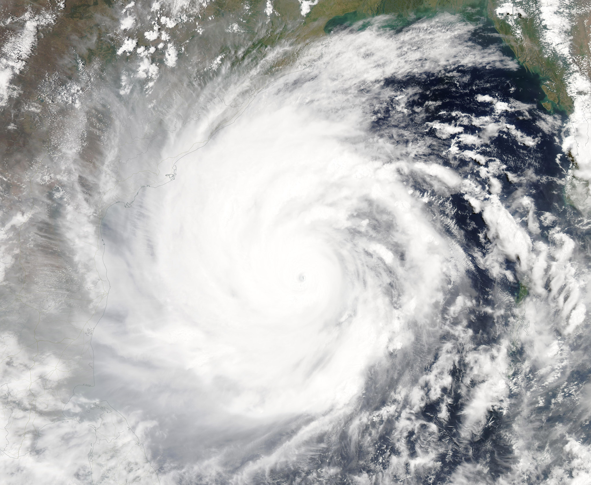
On May 18, 2020, the Moderate Resolution Imaging Spectroradiometer (MODIS) on board NASA’s Aqua satellite acquired a true-color image of Tropical Cyclone Amphan gathering strength in the Bay of Bengal as it was taking aim at India and Bangladesh. The very large storm stretched across much of the Bay of Bengal, sporting a rounded shape with convective bands spiraling into a distinct circular eye—all features of a very strong system.
Tropical Cyclone Amphan formed on Saturday, May 16 from a depression in the Bay of Bengal, quickly reached hurricane strength, and then achieved “super cyclonic storm” (wind speeds greater than 220 km/h or 136.7 mph) status on May 18. As described by WeatherUnderground, “Drawing on very warm sea surface temperatures of 31°C (88°F), high oceanic heat content, and light wind shear, Amphan bolted from minimal tropical storm strength (35 knots or 40 mph) to Category 5 equivalent strength (140 knots or 160 mph) in just 48 hours—and from minimal hurricane strength (65 knots or 75 mph) to Cat 5 equivalent strength in just 24 hours.” A Category 5 storm carries one-minute sustained winds of 252 km/h (157 mph) or higher. As of 11 am EDT on May 18, the Joint Typhoon Warning Center reported that Tropical Cyclone Amphan’s one-minute sustained winds had reached 265.5 km/h (165 mph).
According to the Joint Typhoon Warning Center (JTWC) advisory on May 19 at 0000 (May 18 at 8:00 p.m. EDT) Tropical Cyclone Amphan had weakened slightly as it began an eyewall replacement cycle, packing winds of 222.24 km/h (138 mph), keeping it as a super cyclonic storm but bringing it to Category 4 on the Saffir-Simpson Hurricane Wind Scale. Amphan was located about 430 nautical miles south-southwest of Kolkata, India and was traveling north-northeastward.
The storm is predicted to weaken slightly for the next 12 hours as the eyewall replacement is completed, then strengthen through May 19. It may weaken again before making landfall over southern West Bengal, India and southern Barisal Division, Bangladesh on May 20. According to ReliefWeb, about 1.5 million people in Bangladesh are expected to be displaced by the storm, with about 0.7 million houses damaged or destroyed by winds, floods, or heavy storm surge. In India, the National Disaster Response Force has reportedly been deployed to help evacuate nearly 1.1 million people.
Image Facts
Satellite:
Aqua
Date Acquired: 5/18/2020
Resolutions:
1km (632.3 KB), 500m (1.9 MB), 250m (3.7 MB)
Bands Used: 1,4,3
Image Credit:
MODIS Land Rapid Response Team, NASA GSFC
