
Images


August 1, 2020 - Fires in South America
 Tweet
Tweet
The fire season in Brazil’s Amazon has blazed to an early start, with reports of a rise of almost 20 percent in new fires in June 2020, which would be a 13-year high for the month. According to a July 2 report by BBC News, Brazil’s National Institute for Space Research (INPE) recorded 2,248 fires using satellite imagery in June 2020 as opposed to 1,880 fires in June 2019. In addition, Statista.com reports that from January 1st to July 26th of 2020, a total of 35,632 wildfire outbreaks were identified in Brazil. In response to the increased number of blazes—and from increasing international pressure from governments, business, and environmental groups— on July 9 Brazil declared a 120-day fire ban.
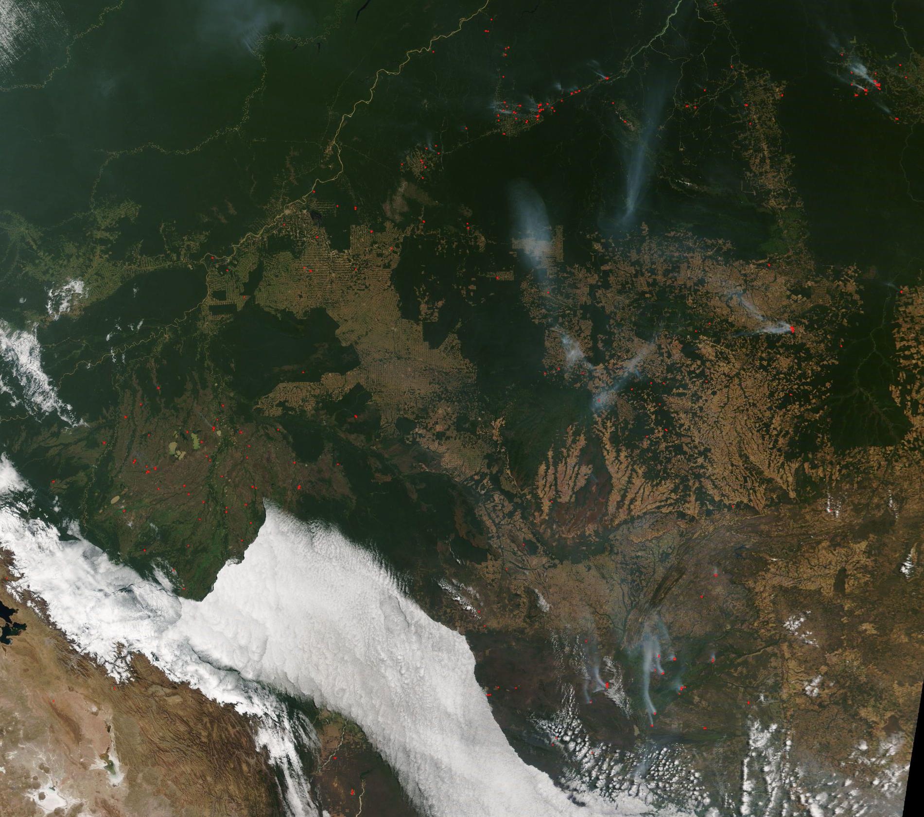
On July 30, the Moderate Resolution Imaging Spectroradiometer (MODIS) on board NASA’s Terra satellite acquired a true-color image of fire and smoke in Brazil. From the north moving clockwise the land belongs to the following states: Amazonas, Pará, Mato Grosso, and Rondônia. Fires are located in all states, with the largest clusters primarily in the state of Amazonas.
One area surrounded with many large fires is Apuí, located near the top of the image. Another notable set of blazes can be seen in the northeast (upper right). These burn near or on the Terra do Meio Ecological Station in Pará. Created in 2005 to conserve nature and support scientific research, the station is classified as an IUCN protected area category 1a (strict nature reserve). In the past, cattle operations had moved into the Station illegally, leading to removal of thousands of head of cattle and the expulsion of many farmers in 2008. In recent years, it appears that these operations have begun once again, with reports of cattle being moved back in by 2017 and, in 2019, reports of opening pasturage using fire. While it’s not possible to know the cause of fires when viewed from space, the widespread nature and high number of the fires near the Station would be compatible with deforestation for commercial or agricultural or pasture use. It is notable that most of the fires— both the large clusters and the individual hot spots—primarily congregate near preserved parkland or Indigenous Lands.
Image Facts
Satellite:
Terra
Date Acquired: 7/30/2020
Resolutions:
1km (430.8 KB), 500m (1.5 MB), 250m (4.5 MB)
Bands Used: 1,4,3
Image Credit:
MODIS Land Rapid Response Team, NASA GSFC
The fire season in Brazil’s Amazon has blazed to an early start, with reports of a rise of almost 20 percent in new fires in June 2020, which would be a 13-year high for the month. According to a July 2 report by BBC News, Brazil’s National Institute for Space Research (INPE) recorded 2,248 fires using satellite imagery in June 2020 as opposed to 1,880 fires in June 2019. In addition, Statista.com reports that from January 1st to July 26th of 2020, a total of 35,632 wildfire outbreaks were identified in Brazil. In response to the increased number of blazes—and from increasing international pressure from governments, business, and environmental groups— on July 9 Brazil declared a 120-day fire ban.
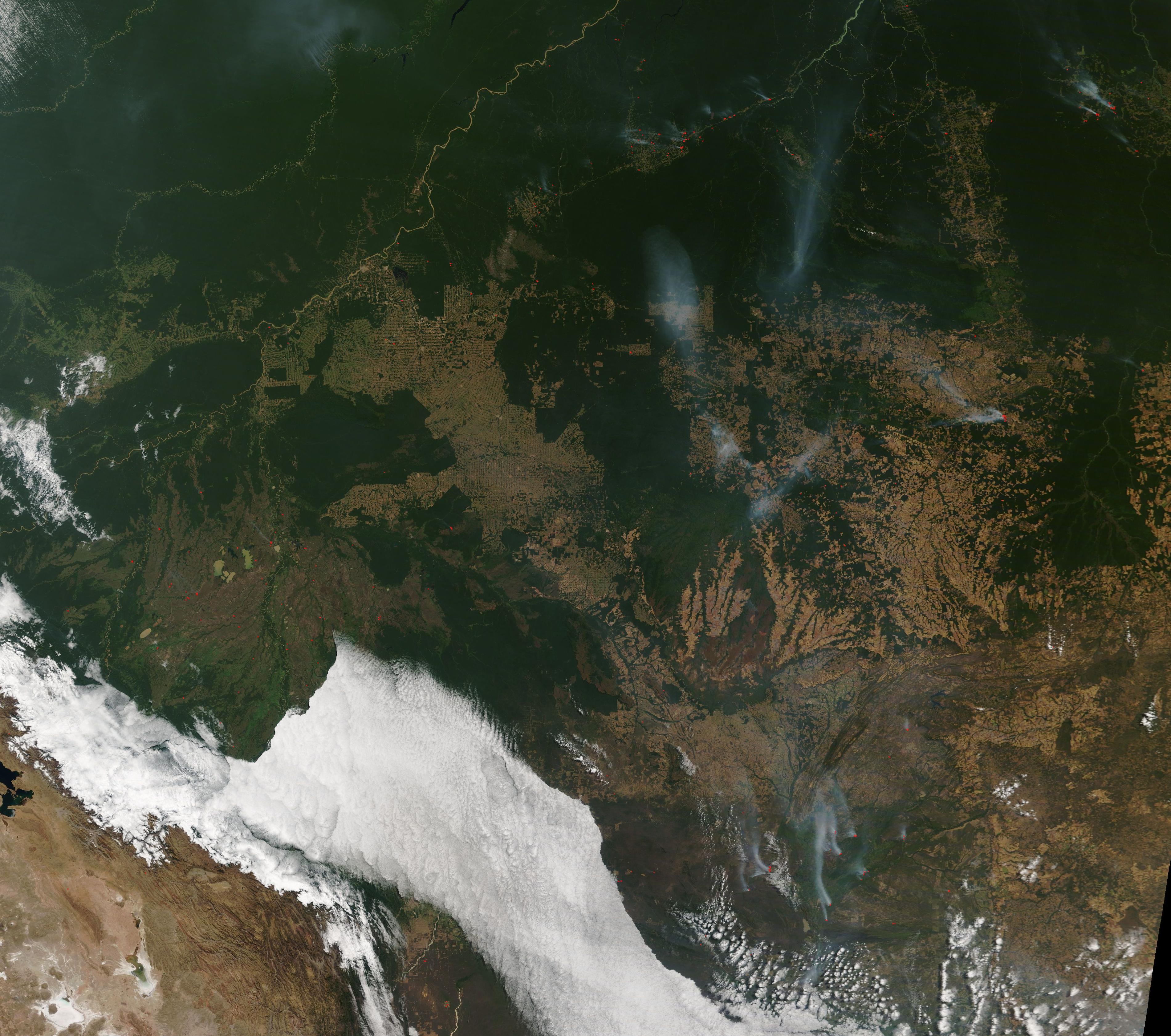
On July 30, the Moderate Resolution Imaging Spectroradiometer (MODIS) on board NASA’s Terra satellite acquired a true-color image of fire and smoke in Brazil. From the north moving clockwise the land belongs to the following states: Amazonas, Pará, Mato Grosso, and Rondônia. Fires are located in all states, with the largest clusters primarily in the state of Amazonas.
One area surrounded with many large fires is Apuí, located near the top of the image. Another notable set of blazes can be seen in the northeast (upper right). These burn near or on the Terra do Meio Ecological Station in Pará. Created in 2005 to conserve nature and support scientific research, the station is classified as an IUCN protected area category 1a (strict nature reserve). In the past, cattle operations had moved into the Station illegally, leading to removal of thousands of head of cattle and the expulsion of many farmers in 2008. In recent years, it appears that these operations have begun once again, with reports of cattle being moved back in by 2017 and, in 2019, reports of opening pasturage using fire. While it’s not possible to know the cause of fires when viewed from space, the widespread nature and high number of the fires near the Station would be compatible with deforestation for commercial or agricultural or pasture use. It is notable that most of the fires— both the large clusters and the individual hot spots—primarily congregate near preserved parkland or Indigenous Lands.
Image Facts
Satellite:
Terra
Date Acquired: 7/30/2020
Resolutions:
1km (430.8 KB), 500m (1.5 MB), 250m (4.5 MB)
Bands Used: 1,4,3
Image Credit:
MODIS Land Rapid Response Team, NASA GSFC
