
Images


October 6, 2020 - Hurricane Delta
 Tweet
Tweet
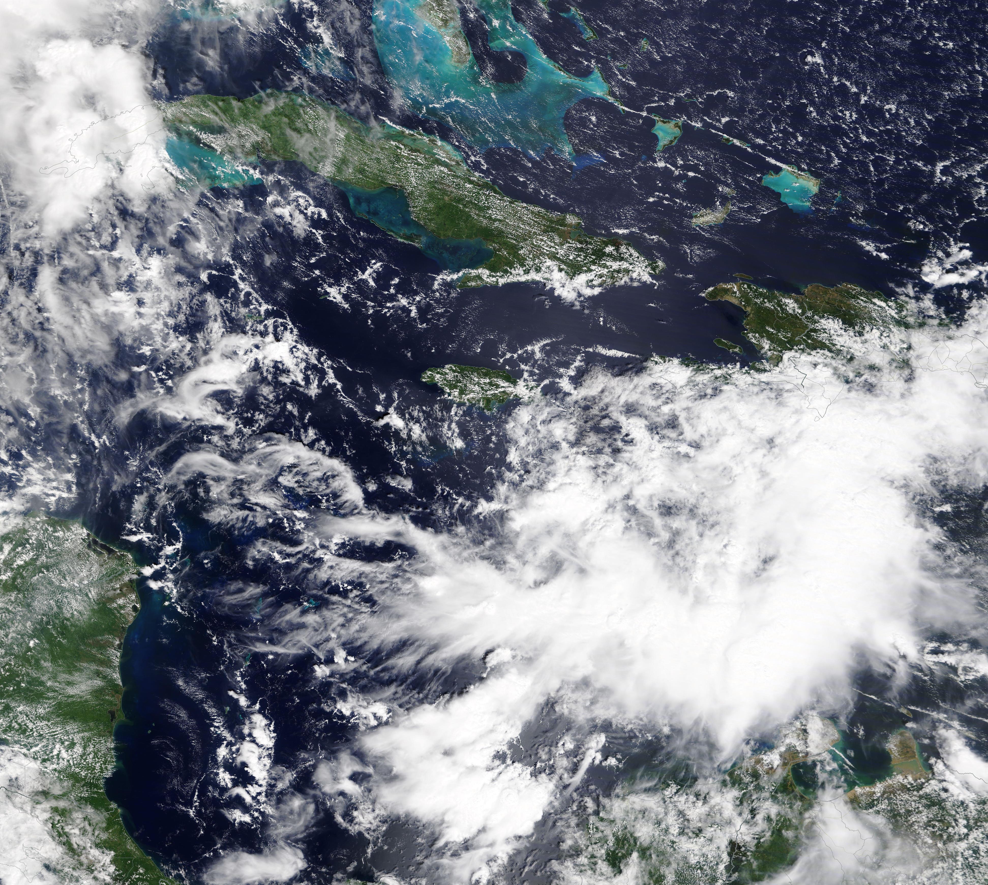
On October 4, 2020, the Moderate Resolution Imaging Spectroradiometer (MODIS) on board NASA’s Terra satellite acquired a true-color image of the birth of Hurricane Delta.
The National Hurricane Center (NHC) first issued an advisory on Potential Tropical Cyclone 26 at 5:00 p.m. EDT (2100 UTC) on October 4, expecting it to become a strong storm. Six hours later, the system became Tropical Depression 26. Continuing to strengthen, it reached tropical storm strength at 8:00 a.m. (1200 UTC) on October 5 and was given the name Delta.
By 8:00 p.m. EDT October 5 (0000 UTC October 6), the NHC reported that maximum sustained winds had reached 75 mph (120 km/h), earning the name Hurricane Delta. At that time, the storm was located about 150 mi (245 km) south southwest of Negril, Jamaica and about 220 mi (355 km) south southeast of Grand Cayman. It was moving west northwest at 8 mph (13 km/h).
A Hurricane Warning is in effect for the province of Pinar del Rio, Cuba and, in Mexico, for Tulum to Lagartos and for Cozumel. Hurricane Watch is in effect for Isle of Youth and the province of Artemisa, both in Cuba. Tropical Storm Warnings are in effect for the Cayman Islands including Little Cayman and Cayman Brac and a Tropical Storm Watch is in effect for the province of La Habana, Cuba.
After impacting Cuba, the Yucatan, and the Cayman Islands, Hurricane Delta is expected to strengthen as it heads towards the Gulf Coast of the United States. The NHC advises that “Delta is forecast to approach the northern Gulf Coast late this week as a hurricane. While there is large uncertainty in the track and intensity of forecasts, there is an increasing risk of dangerous storm surge, wind, and rainfall hazards along the coast from Louisiana to the western Florida Panhandle beginning to Thursday night or Friday. Residents in these areas should ensure they have their hurricane plan in place and monitor updates to the forecast of Delta”.
Image Facts
Satellite:
Terra
Date Acquired: 10/4/2020
Resolutions:
1km (721.1 KB), 500m (2.3 MB), 250m (6.5 MB)
Bands Used: 1,4,3
Image Credit:
MODIS Land Rapid Response Team, NASA GSFC
