
Images


October 13, 2020 - Italy
 Tweet
Tweet
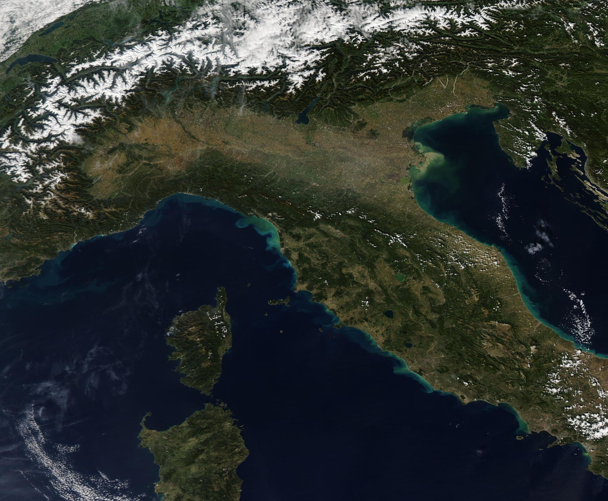
The skies over Italy were crystal clear on October 8, 2020, allowing the Moderate Resolution Imaging Spectroradiometer (MODIS) on board NASA’s Aqua satellite to acquire a true-color image of northern Italy.
The Alps, capped in bright white snow and graced with green valleys, courses across the northern section of the image. Italy’s northern border, where it meets with four countries (France, Switzerland, Liechtenstein, and Austria) runs along most of this crescent-shaped mountain chain. Another mountain chain, the Apennines, runs along Italy’s spine. In this image, a few white clouds top the northern section of the Apennines.
Autumnal oranges, yellows, and tans mark the Po River Valley south of the Alps. The valley is an important agricultural area, producing rice, soybeans, corn, and wheat. Each autumn, the crops begin to brown as weather cools and the leaves of deciduous trees turn from green to orange, yellow, and red. The rich farmland is fed by glacial streams and snowmelt from the Alps.
To the east of the Italian mainland the blue waters of the Adriatic Sea wash the shorelines. The islands of Sardinia and Corsica sit in the Mediterranean, west of the mainland. Sardinia, the second-largest island in the Mediterranean, is an autonomous region of Italy. Corsica, just to the north, is one of the regions of France.
Image Facts
Satellite:
Aqua
Date Acquired: 10/8/2020
Resolutions:
1km (155.5 KB), 500m (524.9 KB), 250m (1.5 MB)
Bands Used: 1,4,3
Image Credit:
MODIS Land Rapid Response Team, NASA GSFC
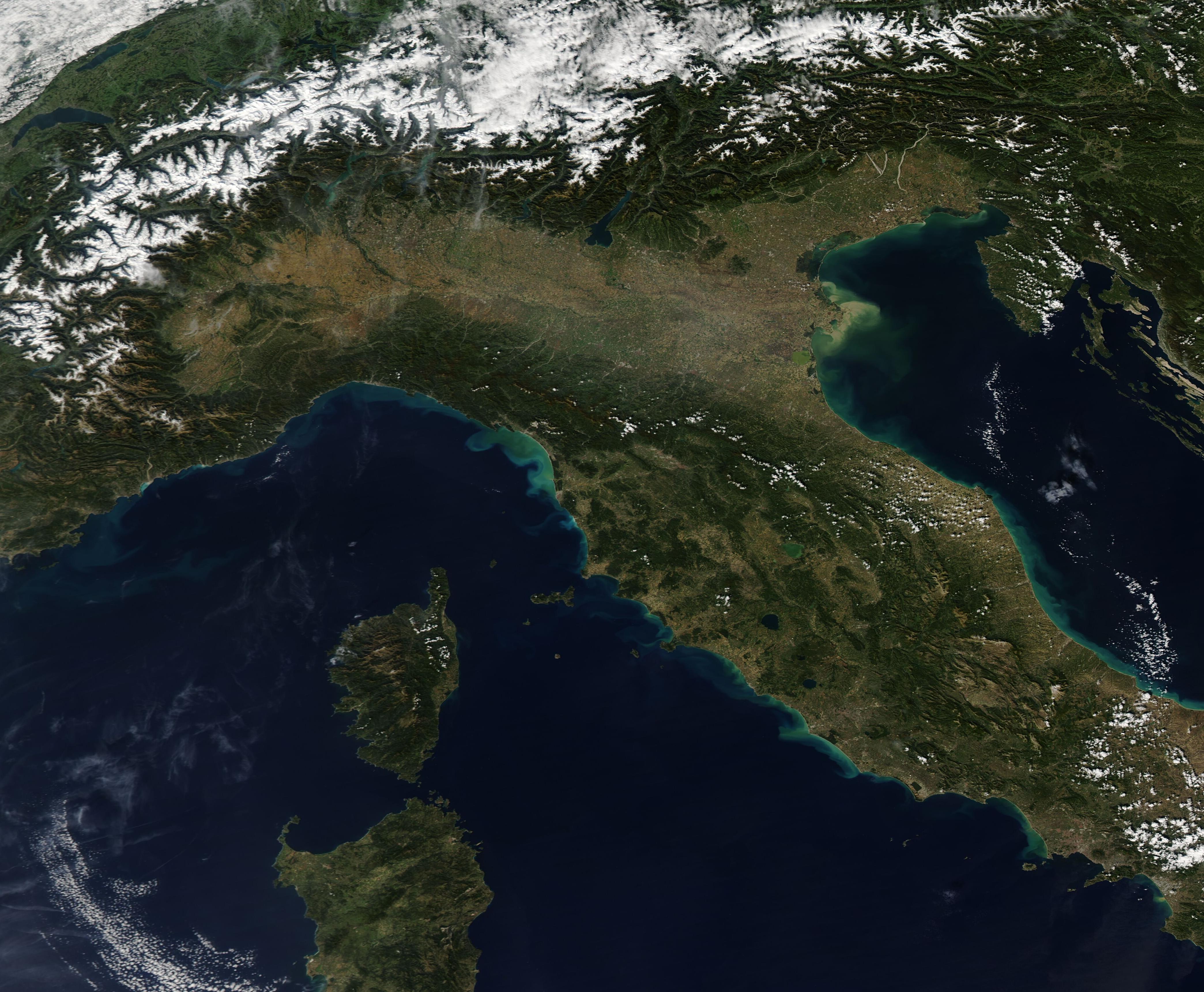
