
Images


January 1, 2021 - Canada's Coast Mountain
 Tweet
Tweet
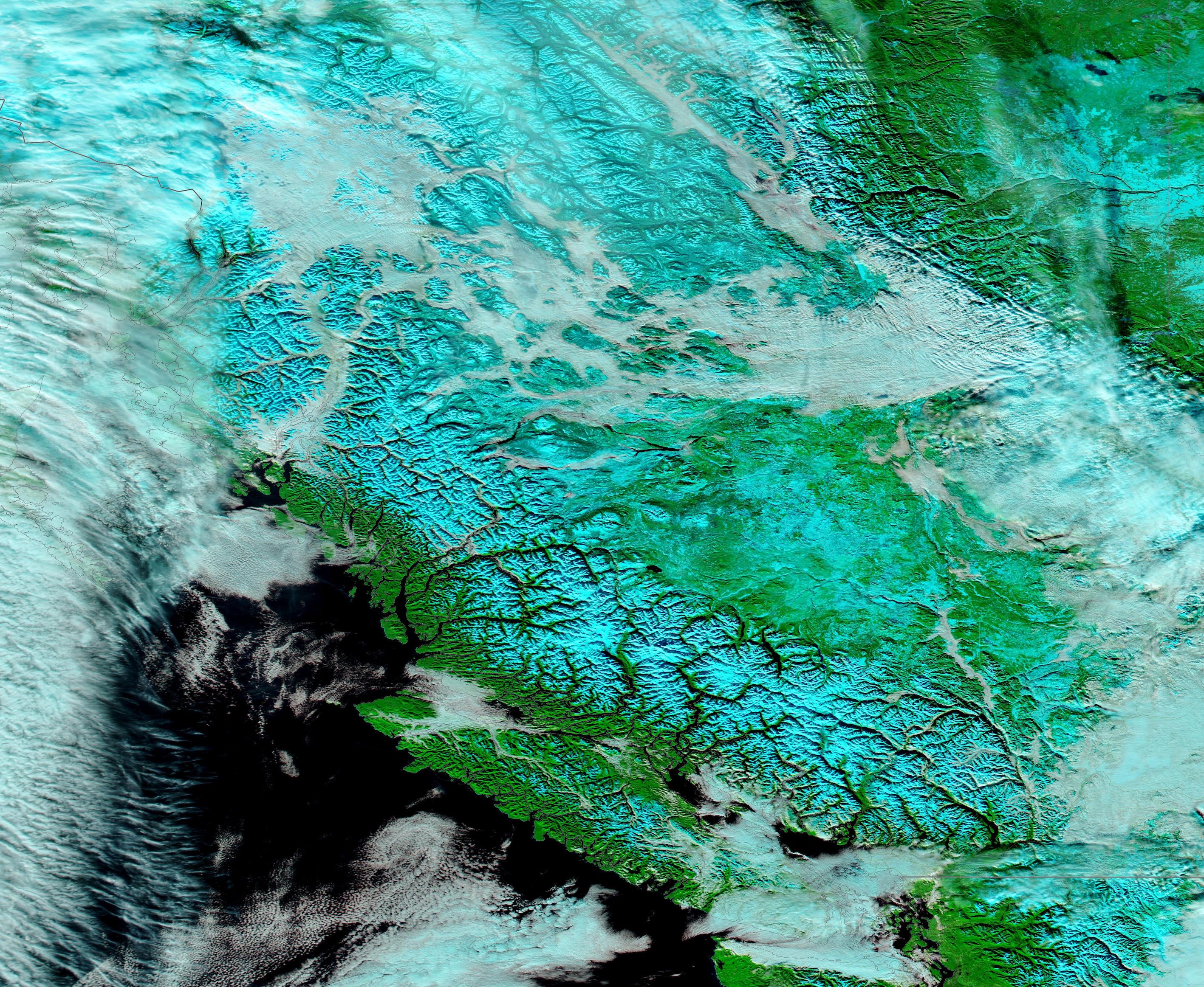
Snow and clouds covered Canada’s Coast Mountains on December 28, 2020 when the Moderate Resolution Imaging Spectroradiometer (MODIS) on board NASA’s Terra satellite acquired a false-color image of the scene.
The Coast Mountains run roughly parallel to the coastline of the Pacific Ocean, stretching from Yukon, Alaska (United States of America) to the Fraser River in southern British Colombia, Canada. They are part of the group called the “American Cordillera”, a nearly unbroken series of mountain ranges that run along the west of North America, Central America, South America, and even Antarctica.
Snow blankets the Coast Mountains in winter but snow can fall at nearly any time of the year in the highest peaks. By December, snow lies thick on the entire mountain range and clouds are frequent. In these conditions, when white cloud overlies white snow, it can be difficult to distinguish between the two with true-color images. However, by using false-color (bands 7,2,1), cloud and snow are easy to tell apart. In this combination vegetation appears bright green, deep water looks black and snow appears electric blue. Cloud appears white, just as in true-color images, unless the clouds are very cold and contain ice crystals. In this case, the cloud will have an electric-blue tint. Low cloud (fog) typically has a light gray tint and sits within mountain valleys.
Image Facts
Satellite:
Terra
Date Acquired: 12/28/2020
Resolutions:
1km (490 KB), 500m (1.6 MB), 250m (5.1 MB)
Bands Used: 7,2,1
Image Credit:
MODIS Land Rapid Response Team, NASA GSFC
