
Images


March 4, 2021 - Tropical Cyclone Niran
 Tweet
Tweet
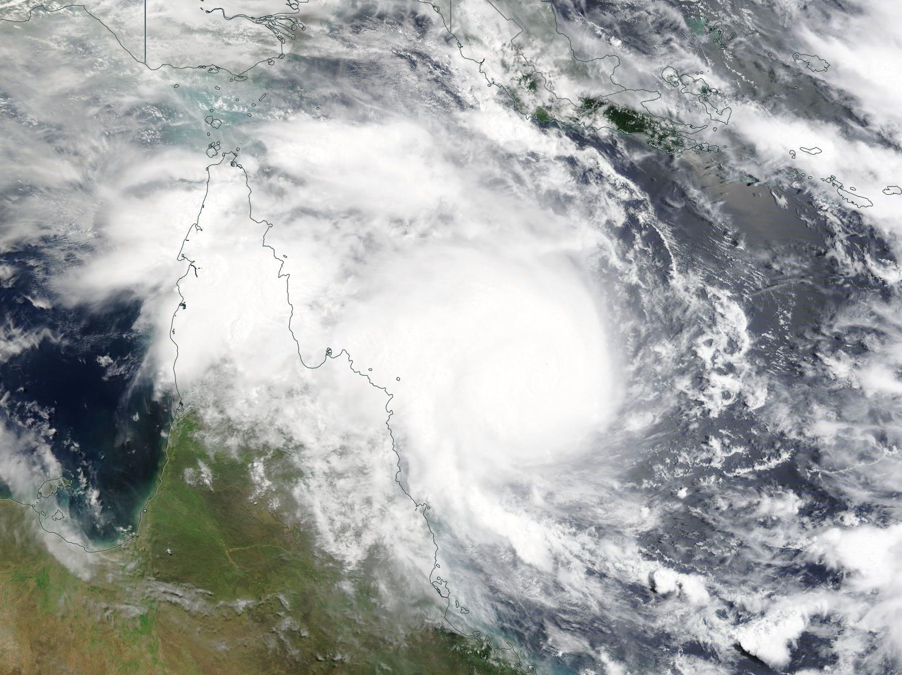
On March 1, 2021, a new tropical cyclone formed in the Coral Sea not far off the northeastern coat of Queensland, Australia. Thanks to warm sea surface temperatures and low wind shear, Tropical Cyclone Niran quickly strengthened. At 2100 UTC on March 3 (4:00 p.m. EST) the storm’s one-minute sustained winds had increased to 92 mph (148 km/h) with gusts measured at 115 mph (185 km/h), placing it in Category 3 of the Saffir-Simpson Hurricane Wind Scale.
With the center located only 193 miles (310 km) northeast of Cairns, the outer bands of the slow-moving storm have battered the coast as Tropical Cyclone Niran slowly crawls to the southeast. According to the Global Disaster Alerts and Coordination System (GDACS), about 42,000 residents have lost power and there have been reports of damage to buildings and crops.
Tropical Cyclone Niran is forecast to continue to move towards the southeast, away from Australia but towards New Caledonia over the next several days. It will soon be entering increasing windshear and cooler sea surface temperatures and is expected to begin to weaken.
The Moderate Resolution Imaging Spectroradiometer (MODIS) acquired a true-color image of Tropical Cyclone Niran on March 3.
Image Facts
Satellite:
Terra
Date Acquired: 3/3/2021
Resolutions:
1km (331.1 KB), 500m (1 MB), 250m (3 MB)
Bands Used: 1,4,3
Image Credit:
MODIS Land Rapid Response Team, NASA GSFC
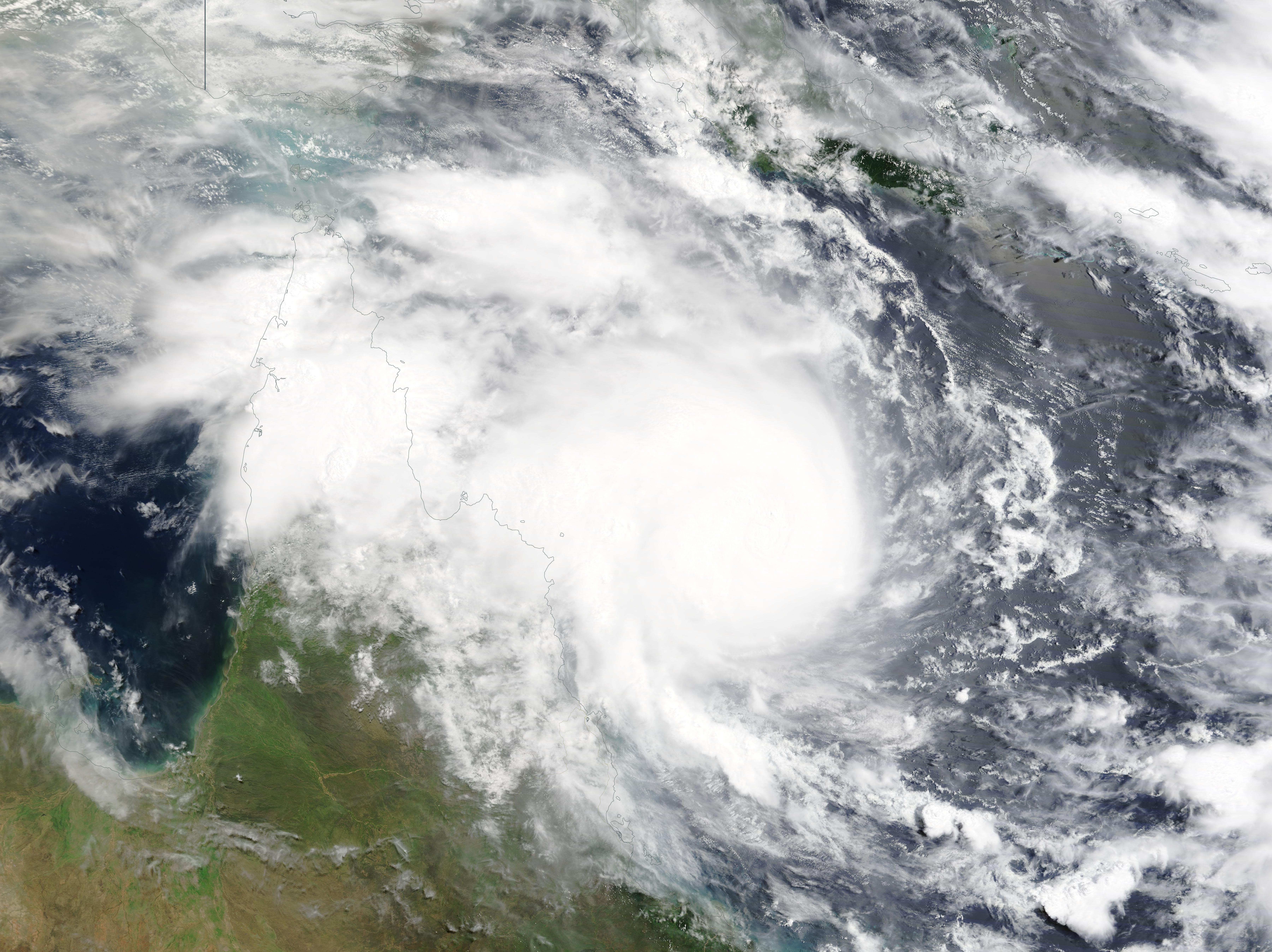
