
Images


March 18, 2021 - Sea ice off of Newfoundland and Labrador
 Tweet
Tweet
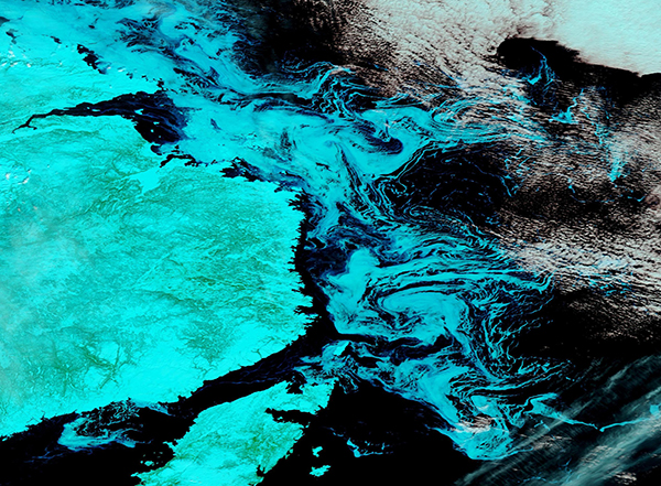
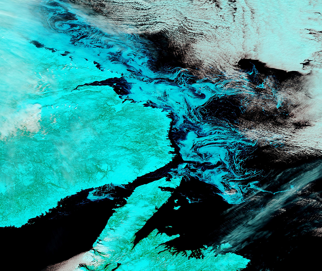
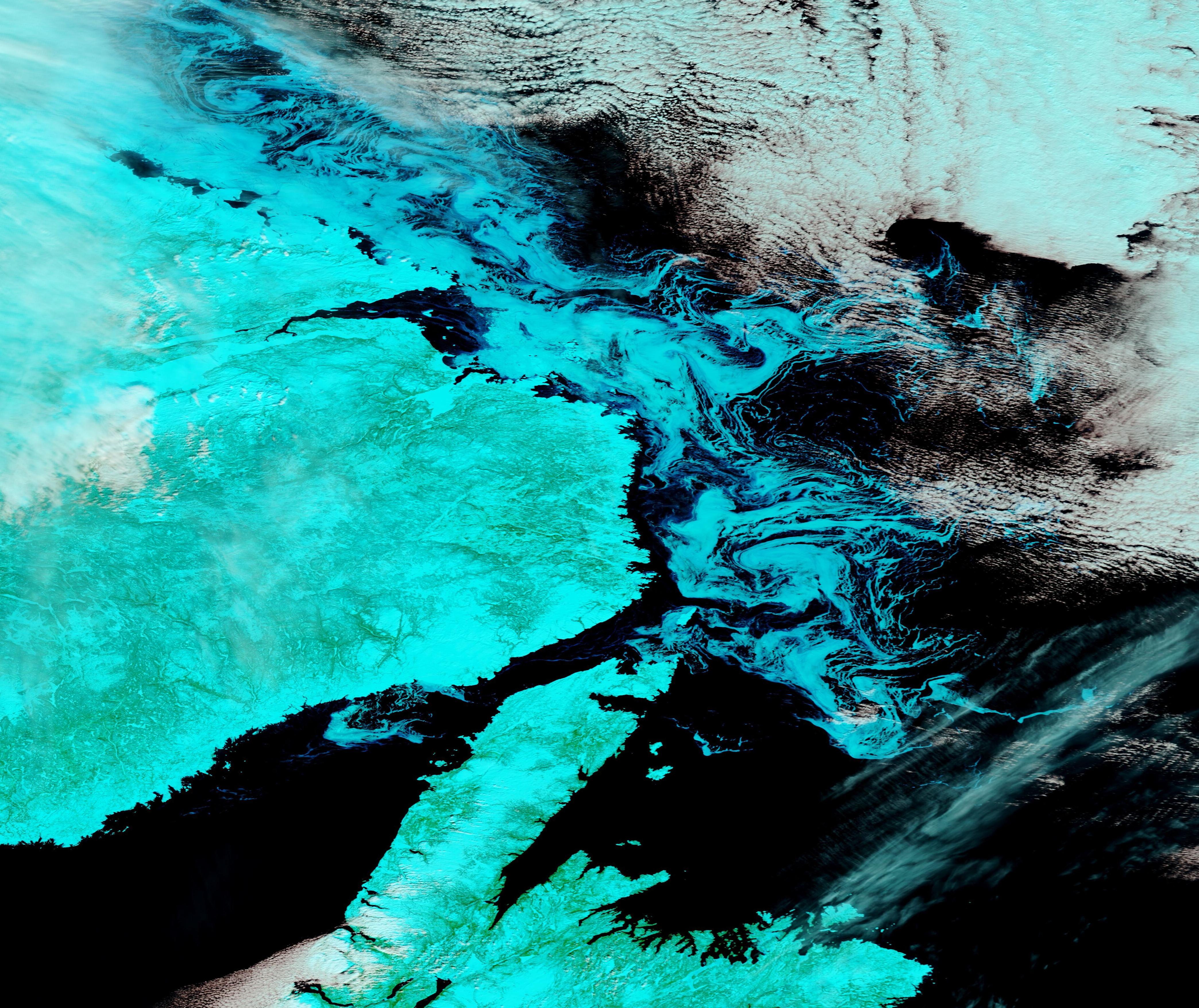
Swirls of sea ice floated in the Davis Strait between Newfoundland and Labrador, Canada and southwestern Greenland in mid-March 2021. The Moderate Resolution Imaging Spectroradiometer (MODIS) on board NASA’s Terra satellite acquired a false-color image of the region on March 10. A small amount of sea ice also can be seen in the Gulf of St. Lawrence.
True-color images use red, green, and blue light to create an image that looks very much like we could see if we looked with our own vision. False-color images such as this one adds infrared light to visible light (MODIS bands 7-2-1)—a great combination for separating ice from cloud. While both would appear white in true-color images, snow and ice appear blue in this type of false-color image while cloud appears white. High cloud which contains ice will have a light tint of blue. In addition, plants appear bright green, open land appears tan, and deep water looks black.
Each winter, sea ice forms in the Davis Strait off the coast of Newfoundland and Labrador as well as in the Gulf of St. Lawrence. It typically lingers into spring, providing breeding grounds for the North Atlantic harp seals. This year, sea ice extent was much lower than usual along the coast and nearly non-existent in the Gulf of St. Lawrence. Fortunately, cool temperatures and movement of sea ice from further north brought more sea ice to the coast in March. Harp seals pupping season is listed as “early March” in the Gulf of St. Lawrence and “mid to late March” along the Newfoundland and Labrador coast. While there is virtually no suitable ice in the Gulf right now, it is thought that adequate ice exists off the coast to support a normal breeding season this year.
Image Facts
Satellite:
Terra
Date Acquired: 3/10/2021
Resolutions:
1km (1.2 MB), 500m (3 MB), 250m (2 MB)
Bands Used: 7,2,1
Image Credit:
MODIS Land Rapid Response Team, NASA GSFC
