
Images


March 27, 2021 - Western Japan and the Seto Inland Sea
 Tweet
Tweet
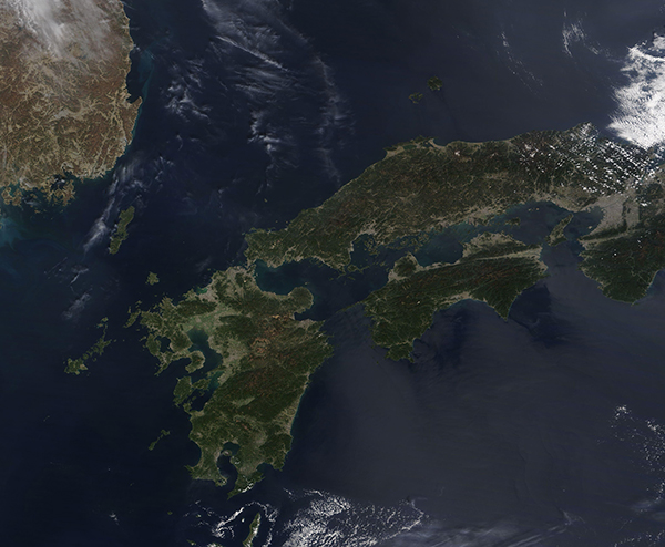
Sun was shining over the island nation of Japan on March 26, 2021. The Moderate Resolution Imaging Spectroradiometer (MODIS) on board NASA’s Terra satellite acquired a true-color image of Western Japan on that same day.
Slightly smaller than the state of California, USA, Japan stretches over 1,900 miles (3,000 km) from the northeast to the southwest and lies between the North Pacific Ocean and the Sea of Japan. The highly volcanic archipelago contains four main islands and about 6,848 smaller islands and islets. The main islands seen in this image are Honshu—the largest and most populous island; Kyushu in the south; and Shikoku tucked along the southeast flank of Honshu. Part of southeastern South Korea can also be viewed in the upper left. The elongated Tsushima Island, Japan sits halfway between Kyushu Island and the South Korean mainland.
The Seto Inland Sea (Setonaikai) sits at the heart of Western Japan. About 400 km (250 mi) long, Setonaikai is tucked between the large islands of Honshu, Shikoku, and Kyushu. Historically an important trade route with calm waters, it is dotted with about 3,000 small islands, several of which have become popular tourist areas. It is also the home to Setonaikai National Park, the largest national park in Japan.
Image Facts
Satellite:
Terra
Date Acquired: 3/26/2021
Resolutions:
1km (504.4 KB), 500m (1.3 MB), 250m (822.7 KB)
Bands Used: 1,4,3
Image Credit:
MODIS Land Rapid Response Team, NASA GSFC
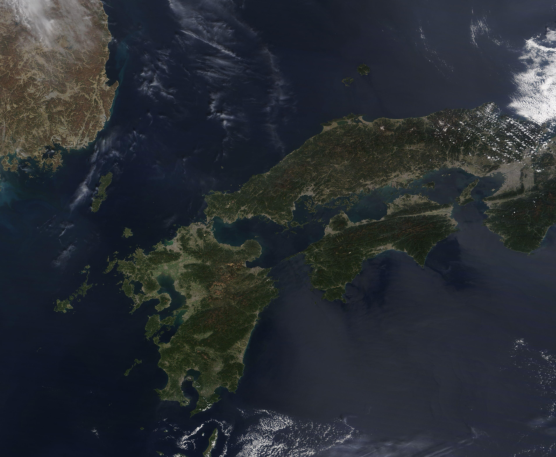
