
Images


April 9, 2021 - Great Salt Lake
 Tweet
Tweet
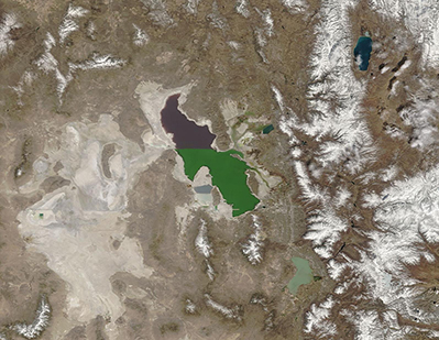
On April 4, 2021, the Moderate Resolution Imaging Spectroradiometer (MODIS) on board NASA’s Terra satellite acquired a stunning true-color portrait of Utah’s two-toned Great Salt Lake centered on a background of tans and white. The waters of the lake contrast not only with each other, but also stand out as a saline oasis in an otherwise arid basin that houses scant vegetation and copious salt flats. Tall mountains surround the basin and are capped with snow—a truly precious commodity that holds precipitation fast until warm weather, when it is released as water. That water will be used by people for drinking, agriculture, and industry—and some will travel through rivers and streams to add water to the Great Salt Lake.
The present Great Salt Lake stretches roughly 75 miles (121 km) in length and 35 miles (56 km) wide, with a maximum depth of about 33 feet and an average depth of 14 feet. It is effectively split into two by a man-made causeway, which runs across the entire like and stops the free flow of water between the northern and southern arm. The plum-colored northern arm, known as Gunnison Bay, contains roughly thirty percent salt. More freshwater rivers run into the southern portion (Gilbert Bay) so not only are the green waters less saline than the north, but the salinity can fluctuate between 6 and 27 percent.
Image Facts
Satellite:
Terra
Date Acquired: 4/4/2021
Resolutions:
1km (150.1 KB), 500m (406.5 KB), 250m (287.5 KB)
Bands Used: 1,4,3
Image Credit:
MODIS Land Rapid Response Team, NASA GSFC
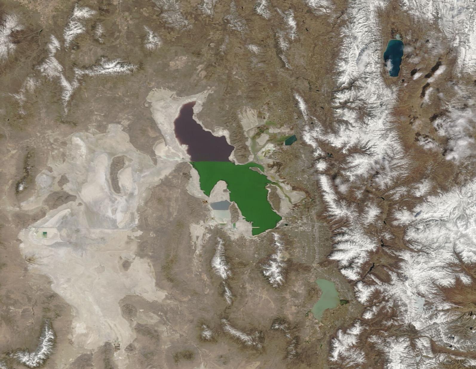
