
Images


May 1, 2021 - Late Wet Season in Northeastern South Africa
 Tweet
Tweet
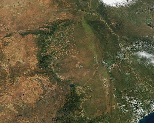
On April 26, 2021, the Moderate Resolution Imaging Spectroradiometer (MODIS) on board NASA’s Terra satellite acquired a stunning true-color image of the greens and golds that color northeastern South Africa. The brilliance of the green washed across the region marks the rich vegetative growth that has been spurred by the long wet season, which runs from October to April. The wet season brings maximum greenness to the countryside, high humidity, and a multitude of migrating birds to northeastern South Africa.
The image is centered on Limpopo Province, where the Limpopo River begins its 1,087-mile (1,750 km) journey through South Africa and Mozambique to reach the Indian Ocean. The Limpopo River is the second-largest river in Africa to drain into the Indian Ocean. In this region, the river forms a boundary between South Africa and Botswana (northeast) and Zimbabwe (north) before coursing into Mozambique.
Not far from the Limpopo River, a swath of light green outlines much of Kruger National Park, probably the most famous game reserve in South Africa. While wild game—and tourism—thrive in Kruger today, human use of the land here is ancient. More than 250 archaeological sites show signs of human occupation of parts of the land contained by the park back about 1 million years ago. The sudden rise of a dark area to the east marks the edge of Kruger National Park and the boundary with Mozambique.
Moving to the west of Kruger National Park, a myriad of tan smudges mark several small towns situation on grassland. To their west the lands rise to a high plateau, where the large city of Polokwane, the capital of Limpopo Province is located. The city can be seen as a gray smudge against a tan landscape.
A gray-and-white structure near the center of the image is the Palabora mine. It is South Africa’s largest open-pit mine, measuring about 1.25 miles (2 km) wide. Copper mining began at Palabora in 1965, and by 1967 the open-pit mine was fully operational. The hole reached 800 meters down into the Earth before the depletion of resources made it uneconomical to continue mining in the pit. Operations moved underground (below the pit) and mostly out of sight in the early 2000s.
Image Facts
Satellite:
Terra
Date Acquired: 4/26/2021
Resolutions:
1km (275.9 KB), 500m (786.2 KB), 250m (1.8 MB)
Bands Used: 1,4,3
Image Credit:
MODIS Land Rapid Response Team, NASA GSFC
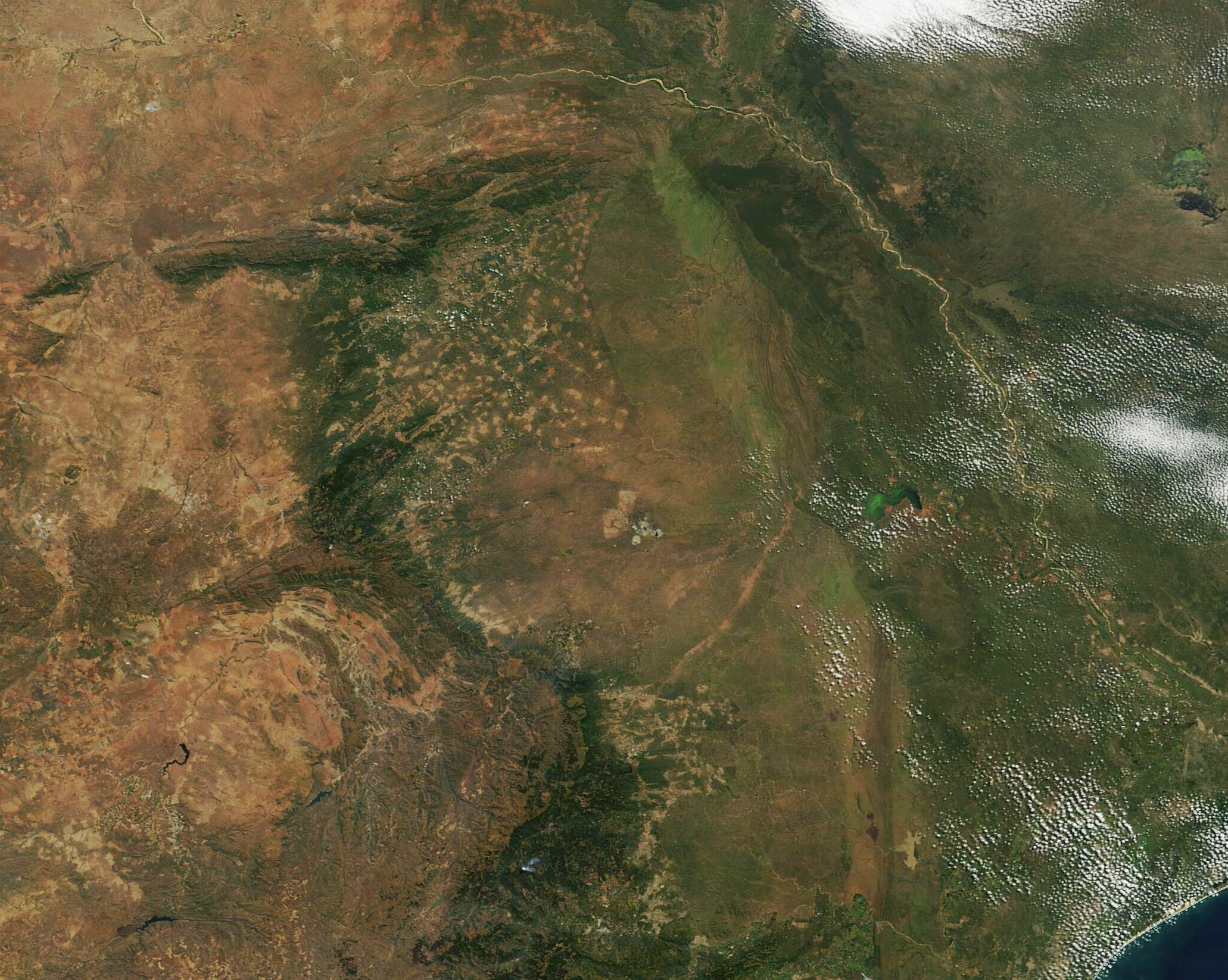
