
Images


May 30, 2021 - Lake Bangweulu, Zambia
 Tweet
Tweet
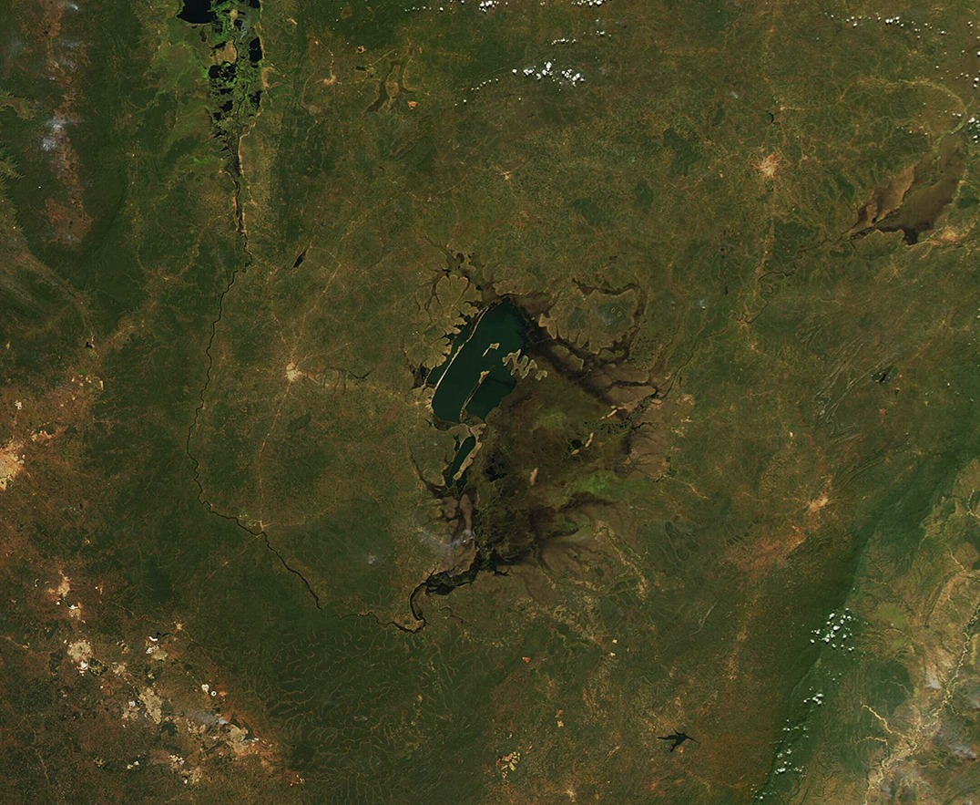
On May 27, 2021, the Moderate Resolution Imaging Spectroradiometer (MODIS) on board NASA’s Aqua satellite acquired a true-color image of rain-swollen Lake Bangweulu, the adjacent Lake Walilupe, and surrounding wetlands.
Sitting in the Congo River basin in northern Zambia, the lake’s area of permanent open water measures about 1,158 square miles (3,000 square km). At the end of the rainy season, which runs from December to May, the surface area can expand to five times that size, making the Bangweulu easily visible from space. The wetlands have been identified as one of the world’s most important wetlands by the Ramsar Convention and as an Important Bird Area (IBA) by BirdLife International. About 400 bird species and 80 species of fish have been identified here, including several that are endangered or threatened species, including a type of antelope known as the black lechwe.
The city of Mansa, Zambia sits within 50 miles (80 km) and to the east of Lake Bangweulu while the town of Kasama sits less than 80 miles (129 km) northeast. To the southwest, at least six cities are clustered about 100 miles from the lake. In the image, the manmade structures—towns, cities, and roadways—appear as gray or grayish-tan pixels. The proximity of growing human habitation and roadways illustrate the growing pressure on the wetland. The Department of National Parks and Wildlife, along with six Community Resource Boards, came together in 2008 to create a plan to sustainably manage and protect the wetlands, allowing people to harvest fish and game, and use the wetland to meet their needs, but in a way that will also preserve the health of the ecosystem.
Image Facts
Satellite:
Aqua
Date Acquired: 5/27/2021
Resolutions:
1km (273.6 KB), 500m (784.3 KB), 250m (1.7 MB)
Bands Used: 1,4,3
Image Credit:
MODIS Land Rapid Response Team, NASA GSFC
