
Images


September 9, 2021 - The Stunning Sands of Mauritania
 Tweet
Tweet
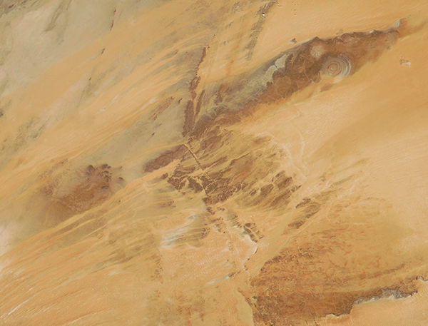
The country of Mauritania sits on the northwestern coast of Africa, straddling both North Africa’s Maghreb region and West Africa’s Sahel. With tan and salmon-tinted sands playing against the rugged rocky outcroppings of the Adrar Plateau, most of the interior of Mauritania is remarkably dry and hot year-round. One of the most sparsely populated countries in Africa, most Mauritanians choose to live along the coast rather than endure the heat and winds of this region. Still, a few cities are scattered along the Adrar Plateau and some farmers and herders earn their living in pockets of moister areas that exist in some valleys.
On September 8, 2021, the Moderate Resolution Imaging Spectroradiometer (MODIS) on board NASA’s Terra satellite acquired a true-color image of the interior of Mauritania. The dark tan of the rocky terrain laid bare by the strong desert winds contrasts with the wide streaks of orange-toned sand. A remarkable feature of the Adrar Plateau is peculiar circular formation known as the Richat Structure. Although the concentric rings bear resemblance to an impact crater, this structure is actually a well-eroded remnant of an ancient volcanic dome. Over time, the large dome hardened and then slowly eroded, exposing the onion-like layers of rock. This structure can be seen in the far eastern section of the ochre-colored gorge.
Image Facts
Satellite:
Terra
Date Acquired: 9/8/2021
Resolutions:
1km (228.9 KB), 500m (636.7 KB), 250m (1.4 MB)
Bands Used: 1,4,3
Image Credit:
MODIS Land Rapid Response Team, NASA GSFC
