
Images


October 31, 2021 - Typhoon Malou
 Tweet
Tweet
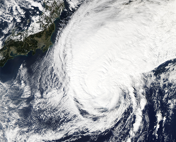
Typhoon Malou had weakened to tropical storm strength on October 29, 2021, when the Moderate Resolution Imaging Spectroradiometer (MODIS) on NASA's Aqua satellite acquired a true-color image of the storm spinning over the Pacific Ocean.
Typhoon Malou formed over the Pacific Ocean east of Guam, first reaching tropical storm strength on October 24. By October 28, maximum sustained winds had peaked at approximately 97.5 mph (157 km/h), placing it as a Category 1 storm on the Saffir-Simpson Hurricane Wind Scale. After drenching the Ogasawara Islands on October 28, Malou began to fight difficult environmental conditions and quickly weakened. The Joint Typhoon Warning Center (JTWC) issued its last advisory on Malou when it was an extra-tropical system on October 30.
Image Facts
Satellite:
Aqua
Date Acquired: 10/29/2021
Resolutions:
1km (2.8 MB), 500m (7.9 MB), 250m (5.8 MB)
Bands Used: 1,4,3
Image Credit:
MODIS Land Rapid Response Team, NASA GSFC
