
Images


March 2, 2022 - Tropical Cyclone Anika
 Tweet
Tweet
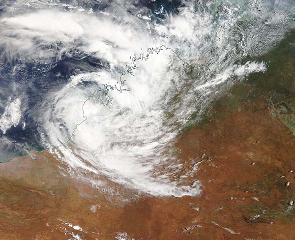
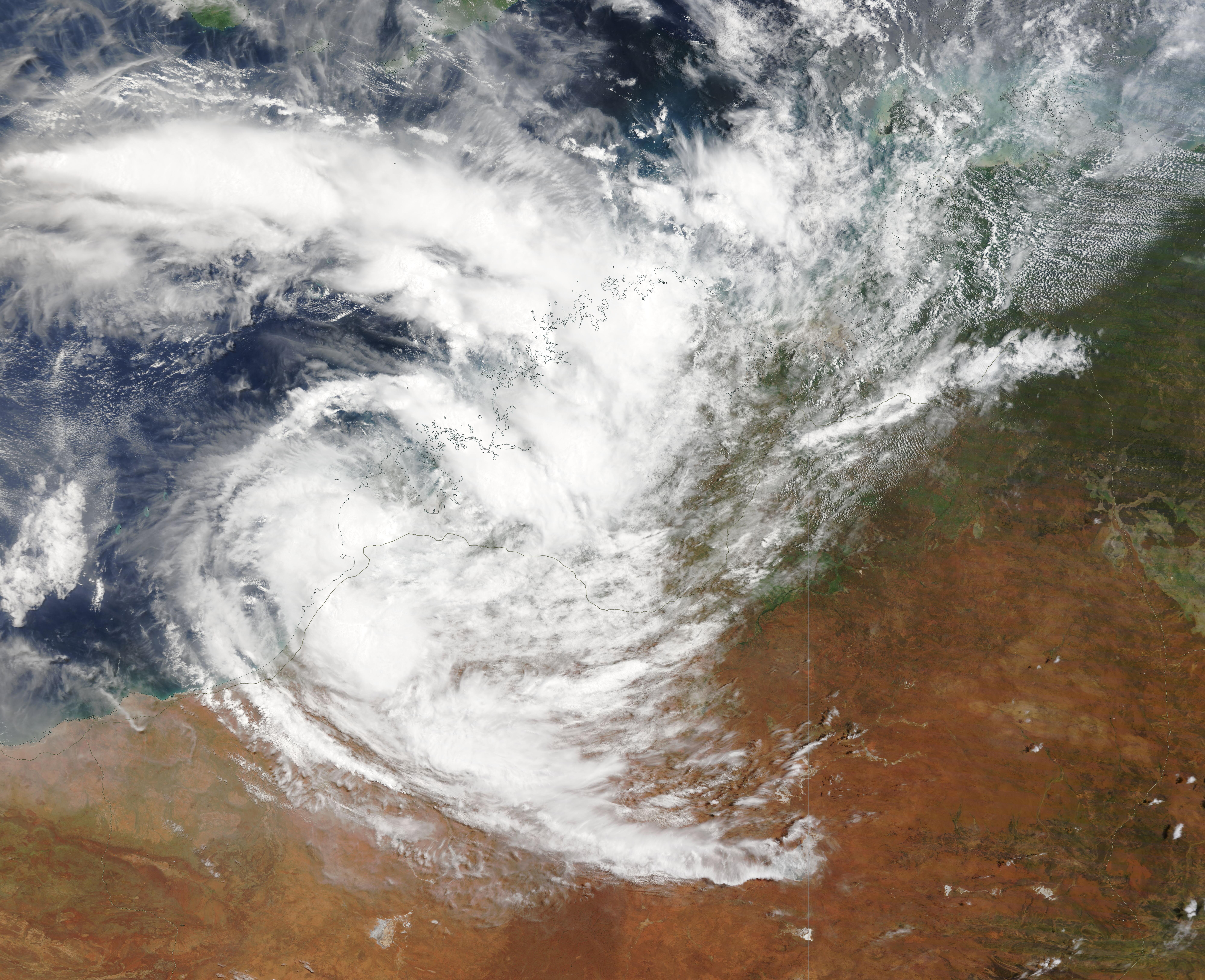
On March 1, 2022, the Moderate Resolution Imaging Spectroradiometer (MODIS) on board NASA’s Terra satellite acquired a true-color image of Tropical Cyclone Anika as it moved over Western Australia south of Broome on its way towards the Indian Ocean. Shortly before this image was acquired, the Australian Bureau of Meteorology (BoM) noted that Anika was carrying gusts of up to 95 km/h (59 mph). Although BoM categorized the weakened system as an Ex-Cyclone, Anika is expected to restrengthen over the Indian Ocean. It will also take a southeasterly turn to make a second landfall over Western Australia.
Tropical Cyclone Anika made its initial landfall over the Kimberly, near Faraway Bay, Western Australia on February 26, carrying maximum sustained winds of about 102 km/h (63 mph) and gusts of up to 120 km/h (74.6 mph). Those wind speeds placed it as a tropical cyclone on the Saffir-Simpson Hurricane Wind Scale and a Category 1 storm on the Australian Tropical Cyclone Intensity Scale. The storm brought down some trees and raised flood warnings near landfall, but quickly weakened as it scooted over Western Australia.
Image Facts
Satellite:
Terra
Date Acquired: 3/1/2022
Resolutions:
1km (467.3 KB), 500m (1.5 MB), 250m (4.6 MB)
Bands Used: 1,4,3
Image Credit:
MODIS Land Rapid Response Team, NASA GSFC
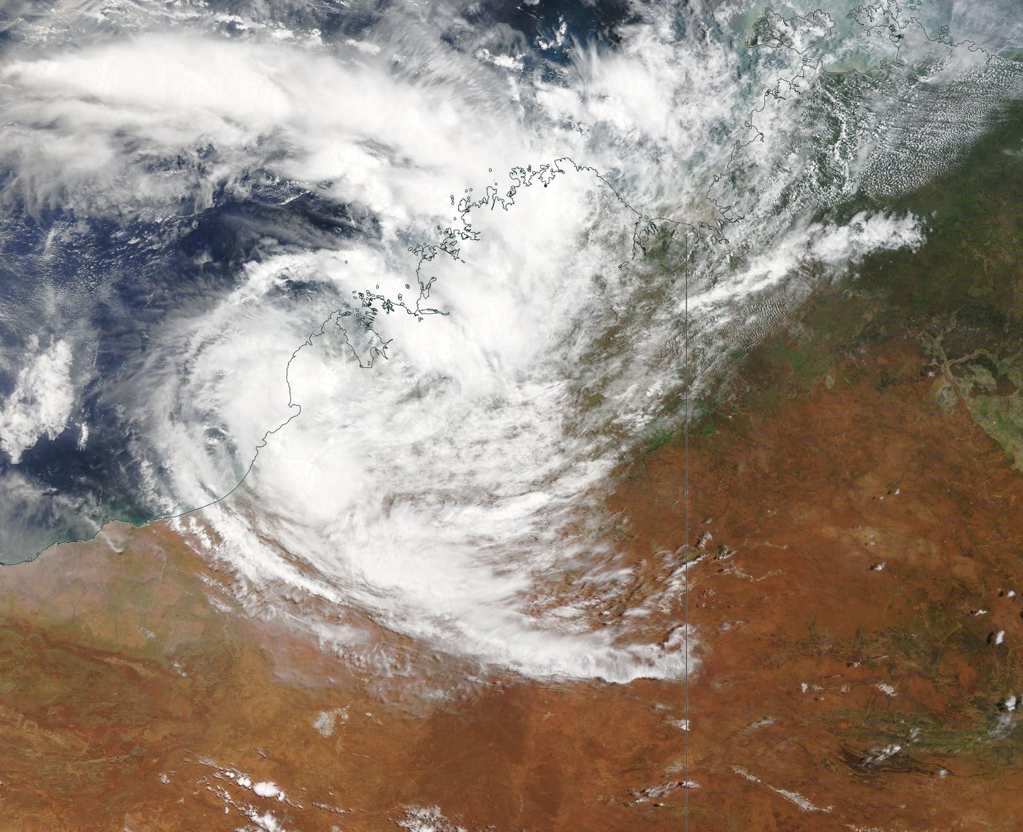
