
Images


May 2, 2025 - The English Channel
 Tweet
Tweet
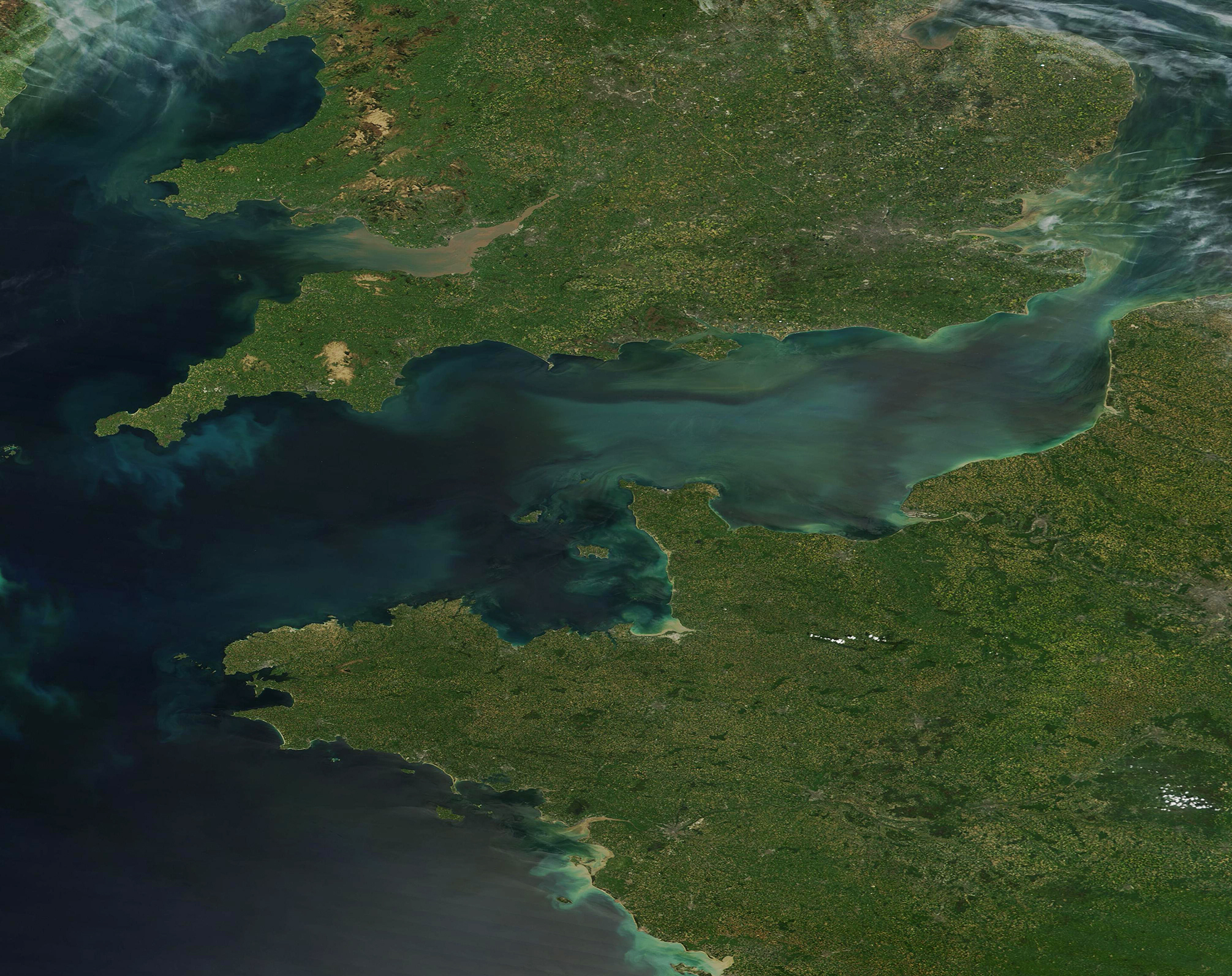
On April 20, 2025, crystal-clear skies allowed the Moderate Resolution Imaging Spectroradiometer (MODIS) on NASA’s Terra satellite to capture this true-color image of decidedly turbid waters of the English Channel. The land visible bordering the Channel belong to England, to the north, and France, in the south.
The waters of the English Channel are often streaked with sediment, as can be seen in this image. Springtime, when the melting of winter’s snows combined with spring rains, is an especially good time for sediment to be washed from inland via the many rivers that spill into the Channel. In addition, the waters of the English Channel are shallow enough that strong winds and tides can churn sediment upward from the seafloor.
Erosion from action of the waves, wind, and rain on the shoreline also adds sediment. This is most evident near the narrowest point of the Channel, in the upper left (northeast) corner of the image. This is the Strait of Dover, which is bounded by chalk-laden cliffs. In England these are called the White Cliffs of Dover, and in Frane the Cap Blanc-Nez. The water near each of these cliffs is tinted white, most likely due to erosion.
Green tints to the water strongly suggest the presence of large numbers of phytoplankton floating in the waters of the English Channel. Phytoplankton are microscopic plant-like organisms that live in these waters year-round. When conditions are favorable, they can reproduce explosively to create large blooms that can be seen from space. Sediment carries nutrients that spurs blooms and upwelling from churning water also brings nutrients for growth.
Image Facts
Satellite:
Terra
Date Acquired: 4/20/2025
Resolutions:
1km (753.8 KB), 500m (2 MB), 250m (3.9 MB)
Bands Used: 1,4,3
Image Credit:
MODIS Land Rapid Response Team, NASA GSFC
