
Images


October 17, 2022 - Katmai National Park and Preserve, Alaska
 Tweet
Tweet
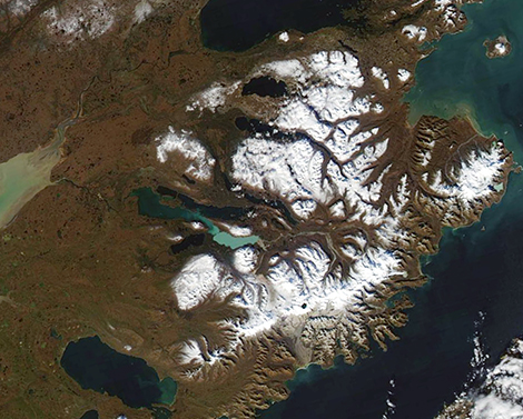
On October 13, 2022, the Moderate Resolution Imaging Spectroradiometer (MODIS) on board NASA’s Aqua satellite acquired a true-color image of autumn in the northern Kenai Peninsula, Alaska. Specific landmarks easily identified from space include sediment-filled Bristol Bay in the southwest, the North Pacific Ocean in the east, and multi-colored Naknek Lake, with the eastern section (called Iliuk Arm) tinted turquoise thanks to glacial flour. Southeast of Naknek Lake, a blue circle stands out in the snow-covered mountains. This is Crater Lake, which sits at the peak of Mount Katmai.
Most of the land seen in this image belongs to Katmai National Park and Preserve, an expanse of about 6,395 square miles of rugged, spectacular, and remote terrain that is filled with volcanoes, fossils, glaciers, lakes, and rivers. The pristine ecosystem provides homes for a variety of wildlife, including brown bears, salmon, caribou, moose, lynx, and snowshoe hare. About 700 species of plants are found within the park and preserve. People also use the area for hunting, fishing, recreation, and tourism. In fact, the park permits subsistence activities on the park land for native and rural peoples found in and adjacent to the park.
While the land of Katmai National Park and Preserve continues to be remote and sparsely populated today, very few people outside of local residents even knew it existed a century ago. However, in June of 1912 a massive volcanic eruption—said to be the century’s largest volcanic eruption in North America—suddenly brought the region to the attention of the world. At first, the exact location of the eruption could not be pinpointed, but scientists soon determined that magma had flowed beneath the tall Mount Katmai to explode through the nearby Novarupta volcano. Erupting at a rate of 520 million tons per hour, the material ejected from this Alaskan volcano was 30 times that spewed in the 1980 eruption of Mount St. Helens. Katmai National Monument was established by the U.S. government in 1918 to protect this extreme volcanic landscape. Since then, the protected area has expanded both in acreage and purpose to embrace and preserve natural and sensitive ecosystems found around Mount Katmai.
Image Facts
Satellite:
Aqua
Date Acquired: 10/13/2022
Resolutions:
1km (121 KB), 500m (337.6 KB), 250m (944.3 KB)
Bands Used: 1,4,3
Image Credit:
MODIS Land Rapid Response Team, NASA GSFC
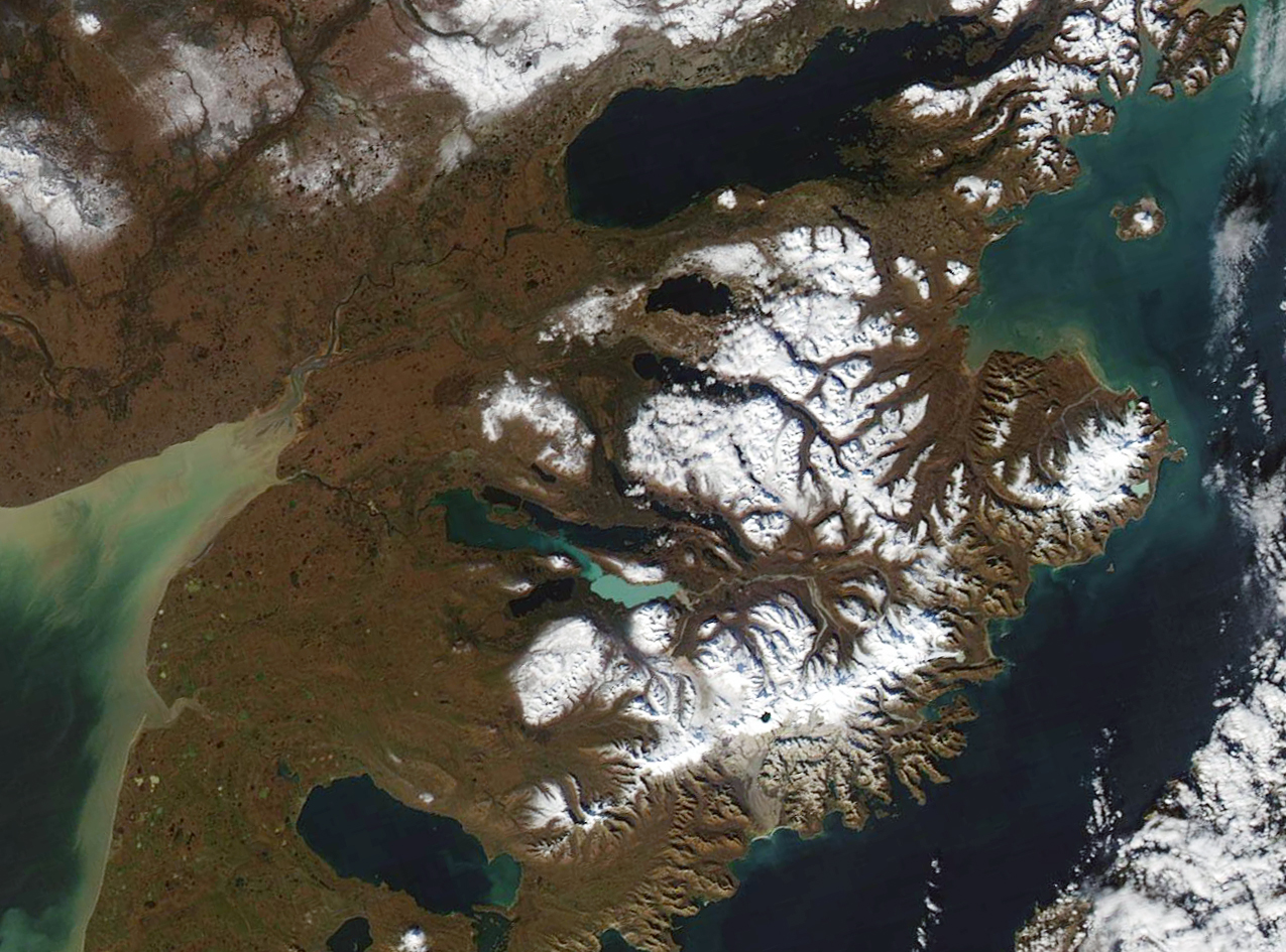
