
Images


October 28, 2022 - Mississippi River Delta
 Tweet
Tweet
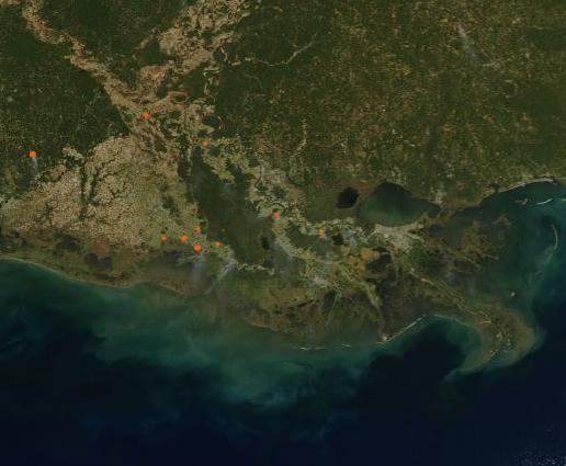
On October 26, 2022, the Moderate Resolution Imaging Spectroradiometer (MODIS) on board NASA’s Aqua satellite acquired a true-color image of the Mississippi River and Delta in Louisiana on a sunny autumn day. The curving course of the mighty river can be seen twisting through fall fields that are tinted gold and tan. Major cities, such as New Orleans, appear to be colored gray. Sediment swirls in Lake Ponchartrain just north of New Orleans and pours into the Gulf of Mexico through channels in the Mississippi Delta.
Water levels in the Lower Mississippi River cycle through the year, with the highest levels (often accompanied by flooding) occurring in springtime as spring rains along the entire basin and snowmelt in the north combine to fill the river. After summer’s heat dries the Mississippi Basin, water levels in the Lower Mississippi River typically drop by fall. This year, driven by an extremely warm summer upstream and Moderate to Severe Drought (D1-D2) registered through most of the state of Louisiana, water levels have dropped to levels not seen since 2012, according to the National Weather Service (NWS).
On October 18, the NWS Lower Mississippi River Forecast Center (LMRFC) reported that preliminary data showed some locations along the river from Cairo, Illinois to Memphis, Tennessee had broken modern-day low-level records. Memphis registered -10.7 feet, with a forecast for the river to reach a low of -11.1 feet.
Low water levels in the Lower Mississippi River have allowed salty water from the Gulf of Mexico to push up the Delta and upriver into the Mississippi River, threatening water supplies. To prevent saltwater from getting farther upstream, the Corps began construction on an underwater sill in Myrtle Grove, Louisiana, on October 11.
Image Facts
Satellite:
Aqua
Date Acquired: 10/26/2022
Resolutions:
1km (29.3 KB), 500m (101.7 KB), 250m (312.1 KB)
Bands Used: 1,4,3
Image Credit:
MODIS Land Rapid Response Team, NASA GSFC
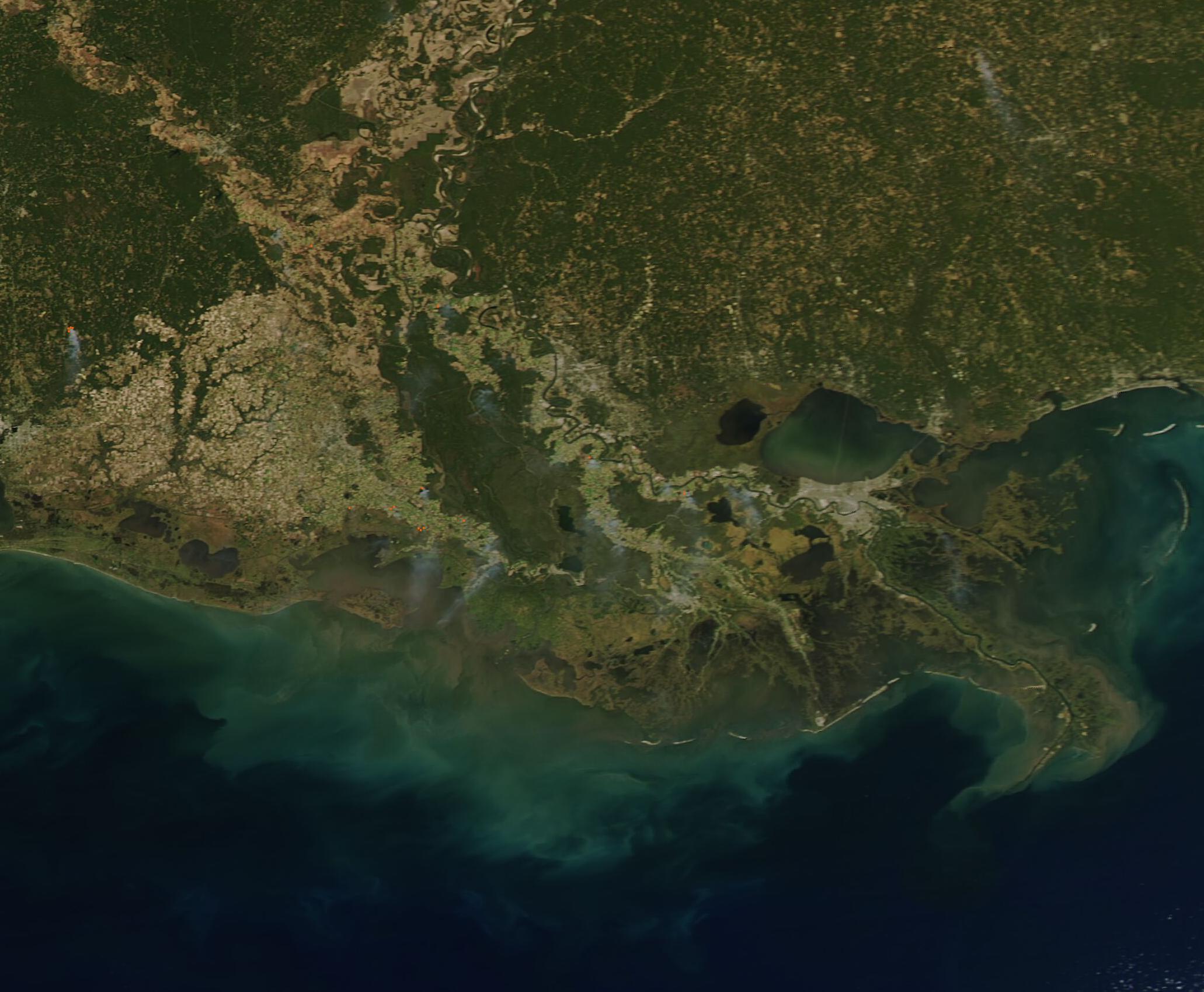
