
Images


December 23, 2022 - Fog in the Central Valley
 Tweet
Tweet
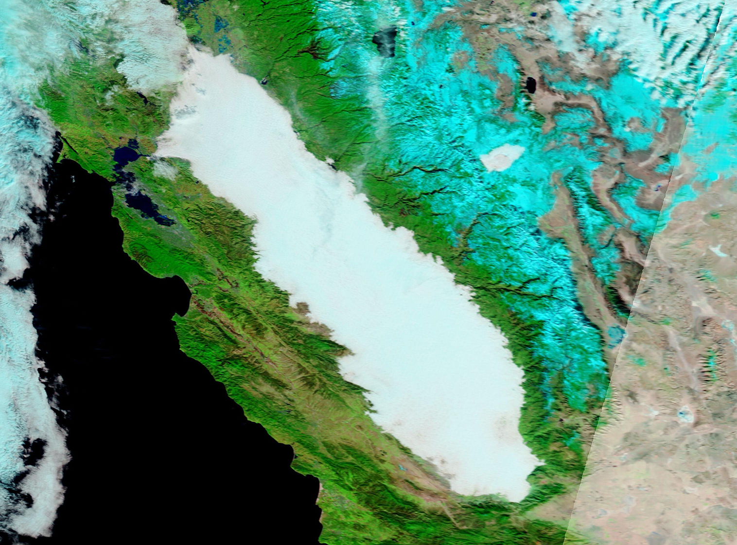
Thick fog frequently fills California’s Central Valley in late fall and winter, often creating a risk for drivers as visibility plummets. The Moderate Resolution Imaging Spectroradiometer (MODIS) on board NASA’s Terra satellite acquired a false-color image of a huge bank of fog on December 15.
In this type of false-color image, infrared and visible light (MODIS Bands 7,2,1) are combined to help separate snow, which appears electric blue, from cloud and fog. Fog and most clouds look bright white, although high, cold clouds which contain ice crystals, may be tinted with electric blue. Vegetation appears green, open land looks tan, while water shows up as inky-black.
The formation of fog requires three ingredients: wet ground, still air, and cold temperatures. Conditions are ripe after the ground has become damp from a recent rain. During the day, the warmth of the Sun causes the moisture to evaporate into the air. After sunset, air temperature slowly drops. Because cool air can hold less moisture than warm air the many tiny moisture droplets suspended in the air during the day combine into large droplets, creating “low cloud”, or fog.
The Central Valley winter fog, also called Tule (too-le) tends to form—often rapidly— after sunset, become thickest just before dawn, then slowly thins as air warms in the morning. Tule fog season typically begins in December and ends in February.
Image Facts
Satellite:
Terra
Date Acquired: 12/21/2022
Resolutions:
1km (474.1 KB), 500m (1.1 MB), 250m (684.2 KB)
Bands Used: 1,4,3
Image Credit:
MODIS Land Rapid Response Team, NASA GSFC
