
Images


January 8, 2023 - Snow in the Midwestern United States
 Tweet
Tweet
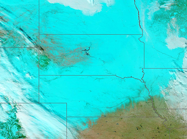
The first winter storm of 2023 roared across California and the Midwestern United States in early January 2023.
The storm began in the opening weekend of the new year, bringing heavy rain and high wind to parts of California, as well as deep snow in the high country in the Sierra Nevada. Up to 54 inches of fresh snowfall was reported at Mammoth Mountain in the southern Sierra. By January 3, the Central Plains and Midwest was reeling under heavy snow. Treacherous driving conditions closed roads across several states, while slick surfaces caused the nose of an airplane to slide thirty feet off the taxiway at a Minneapolis-St. Paul International Airport. Meanwhile, the same weather system triggered a tornado outbreak in the south.
On January 5, the skies had cleared over the Midwest, allowing the Moderate Resolution Imaging Spectroradiometer (MODIS) on board NASA’s Aqua satellite to acquire a false-color image of the aftermath of the snowstorm. In this type of image, snow appears electric blue, cloud looks white, open or sparsely vegetated land appears tan, and vegetation looks bright green.
The tier of states at the center of the image, from north to south, are North Dakota, South Dakota, and Nebraska. On January 7, current snow depth was estimated by the USDA Forest Service, is as high as 39 inches, especially in eastern North Dakota. In South Dakota, the winding Missouri River stands out against the snowy background and appears to remain ice-free.
Image Facts
Satellite:
Aqua
Date Acquired: 1/5/2023
Resolutions:
1km (894.9 KB), 500m (942.2 KB), 250m (3.1 MB)
Bands Used: 7,2,1
Image Credit:
MODIS Land Rapid Response Team, NASA GSFC
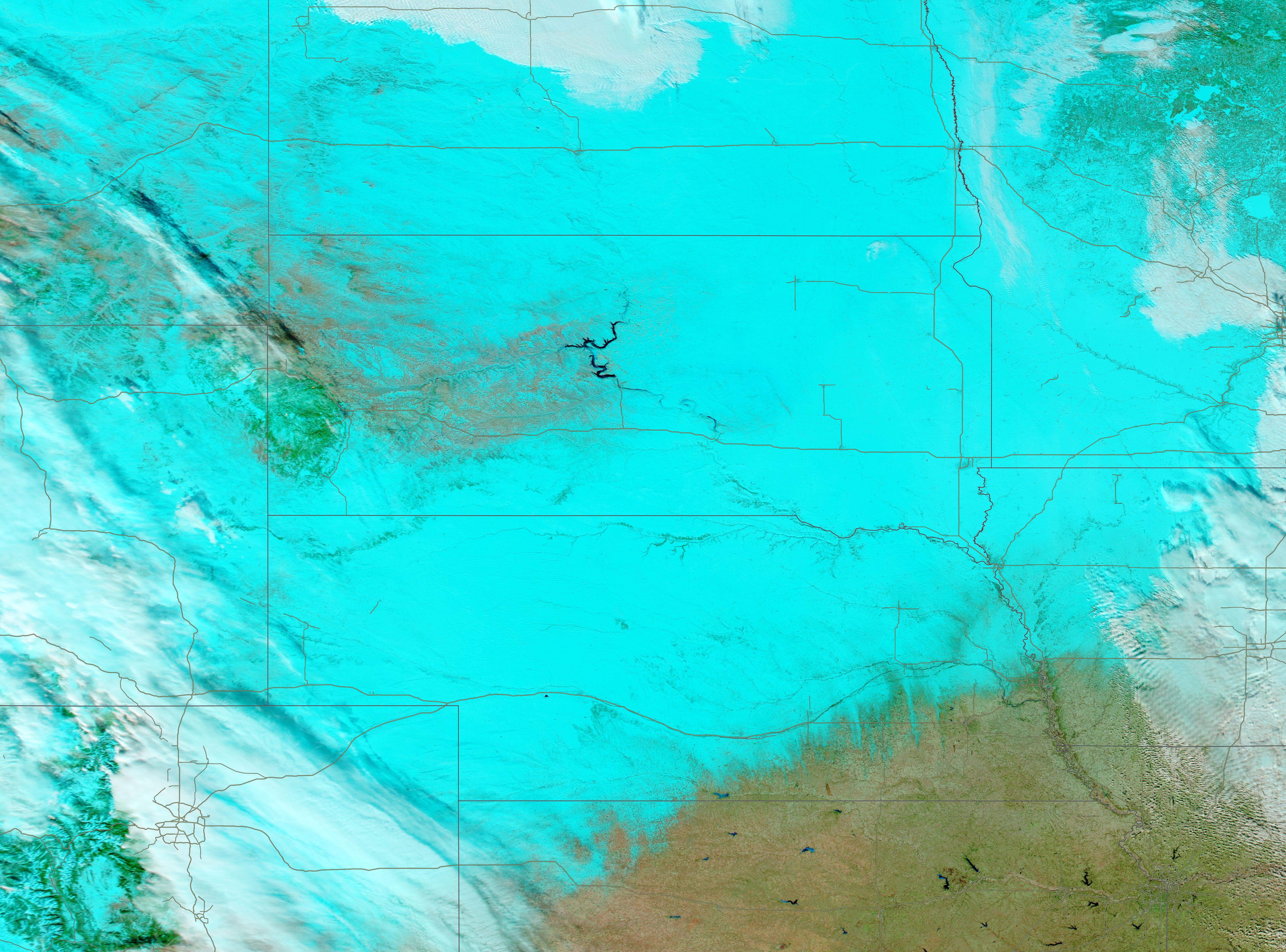
