
Images


January 13, 2023 - Storms Continue to Batter the West Coast of the United States
 Tweet
Tweet
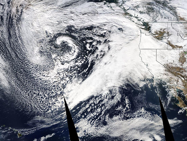
On January 11, 2023, the Moderate Resolution Imaging Spectroradiometer (MODIS) on board NASA’s Aqua satellite acquired a true-color image of yet atmospheric river winding up over the Pacific Ocean and taking aim at a thoroughly-drenched California.
A series of five back-to-back atmospheric rivers has battered much of the state since late December 2022, creating severe flooding, landslides, more than a billion dollars of damage, and the death of at least 18 people.
According to the National Weather Service, almost all of the state has received rainfall totals of 400-600 percent above average between December 26, 2022 and January 9, 2023. The latest storm hit particularly hard in Southern California. Over January 8-9, 2023, much of the region from Santa Barbara to Los Angeles received 3 to 7 inches (8 to 18 cm) of rain. Some areas of Ventura and Santa Barbara counties saw over 16 inches (41 cm) of rainfall in just two days. The highest rainfall reported was in Ventura, which recorded 18.78 inches (47.7 cm).
An atmospheric river is a long, narrow corridor of concentrated moisture that can transport moisture for thousands of miles—they are the largest transport mechanism of freshwater on Earth. They are also among the most damaging storm types in the middle latitudes, especially with regard to the hazardous wind they produce.
While January 12 brought some relatively clear skies and a break in the rain to parts of California, the next system will bring rain and snow to the West Coast beginning on January 13. As it exits, yet another atmospheric river is expected to bring additional precipitation and wind starting on January 15.
Image Facts
Satellite:
Aqua
Date Acquired: 1/11/2023
Resolutions:
1km (4.5 MB),
Bands Used: 1,4,3
Image Credit:
MODIS Land Rapid Response Team, NASA GSFC
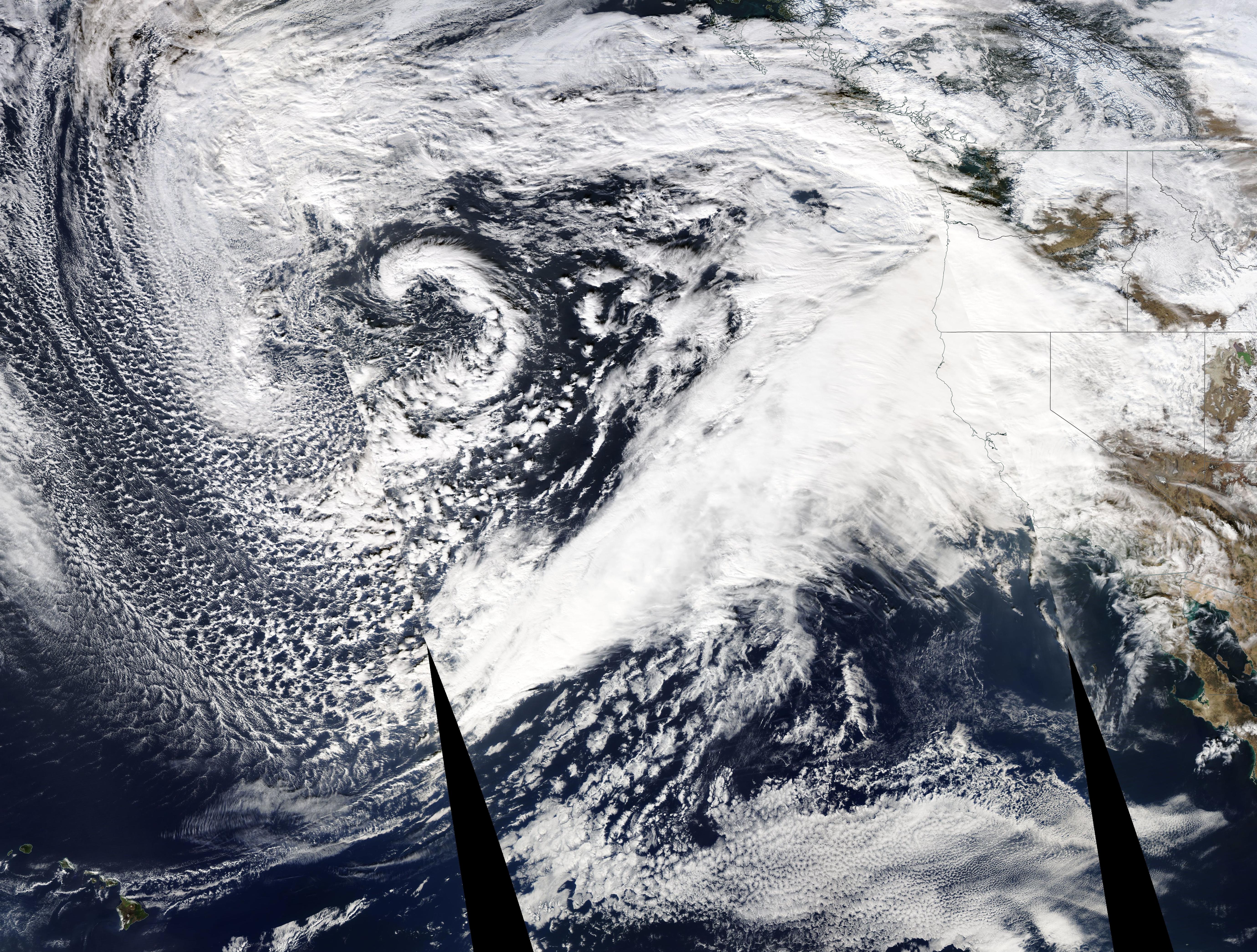
