
Images


March 18, 2023 - Snow from Nor'easter across New England
 Tweet
Tweet
Wild winds and spots of heavy snow marked the first nor’easter of the winter season in mid-March 2023. From March 13-15, some high elevations in New York, Vermont, Massachusetts, and New Hampshire saw 36 inches (76.2 cm) of fresh snow with a few spots registering 40 inches (101.6 cm). Meanwhile, the storm brought wind gusts up to 60 mph (96.5 km/h), downing powerlines and creating widespread power outages.
The chill didn’t last long, however. By March 17, most of New England was enjoying temperatures over 50˚F (12.8˚C). The warm-up, combined with showers scattered across the region, encouraged melting of the new snow, especially in lower elevations.
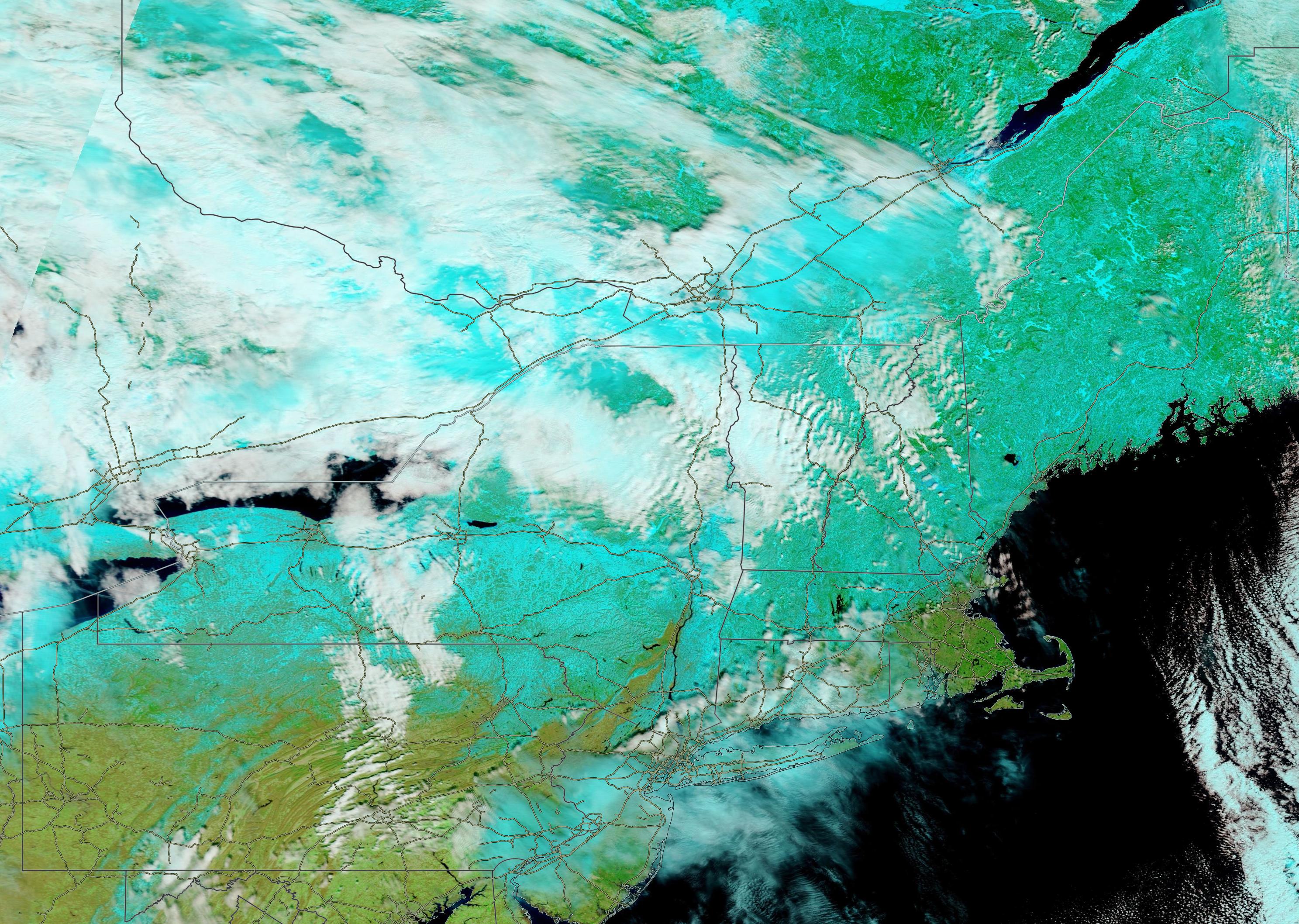
On March 16, the Moderate Resolution Imaging Spectroradiometer (MODIS) on board NASA’s Terra satellite acquired a false-color image of the Northeastern United States and Southeastern Canada. In this type of image, which uses MODIS bands 7,2,1, vegetation appears green, snow looks electric blue, water looks deep blue, open land is tan, and clouds can be white or—if they are cold, containing ice crystals—can be tinted electric blue.
In this image, much of Canada lies under cloud cover, parts of which stretch into the United States. Snow can be seen covering the ground from the highest elevations of Pennsylvania’s Appalachian Mountains and beyond the northernmost tip of Maine. In most areas, the snow does not appear to be very thick, as it is tinted with the green of underlying vegetation. Coastal regions, such as the hook-shaped Cape Cod, Massachusetts, and southern states are snow-free.
Image Facts
Satellite:
Terra
Date Acquired: 3/16/2023
Resolutions:
1km (298.9 KB), 500m (1.1 MB), 250m (3.6 MB)
Bands Used: 7,2,1
Image Credit:
MODIS Land Rapid Response Team, NASA GSFC
Wild winds and spots of heavy snow marked the first nor’easter of the winter season in mid-March 2023. From March 13-15, some high elevations in New York, Vermont, Massachusetts, and New Hampshire saw 36 inches (76.2 cm) of fresh snow with a few spots registering 40 inches (101.6 cm). Meanwhile, the storm brought wind gusts up to 60 mph (96.5 km/h), downing powerlines and creating widespread power outages.
The chill didn’t last long, however. By March 17, most of New England was enjoying temperatures over 50˚F (12.8˚C). The warm-up, combined with showers scattered across the region, encouraged melting of the new snow, especially in lower elevations.
On March 16, the Moderate Resolution Imaging Spectroradiometer (MODIS) on board NASA’s Terra satellite acquired a false-color image of the Northeastern United States and Southeastern Canada. In this type of image, which uses MODIS bands 7,2,1, vegetation appears green, snow looks electric blue, water looks deep blue, open land is tan, and clouds can be white or—if they are cold, containing ice crystals—can be tinted electric blue.
In this image, much of Canada lies under cloud cover, parts of which stretch into the United States. Snow can be seen covering the ground from the highest elevations of Pennsylvania’s Appalachian Mountains and beyond the northernmost tip of Maine. In most areas, the snow does not appear to be very thick, as it is tinted with the green of underlying vegetation. Coastal regions, such as the hook-shaped Cape Cod, Massachusetts, and southern states are snow-free.
Image Facts
Satellite:
Terra
Date Acquired: 3/16/2023
Resolutions:
1km (298.9 KB), 500m (1.1 MB), 250m (3.6 MB)
Bands Used: 7,2,1
Image Credit:
MODIS Land Rapid Response Team, NASA GSFC
