
Images


June 3, 2023 - Mawar Weakens off Japan
 Tweet
Tweet
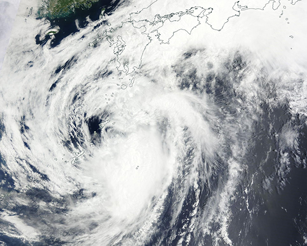
On June 2, 2023, the Moderate Resolution Imaging Spectroradiometer (MODIS) on board NASA’s Terra satellite acquired a true-color image of a much-weakened Tropical Storm Mawar spinning in the Philippine Sea off the coast of Japan. Near the time the image was acquired, maximum sustained winds were estimated near 50 mph (80.5 km/h) and it was traveling towards the northeast, roughly parallel to the main islands of Japan. It is expected to continue to weaken as it moves away from land and becomes extratropical on June 3, when maximum sustained winds should register only 40 mph (64.4 km/h).
Mawar (also known as Betty) clipped northern Guam on May 24 as a Violent Typhoon carrying maximum sustained winds of 135 mph (217 km/h), which is the equivalent of a Category 4 storm on the Saffir-Simpson Hurricane Wind Scale. It rapidly intensified, reaching peak strength on May 25 as a Super Typhoon, with maximum sustained winds estimated at 185 mph (298 km/h)—an extremely strong Category 5 storm. The only other West Pacific Typhoon to become that strong in the month of May occurred in 1958, when Typhoon Phyllis reached that windspeed for a brief period.
Image Facts
Satellite:
Terra
Date Acquired: 6/2/2023
Resolutions:
1km (376.6 KB), 500m (1.1 MB), 250m (3.3 MB)
Bands Used: 1,4,3
Image Credit:
MODIS Land Rapid Response Team, NASA GSFC
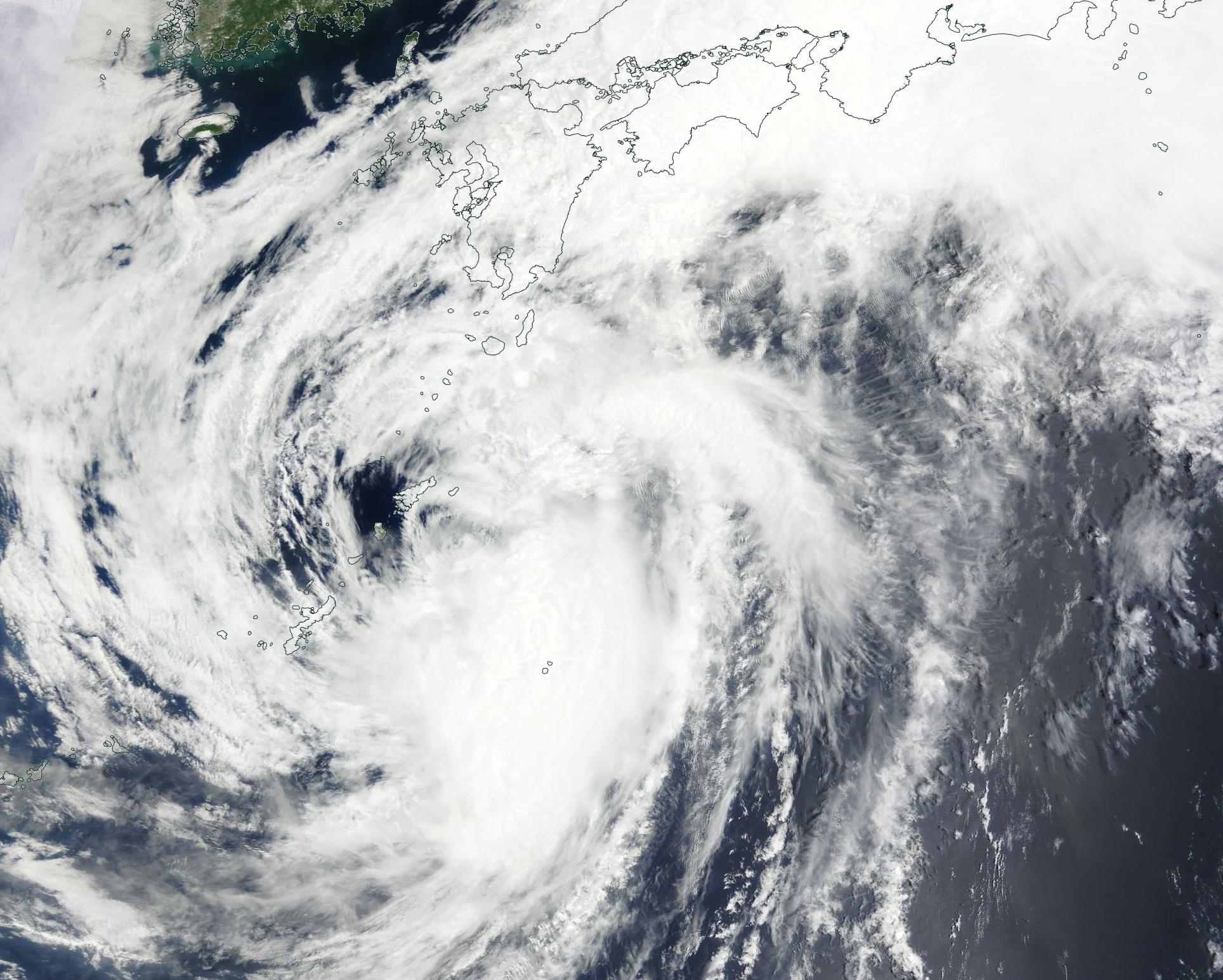
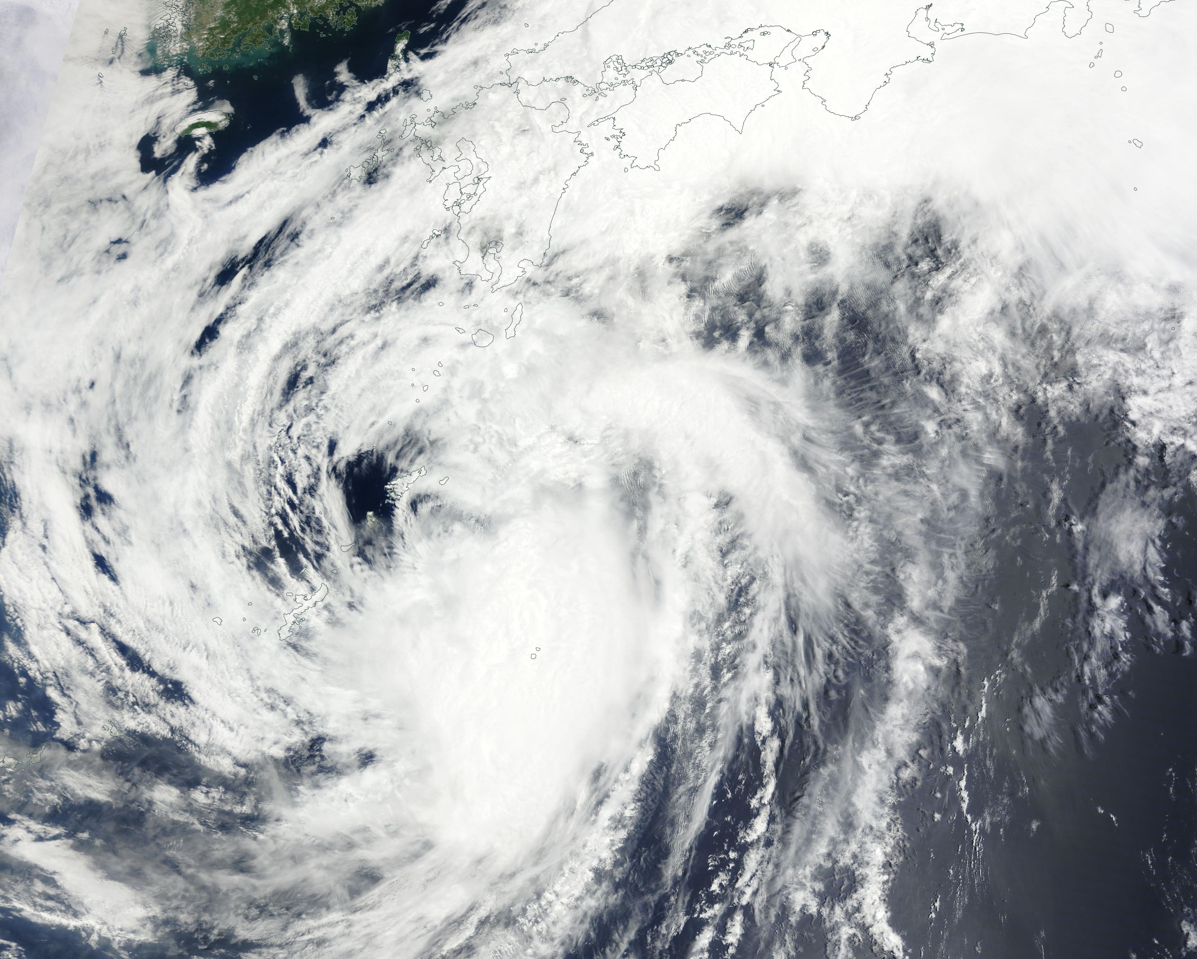
