
Images


January 30, 2024 - Tropical Cyclone Anggrek
 Tweet
Tweet
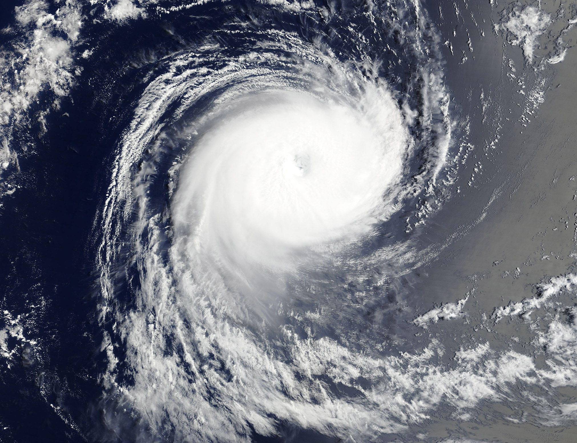
Long-lived Tropical Cyclone Anggrek continued to spin over the Indian Ocean on January 29, 2024, nearly two weeks after it first formed. The Moderate Resolution Imaging Spectroradiometer (MODIS) on NASA’s Terra satellite acquired this true-color image on that same day.
Near the time this image was acquired, the storm carried maximum sustained winds of about 120 mph (193 km/h), which placed it as a Category 3 storm on the Saffir-Simpson Hurricane wind scale. It was located about 990 miles (1,595 km) east-southeast of Réunion.
Anggrek first became a tropical low on January 10 and strengthened to a tropical cyclone on January 15 northwest of the Cocos Islands. It slowly wandered in that general location until January 19, when the storm began to move to the southwest as it strengthened. Tropical Cyclone Anggrek reached peak strength, carrying maximum sustained winds of 125 mph (201 km/h), on January 28. Since then, it has continued to slowly weaken.
The Joint Typhoon Warning Center (JTWC) forecasts that the storm is expected to continue to track southward and eventually drift towards the southeast into an increasingly unfavorable environment. It will battle windshear associated with the Westerlies while sea surface temperatures decrease, causing the storm to begin extra-tropical transition by February 1. Given the difficult environment, Tropical Cyclone Anggrek is not expected to restrengthen.
Image Facts
Satellite:
Terra
Date Acquired: 1/29/2024
Resolutions:
1km (342.3 KB), 500m (861.6 KB), 250m (1.6 MB)
Bands Used: 1,4,3
Image Credit:
MODIS Land Rapid Response Team, NASA GSFC
