
Images


March 26, 2024 - Late Spring Snowstorm in Northeastern United States
 Tweet
Tweet
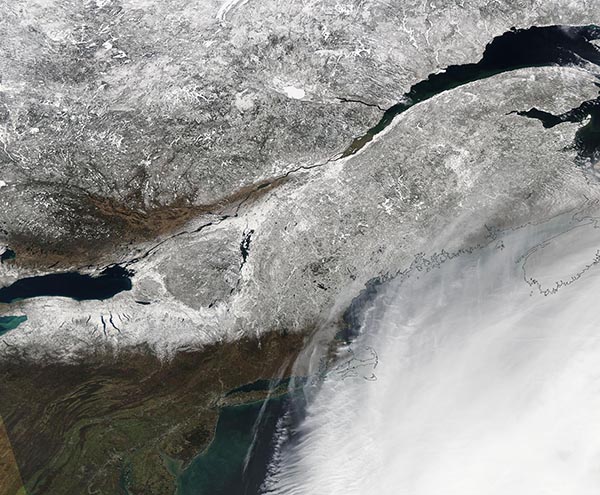
The first weekend of spring brought an intense winter storm to the Canadian Maritimes and the Northeastern United States on March 23-24. The Moderate Imaging Spectroradiometer (MODIS) on NASA’s Terra satellite acquired a true-color image of the snowy aftermath on March 24.
The storm brought howling winds and feet of snow to parts of the region, knocking out power, downing trees, and snarling transportation. The heaviest snow in the United States was in parts of Vermont, New Hampshire, New York, and Maine. According to the National Weather Service, with West Windsor and Landgrove, Vermont reporting 33 inches (83.8 cm) and 32 inches (81.3 cm) respectively. Paulet, New York reported 26.5 inches (67.3 cm); Lebanon, New Hampshire received 26 inches (66 cm); and 25.0 inches (63.5 cm) fell at Bryant Pond, Maine. In warmer regions and along the coast, the storm brought rain and freezing rain, the latter creating treacherous conditions. Old Orchard Beach, Maine, Highpoint, New Jersey, and Albany New York all reported more than 0.5 inch (1.27) of freezing rain. The most severe wind gusts were measured at Mount Washington, New Hampshire (63 mph/101 km/h) and Nantucket Memorial Airport, Massachusetts (60 mph/97 km/h).
Image Facts
Satellite:
Aqua
Date Acquired: 3/24/2024
Resolutions:
1km (581.6 KB), 500m (1.9 MB), 250m (5.5 MB)
Bands Used: 1,4,3
Image Credit:
MODIS Land Rapid Response Team, NASA GSFC
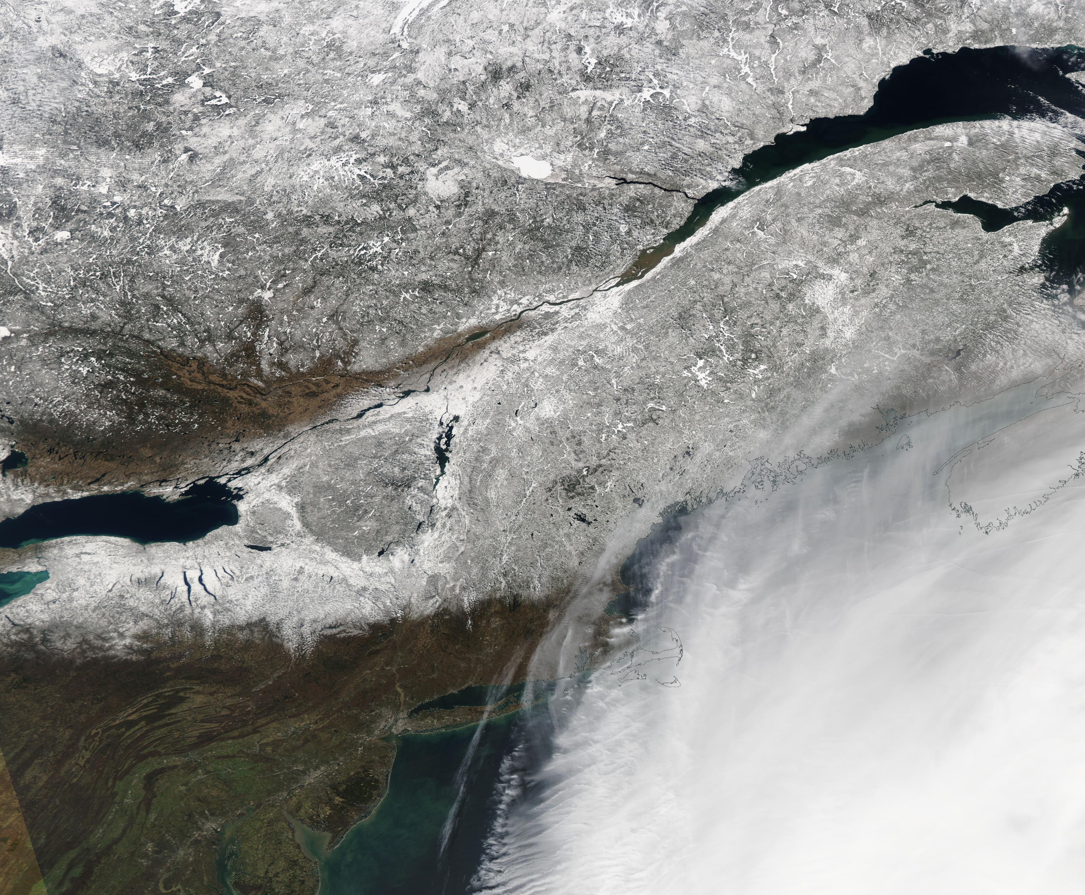
