
Images


March 27, 2024 - Heavy Smoke over South America
 Tweet
Tweet
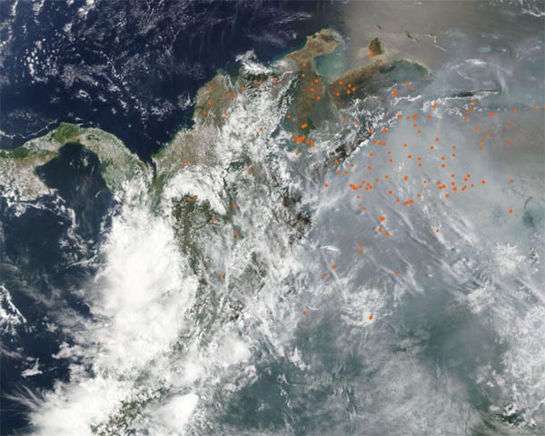
Northwestern South America was shrouded in smoke from hundreds of fires in late March 2024. The Moderate Resolution Imaging Spectroradiometer (MODIS) on NASA’s Terra satellite acquired this true-color image of the smoky scene on March 25.
Each red “hot spot” marks an area where the thermal bands on the MODIS instrument detected high temperature. When combined with typical smoke, as in this image, such hot spots are diagnostic for actively burning fire. Most of the extremely dense smoke hangs over Venezuela and eastern Columbia, while western Columbia and Panama lies under white cloud. Hot spots are widespread across both countries.
It is not possible to know, from satellite imagery, the cause of the fires. It’s likely most of them have been deliberately set to manage land for agricultural purposes, or to open new land for agriculture, a process known as slash-and-burn. The region has also been suffering from a heatwave, elevating the risk of wildfires.
According to Global Forest Watch (GFW), the peak fire season in Columbia begins in January and lasts about 14 weeks. There have been 3,175 fire alerts reported this year so far in 2024, which GFW considers normal compared to previous totals going back to 2012. Venezuela’s peak fire season begins in January and last 17 weeks. There have been 13,956 high-confidence alerts so far in 2024, which GFW reports is unusually high compared to previous totals going back to 2012.
Image Facts
Satellite:
Terra
Date Acquired: 3/25/2024
Resolutions:
1km (548.6 KB), 500m (1.8 MB), 250m (5.2 MB)
Bands Used: 1,4,3
Image Credit:
MODIS Land Rapid Response Team, NASA GSFC
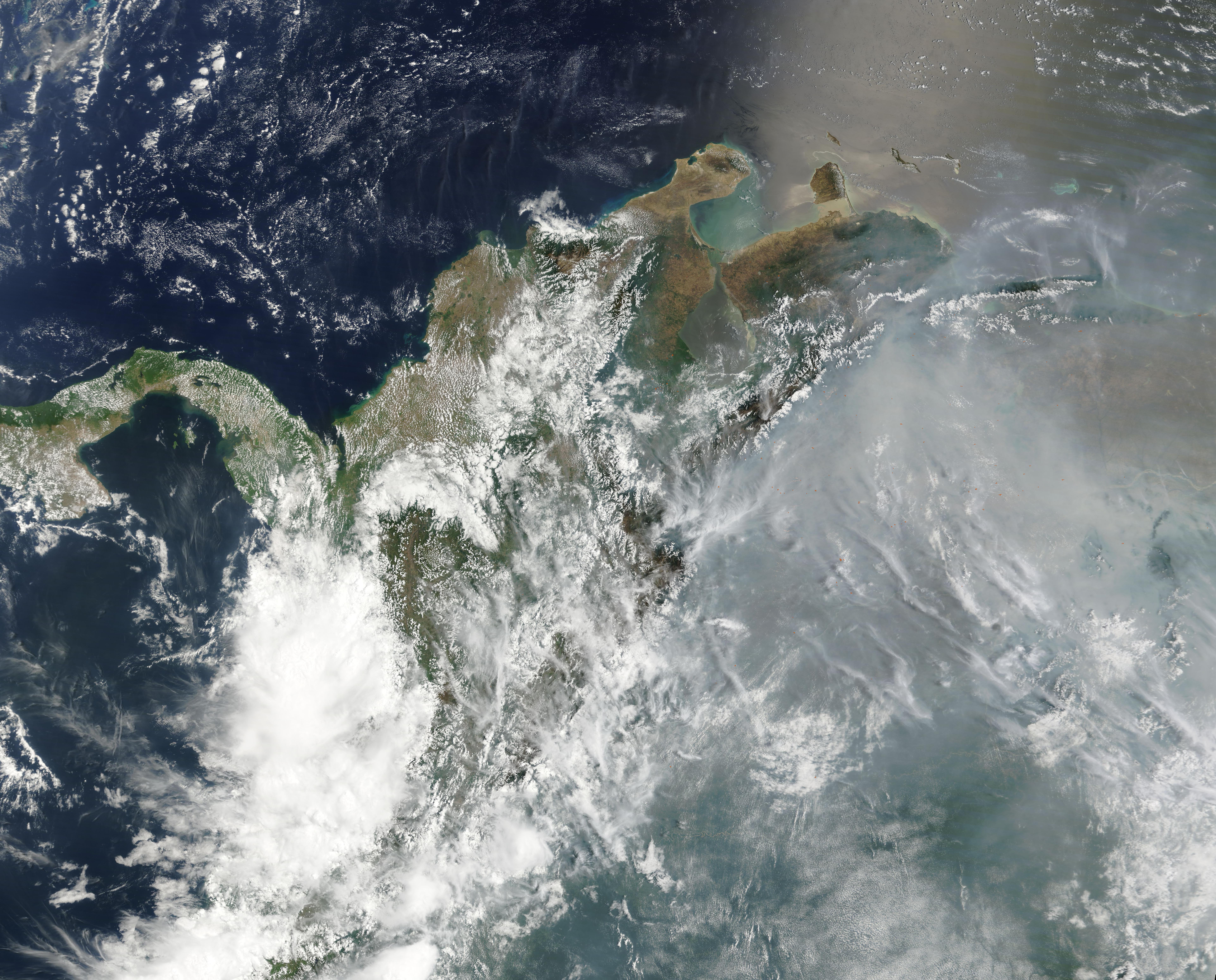
