Images
November 4, 2024 - Valencia Province Under Floodwater
Tweet
On October 29, 2024, torrential rain began to fall over eastern Spain, dropping up to a single year’s worth of precipitation over parts the province of Valencia in just eight hours. The drenching resulted in fast-rising flood waters that damaged power and water infrastructure, carried off cars, and buried streets in feet of clinging, foul-smelling mud. Floods, mud, and landslides also left more than 200 people dead and thousands more missing, according to media reports. Rain continued for several days as emergency response personnel, military, citizens, and volunteers searched for victims, attempted rescues, and began the massive job of digging out from under all the mud. That recovery effort is still ongoing.
The rain came from a high-altitude low-pressure weather system that became isolated from the jet stream, according to AEMET. These storm systems are known locally by the Spanish acronym DANA (Depresión Aislada en Niveles Altos), or more generally as cut-off lows. They occur where cold fronts encounter warm, humid air masses, such as over the Mediterranean Sea. The storms can remain relatively stationary before dissipating, amplifying their flooding potential.
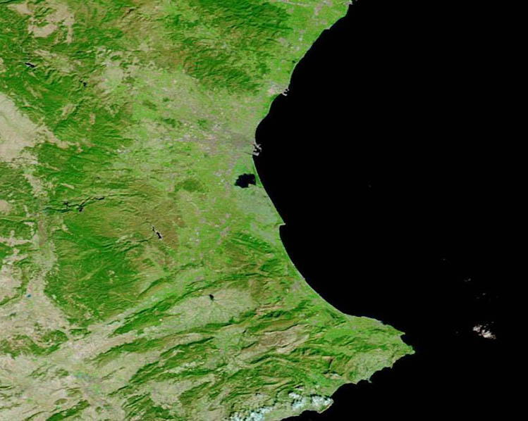
The Moderate Resolution Imaging Spectroradiometer (MODIS) on NASA’s Aqua satellite acquired pair of false-color images of eastern Spain that together illustrate the massive inundation. The images were acquired on October 31, 2024, and October 4, 2024, and each can be viewed by clicking on the respective date.
The first image, acquired on October 31, shows a massive amount of water (dark blue) along the shoreline of the Balearic Sea of eastern Spain. The impression is of a large lake partially separated from the Sea by a thin line of vegetated land (bright green), but that “lake” is actually flooded coastal plain. A broad band of turquoise within the flooded area is made by sediment pouring from local rivers. The city of Valencia can be seen as gray pixels north of the flooded area. Clouds, which have been carrying rain, hover over the northeastern corner of the image. Higher clouds are light blue while lower clouds look white.
The second image, acquired on October 4, shows the region prior to the devastating storm. The coastline appears remarkably different, especially south of the city of Valencia. This area, which had been completely submerged on October 31 appears dry and richly vegetated, except for the Albufera Lagoon.
Image Facts
Satellite:
Terra
Date Acquired: 10/31/2024
Resolutions:
1km ( B), 500m (67.3 KB), 250m (136.5 KB)
Bands Used: 7,2,1
Image Credit:
MODIS Land Rapid Response Team, NASA GSFC


