
Images


April 13, 2024 - Tropical Cyclone Paul
 Tweet
Tweet
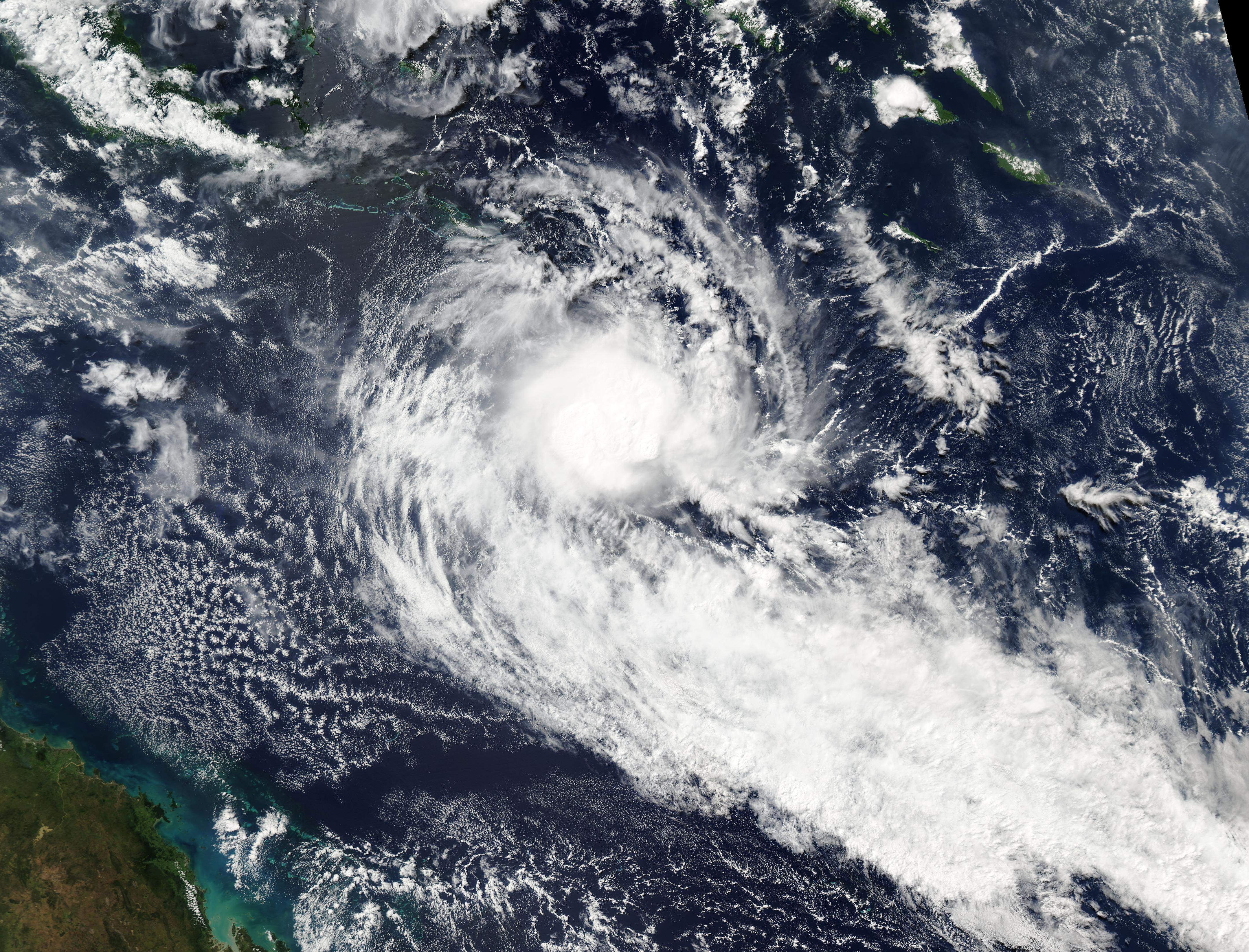
Tropical Cyclone Paul was just spinning up in the far northern Coral Sea on April 11, 2024, when the Moderate Resolution Imaging Spectroradiometer (MODIS) on NASA’s Aqua satellite acquired this true-color image.
Paul became the eighth named cyclone of the 2023/2024 cyclone season in the Australian Region, but it was exceedingly short lived. Maximum sustained winds peaked at 60 mph (96.5 km/h) early on April 11, but increasingly difficult wind shear caused Paul to quickly weaken, dropping to below cyclone strength that same evening.
The Joint Typhoon Warning Center (JTWC) issued its final advisory on Tropical Cyclone Paul at 1200 UTC (8:00 a.m. EST) on April 12. At that time, the storm was located approximately 732 miles (1,178 km) east of Cairns, Australia and was carrying maximum sustained winds of 40 mph (64 km/h). The advisory stated that the system had “rapidly deteriorated and unraveled with the disorganized central convection severely collapsed and sheared.” The storm was being battered by very strong vertical wind shear and was expected to quickly fall below the warning threshold.
While the storm will be closely monitored for signs of regeneration, neither the JTWC nor the Australian Bureau of Meteorology (BoM) forecast any significant impacts on the Australian coast or territories.
Image Facts
Satellite:
Aqua
Date Acquired: 4/11/2024
Resolutions:
1km (2.9 MB), 500m (2.7 MB),
Bands Used: 1,4,3
Image Credit:
MODIS Land Rapid Response Team, NASA GSFC
