
Images


April 14, 2024 - Sea Ice in the Strait of Belle Isle
 Tweet
Tweet
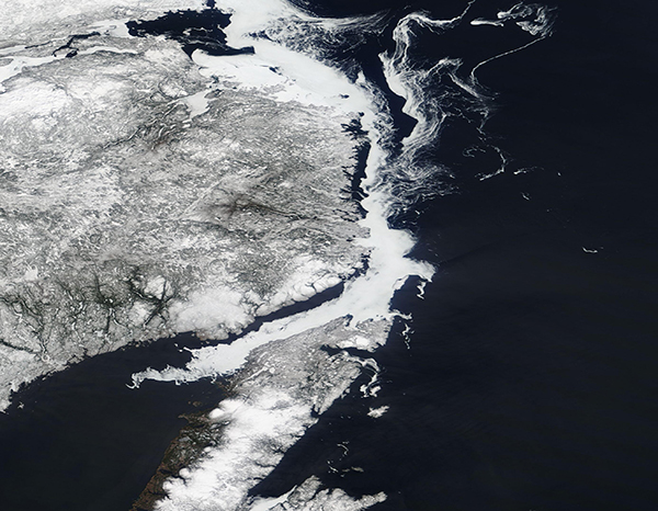
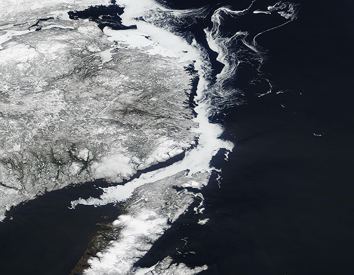
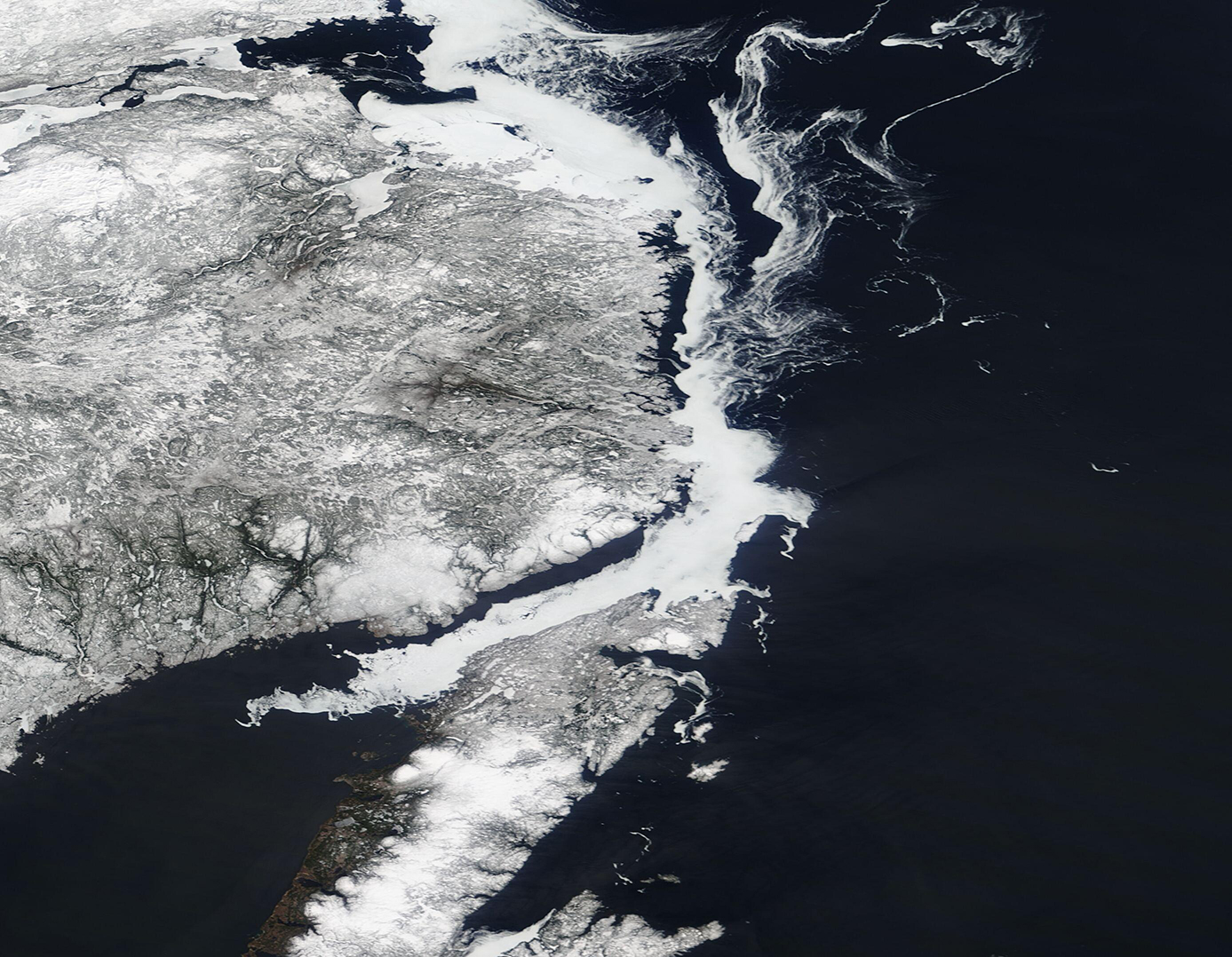
The narrow Strait of Belle Isle separates Canada’s Labrador mainland (west) from Newfoundland and the small Belle Island (east). It lies in a key location; it is the shortest shipping lane between the Great Lakes and Europe, and also on the main north-south shipping route to Hudson Bay and the Northwest Territories.
The frigid Labrador Current flows through the Strait, chilling the waters and encouraging early freeze-up each winter and slow spring ice-out. Icebergs ride the current, especially in spring, traveling from the Arctic to the Gulf of St. Lawrence, where they ultimately melt. Icy conditions typically limit the shipping season, reliably allowing commercial passage between June and late November.
The Moderate Resolution Imaging Spectroradiometer (MODIS) on NASA’s Terra satellite acquired a true-color image of ice filling Belle Isle Strait on April 11, 2024.
Ice wraps around the coast of Labrador and forms a continuous sheet through the Strait and into the Gulf of St. Lawrence. Some of the ice sticks fast to the coast but most is free-floating sea ice which drifts southward on the Labrador Current. According to the Canada government’s Marine Forecast for April 13, the strait was filled with 7 tenths first-year ice with consolidated first-year ice along parts of the coasts. There were also an estimated 51 to 100 icebergs within the strait on that date.
Image Facts
Satellite:
Terra
Date Acquired: 4/11/2024
Resolutions:
1km (319.7 KB), 500m (845.8 KB), 250m (666 KB)
Bands Used: 1,4,3
Image Credit:
MODIS Land Rapid Response Team, NASA GSFC
