
Images


June 14, 2024 - Central Africa Filled with Fires
 Tweet
Tweet
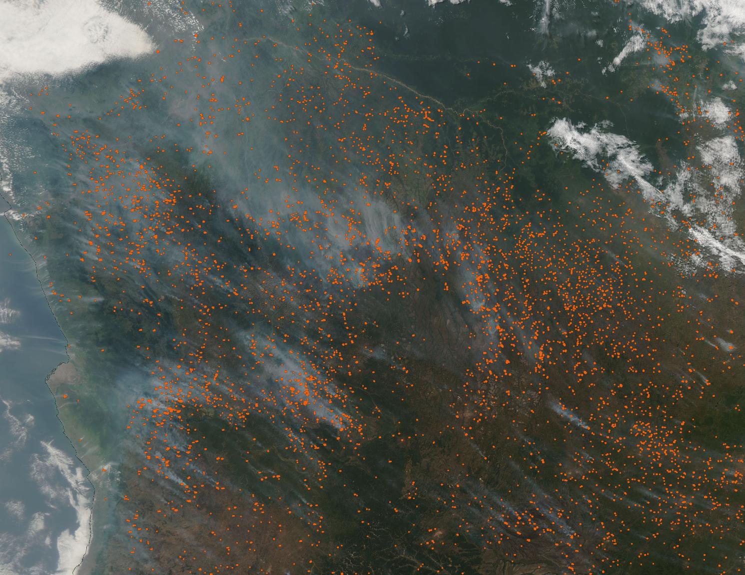
Thick gray smoke hung over Central Africa as many hundreds of fires burned in the fields and forests in mid-June 2024.
The Moderate Resolution Imaging Spectroradiometer (MODIS) on NASA’s Aqua satellite acquired this true-color image of the Democratic Republic of the Congo and Angola on June 11. Each red “hot spot” marks an area where the thermal bands on the MODIS instrument detected high temperatures. When combined with typical smoke, as in this image, such hot spots mark actively burning fire.
Fire is used as an agricultural tool in many parts of the world, including in Central Africa. Given the abundance of the fires in this image, their location, and time of year, most of the fires are undoubtedly agricultural in origin. That means they have been deliberately set to clear fields of old stubble, prepare fields for planting, open new cropland, or pastureland, or to renew pastureland. Because agricultural fires can sometimes slip out of control, it is likely that some of the fires in this region may be wildfires.
According to Global Forest Watch, the peak fire season in the Democratic Republic of the Congo and Angola begins in late May and lasts about 16 weeks.
Image Facts
Satellite:
Aqua
Date Acquired: 6/11/2024
Resolutions:
1km (276.8 KB), 500m (782.1 KB), 250m (2.2 MB)
Bands Used: 1,4,3
Image Credit:
MODIS Land Rapid Response Team, NASA GSFC
