
Images


June 17, 2024 - Arkansas
 Tweet
Tweet
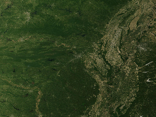
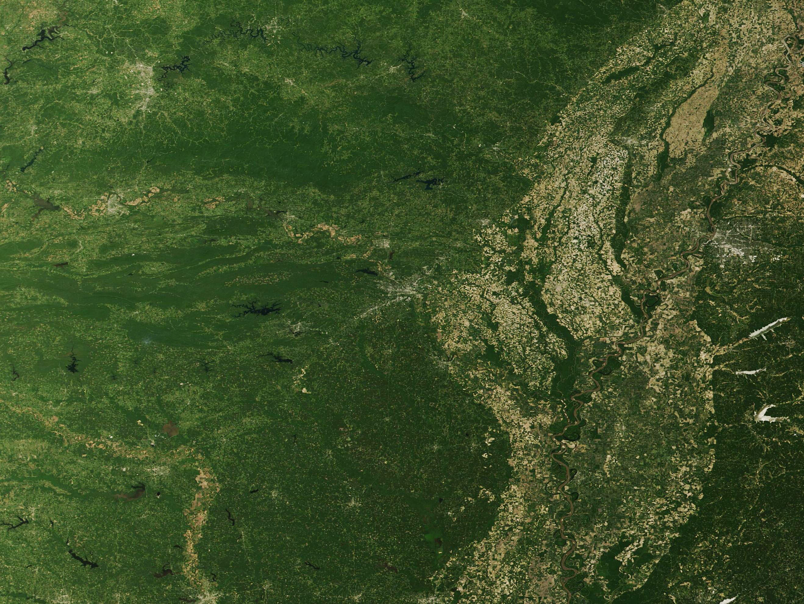
In 1995, the Arkansas state legislature officially adopted the nickname, “The Natural State”, citing the Arkansas’ “unsurpassed scenery, clear lakes, free-flowing streams, magnificent rivers, meandering bayous, delta bottomlands, forested mountains and abundant fish and wildlife.” On June 13, 2024, a true-color image acquired by the Moderate Resolution Imaging Spectroradiometer (MODIS) on NASA’s Terra satellite highlighted several of these natural features.
Little Rock, the capital and largest city in the state, sits on the south bank of the Arkansas River. The city can be seen near the center of this image as a spider-web-like assemblage of gray pixels. A similarly gray “tail” sprouts from the southwestern side of Little Rock and stretches towards the southwest. This is Interstate 30, a major interstate highway.
The Arkansas River is a major tributary of the Mississippi River. It rises in the mountains near Leadville, Colorado and flows generally east and southeast through four states (Colorado, Kansas, Oklahoma, and Arkansas). In this image, it can be seen winding its way across the state from generally west to east, passing south of the heavily forested Ozark Mountains and north of the Ouachita Mountains, the site of many hot springs. After passing by Little Rock, the Arkansas River travels through the rich farmland along the Mississippi Alluvial Plain before pouring into the Mississippi River. The Mississippi forms the boundary between the states of Arkansas (west) and Mississippi (east).
Image Facts
Satellite:
Terra
Date Acquired: 6/13/2024
Resolutions:
1km (162.1 KB), 500m (462.4 KB), 250m (1.2 MB)
Bands Used: 1,4,3
Image Credit:
MODIS Land Rapid Response Team, NASA GSFC
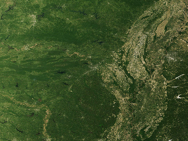
