
Images


June 15, 2024 - The Crimean Peninsula
 Tweet
Tweet
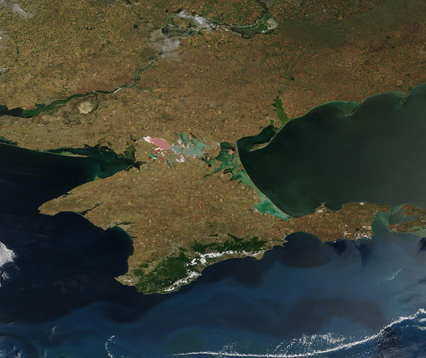
On June 13, 2024, the Moderate Resolution Imaging Spectroradiometer (MODIS) on NASA’s Terra satellite acquired a true-color image of bright colors surrounding and on the Crimean Peninsula.
The tan tones that dominate the peninsula mark agricultural fields in various stages of planting and early growth. In the southeast, the Crimean Mountains are densely vegetated, and a line of clouds covers the coast between the mountains and the Black Sea. Swirls of turquoise in the Black Sea mark a large bloom of phytoplankton—microscopic plant-like organisms that live in these waters year-round in smaller numbers and reproduce to form massive “blooms” when conditions are favorable.
The Sea of Azov, an extension of the Black Sea, sits in the east. It connects to the Black Sea through the narrow Strait of Kerch, which can be seen in the lower right (southeast) side of the image. In contrast to the turquoise tints found in the Black Sea, the water in the Sea of Azov contains splotches of green. This is likely from sediment floating near the surface of the water.
Milky-green water along the peninsula’s northeastern coast marks the Syvash, a system of shallow inlets of the Sea of Azov. A long, narrow sandbar known as the Arabat Spit separates the Syvash from the Sea of Azov. The milky tones hint at the high salinity and shallowness of the lakes of the Syvash. In summer, evaporation usually drives away much of the water, leaving behind a mineral crust.
The Syvash lagoons also cross the northern neck of the peninsula, ending in the profoundly pink waters of Lake Lemuria. The color comes from a salt-loving single-celled algae that thrives in the super-saline lake.
Image Facts
Satellite:
Terra
Date Acquired: 6/13/2024
Resolutions:
1km (90.1 KB), 500m (261 KB), 250m (576.6 KB)
Bands Used: 1,4,3
Image Credit:
MODIS Land Rapid Response Team, NASA GSFC
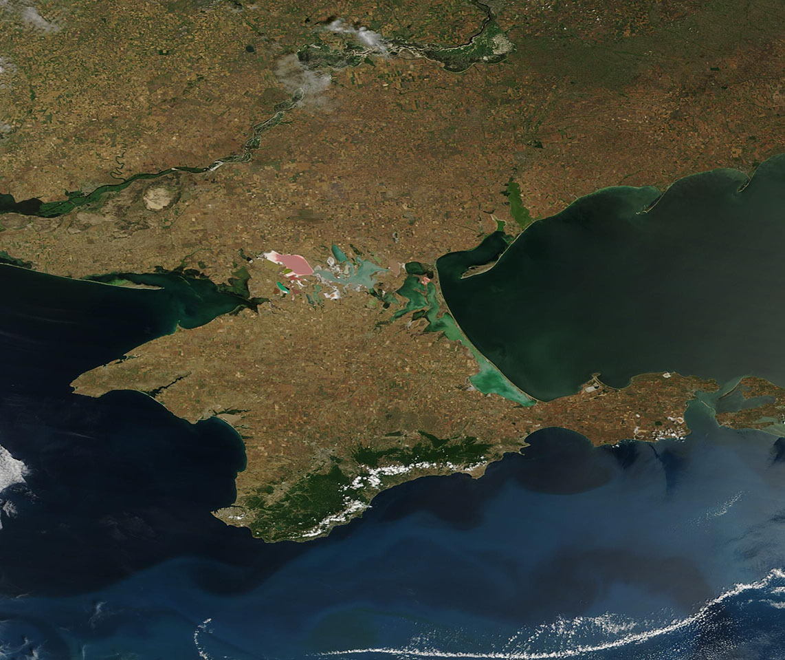
