
Images


July 28, 2024 - Sunglint on Chesapeake Bay
 Tweet
Tweet
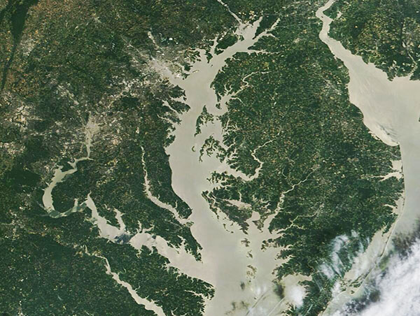
The Chesapeake Bay was shining like a silver-backed mirror on July 16, 2024, when the Moderate Resolution Imaging Spectroradiometer (MODIS) on NASA’s Terra satellite captured this spectacular true-color image.
The uniformly bright color was created by “sunglint”, which is an optical phenomenon that occurs when sunlight reflects off the surface of water at the same angle that a satellite sensor views it. The result is a mirror-like glare as the sensor is saturated with the high-intensity reflected light. Besides creating a stunning image, the sunglint helps highlight the outlines of the entire Chesapeake Bay, including the rivers that flow into it. As a bonus, sunglint also lights up the smaller Delaware Bay, which is located northeast of the Chesapeake.
The Chesapeake Bay is located on the eastern coast of the United States and is about 200 miles long , stretching between Virginia Beach, Virginia northward to Havre De Grace, Maryland, where the Susquehanna River flows into the narrow top of the Bay. It’s the largest estuary—a place where salty ocean water mixes with freshwater—in the United States and the third largest estuary in the world. The Bay and its tidal tributaries have about 11,684 miles of shoreline. This is longer than the entire West Coast of the United States.
A major roadway, Interstate 95, carries traffic north and south along the Western Shore of the Chesapeake Bay. Major cities have grown up around the Bay and this busy interstate. The two largest cities seen in this image are Washington, DC (the District of Columbia), and Baltimore, Maryland. Washington, DC is the capital city and the federal district of the United States. It can be seen as a cluster of gray on the Potomac River. The Port of Baltimore was first built in 1706 and has grown along the three branches of the Patapsco River. The Town of Baltimore was established in 1729 and has grown to become the most populous city in Maryland. The Port of Baltimore is now the nation’s largest port for specialized cargo (roll-on/roll-off ships) and passenger facilities.
Image Facts
Satellite:
Terra
Date Acquired: 7/16/2024
Resolutions:
1km (58.2 KB), 500m (129.7 KB), 250m (274.1 KB)
Bands Used: 1,4,3
Image Credit:
MODIS Land Rapid Response Team, NASA GSFC
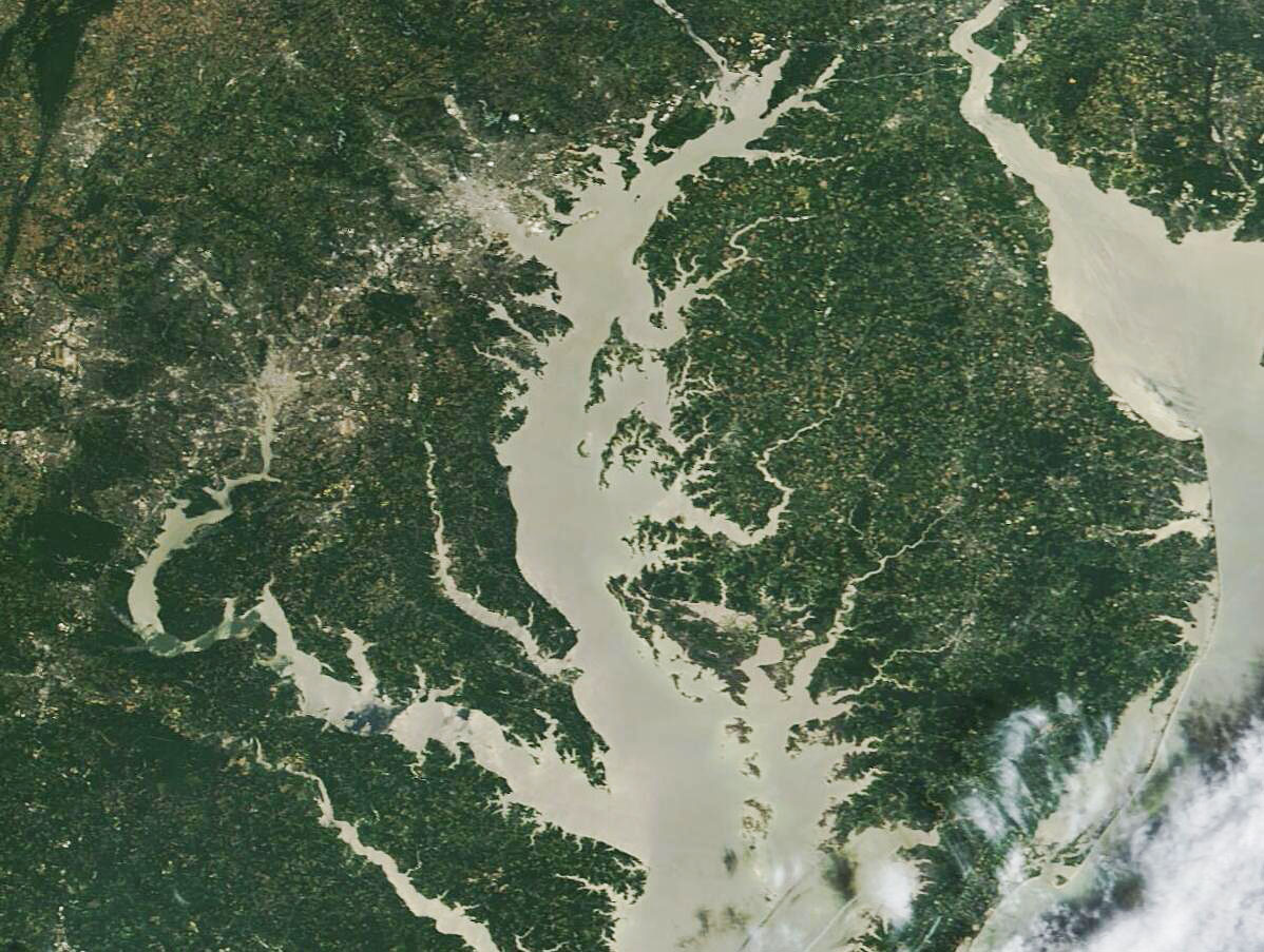
