
Images


August 1, 2024 - Deforestation Heats Up in Brazil
 Tweet
Tweet
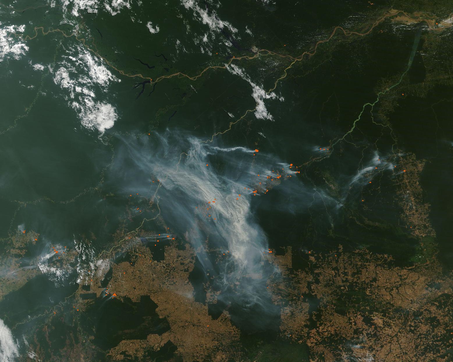
Deforestation by fire continued in Brazil in July 2024. The Moderate Resolution Imaging Spectroradiometer (MODIS) on NASA’s Terra satellite acquired a true-color image of the burning on July 28.
While reports indicated that fires across the Amazon Rainforest had decreased in the first quarter of 2024, fires appeared to be growing by the end of July. The fires captured in this image, each marked by a red “hot spot”, are located primarily in the state of Amazonas. Some of the southernmost fires are in the state of Rondônia. Smoke is so thick that it obscures much of the region from view.
While it’s not possible to absolutely determine if a fire is deliberately set and managed to clear forest or is a wildfire, the location and high number of these fires make it unlikely that they are wildfires. When viewed at high resolution, this image clearly shows that most of the hot spots are at the edge of the forest in areas previously cleared and along roads. This pattern indicates deliberate use of fire to clear forests for agricultural or commercial purposes.
According to Global Forest Watch, in Brazil the peak fire season typically beings in late July and lasts about 13 weeks. In addition, they report that the fire alerts in the last year—between July 24, 2023, and July 24, 2024—were unusually high. Those alerts were high-confidence alerts using satellite data from NASA’s Visible Infrared Imaging Radiometer Suite (VIIRS). VIIRS extends observational records collected by similar instruments aboard previously launched satellites, such as MODIS.
Image Facts
Satellite:
Terra
Date Acquired: 7/28/2024
Resolutions:
1km (253.6 KB), 500m (849.7 KB), 250m (2.5 MB)
Bands Used: 1,4,3
Image Credit:
MODIS Land Rapid Response Team, NASA GSFC
