
Images


August 10, 2024 - Hainan, China
 Tweet
Tweet
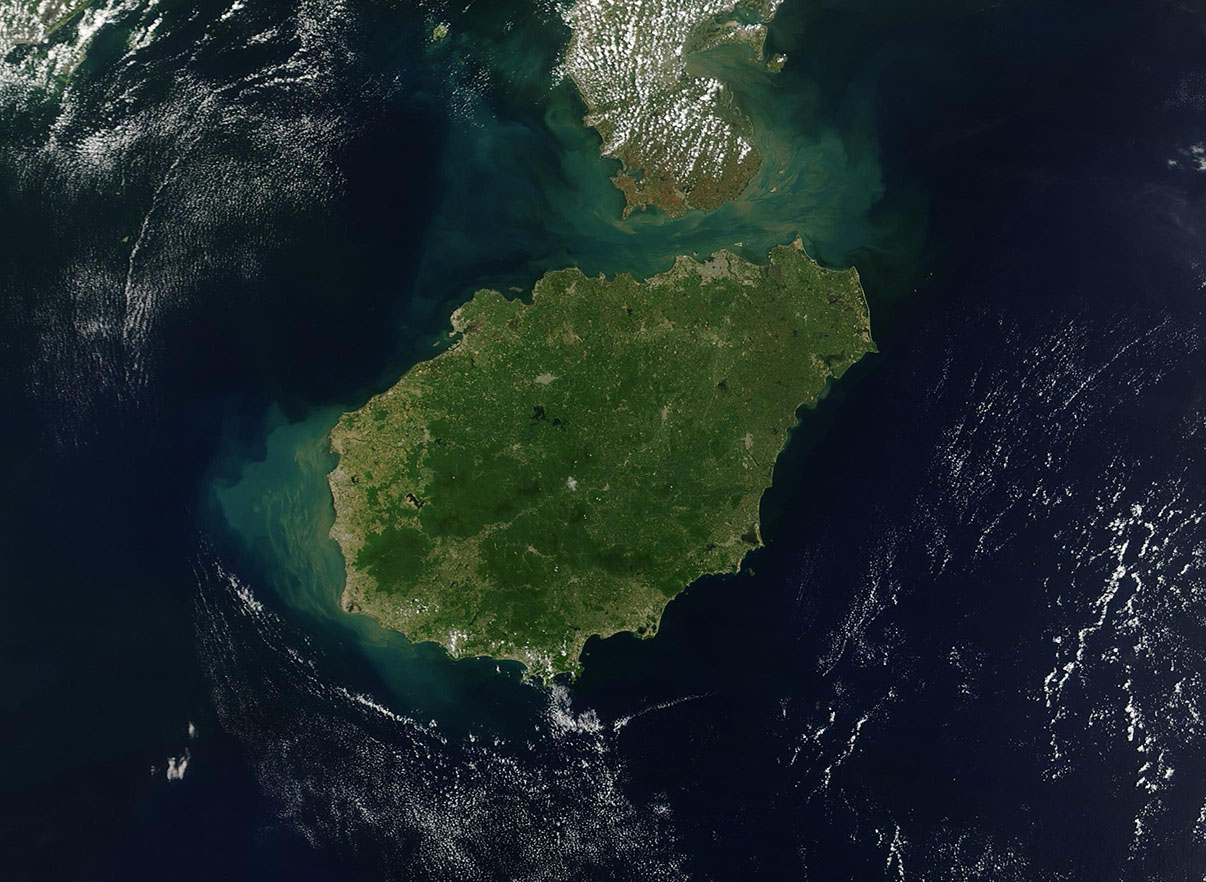
Sitting south of mainland China, the island province of Hainan is the southernmost point of the country. Sometimes called the “Hawaii of China,” the island boasts gorgeous sand beaches, top-flight resorts, luxury and duty-free shops, China’s largest free-trade port, coastal wetlands, tropical forests, and key military bases. It also is a biodiverse hotspot and sits in a critical location for birds flying along the Earth’s longest migratory flyway, the East Asian-Australasian Flyway.
A study published in Global Ecology and Conservation in 2021 tallied 452 species recorded on the island over a 150-year period (1868-2017). The study provided a baseline dataset of historical records of birds on Haian island, noting that many species were recorded prior to 1910, strongly suggesting extinction due to loss of habitat. In addition, most species were found below 500 meters (1,640 feet) but most of the island’s protected area is above 500 meters, pointing to a need for additional protection to preserve vulnerable and endangered bird species. Birds are among the most rapidly declining taxa worldwide yet play critical roles in ecosystems for control of bugs, pests, and in many other ways.
The Moderate Resolution Imaging Spectroradiometer (MODIS) on NASA’s Terra satellite acquired this true-color image of Hainan Island on August 7, 2024.
In the image, sediment fills the Hainan Strait which separates Hainan from the Leizhou Peninsula. Sediment is also suspended in the South China Sea on the western and southwestern coast. The southern and eastern coastlines, which also face the South China Sea, appear clear.
The island measures about 260 km (160 miles) from west to east with a maximum width of about 210 km (130 miles) from north to south. Much of Hainan is rolling hills and tableland, but tall mountains are found in the southwestern interior, which is the greenest area in this image. The tallest peak is Mount Wuzhi, rising to 1,867 meters (6,125 feet) above sea level.
Image Facts
Satellite:
Terra
Date Acquired: 8/7/2024
Resolutions:
1km (84.5 KB), 500m (252 KB), 250m (462.6 KB)
Bands Used: 1,4,3
Image Credit:
MODIS Land Rapid Response Team, NASA GSFC
