
Images


August 5, 2024 - Etesian Winds over the Aegean Sea
 Tweet
Tweet
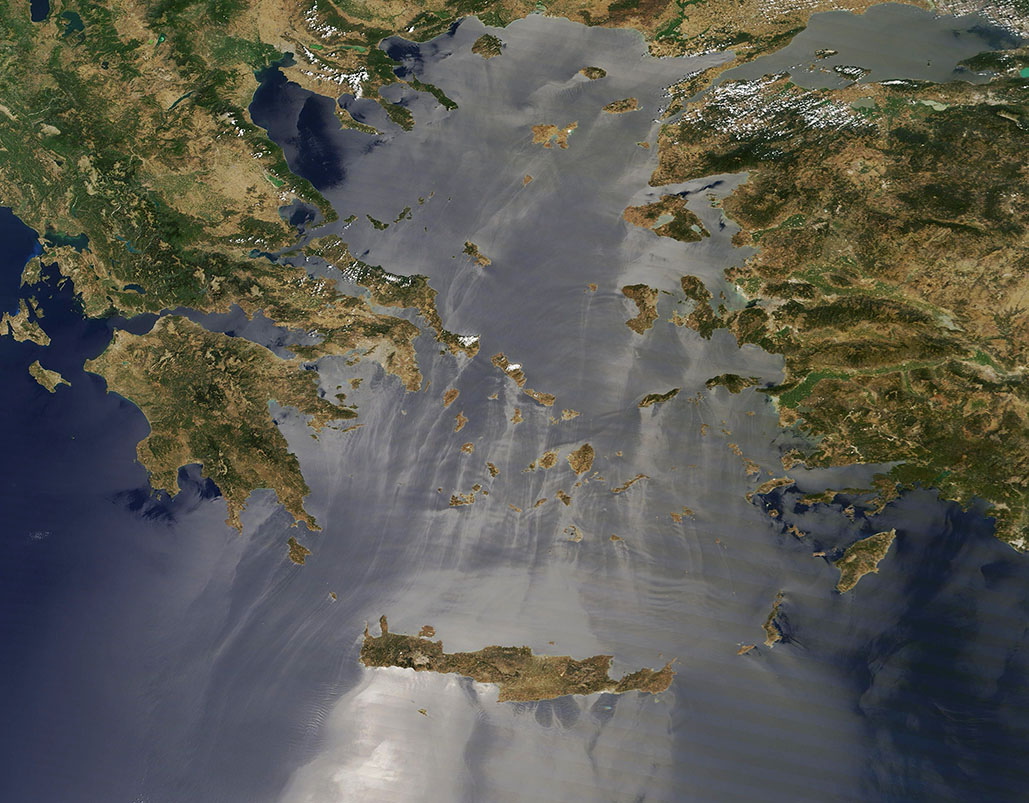
Each summer, the Aegean Sea is combed by strong northerly winds. Known as “Etesian winds”, they usually originate from air masses over southern Russia or the Caspian Sea and sweep southward. They winds are dry and relatively cool, so they can help moderate the peak summer heat of Greece, Türkiye, and the associated islands in the Aegean.
Etesian winds may come on suddenly and often reach gale force. Blowing between 39-46 miles per hour (62-74 kilometers per hour), gale force winds can cause difficulty with small craft navigation and may feed rapid spread of wildfires.
The name “Etesian” is said to derived from the Greek word “etesios”, which means annual. They are also known as “meltemia” in the region.
On July 28, 2024, the Moderate Resolution Imaging Spectroradiometer (MODIS) on NASA’s Terra satellite captured a true-color image that revealed the presence of Etesian winds blowing across the Aegean Sea. For orientation, Greece is in the west (left) and Türkiye sits in the east (right). Crete, a large Greek island, stretches across the southern section of the image at the border between the Aegean Sea (north) and Mediterranean Sea (south).
While the wind itself is, of course, invisible, the optical phenomenon known as “sunglint” marks its passage. Sunglint occurs when the reflection of light off water aims directly back at the satellite sensor. This creates a bright, mirror-like area in a true-color image when the water surface is still and flat. In contrast, where the surface has been roughened by passing wind, light is scattered in many directions, causing those areas to appear darker. As flowing air strikes tall objects, such as the tall terrain of Crete, it is blown around the object. This creates turbulence near and on the edges, but the lee side is protected from the wind and looks bright. The direction of moving air can be estimated from the patches of bright sunglint behind the islands, including Crete.
Image Facts
Satellite:
Terra
Date Acquired: 7/28/2024
Resolutions:
1km (238.6 KB), 500m (592.5 KB), 250m (1.5 MB)
Bands Used: 1,4,3
Image Credit:
MODIS Land Rapid Response Team, NASA GSFC
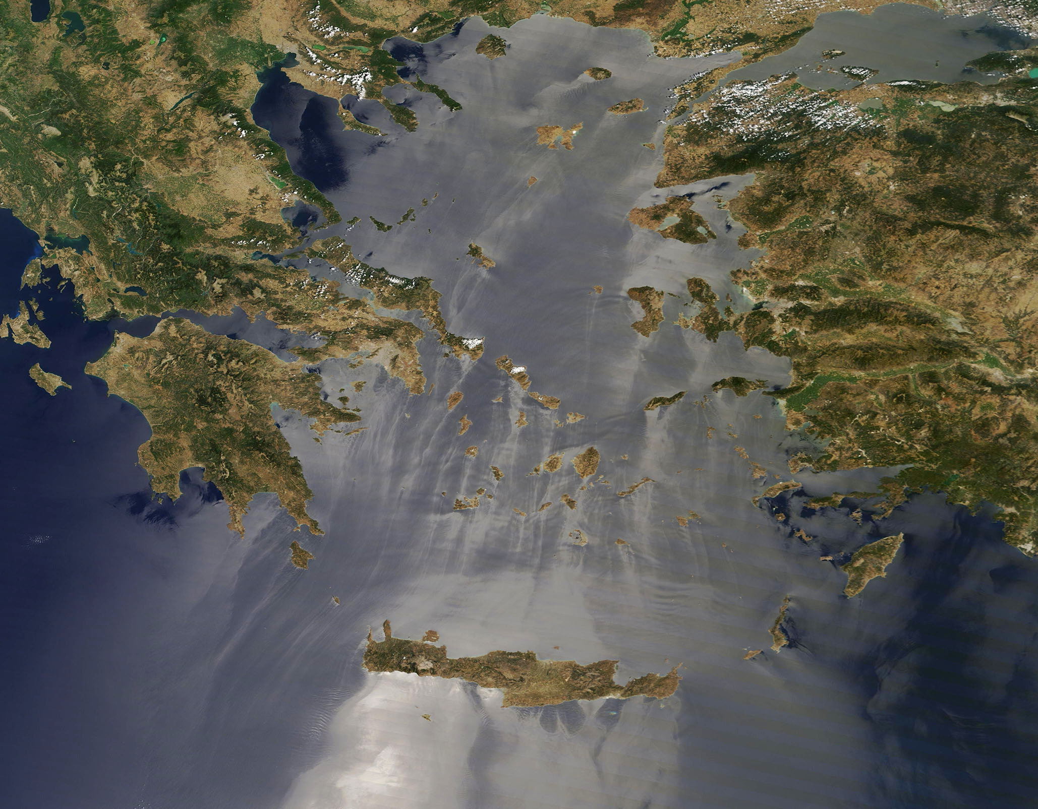
