
Images


September 1, 2024 - Foxe Basin and Baffin Island
 Tweet
Tweet
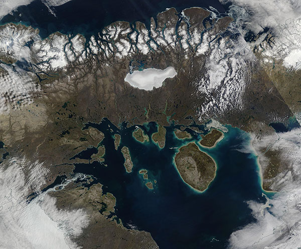
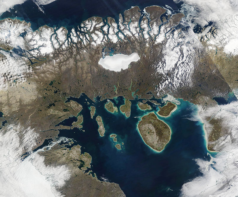
The seasonal melting of sea ice across the central Arctic Ocean and surrounding basins begins in June and peaks in July, the region’s warmest month. Typically, ice reaches maximum retreated in Foxe Basin in late August and early September before new ice begins to form in October.
The Moderate Resolution Imaging Spectroradiometer (MODIS) on NASA’s Terra satellite acquired a true-color image centered on Foxe Basin on August 16, 2024. The scant sea ice that remains floats near the southern shores and along narrow waterways. Year-round ice remains atop high elevations on Baffin Island. The roughly oval-shaped bright white area on Baffin Island is Barnes Ice Cap, the largest ice cap on the island. A halo of gray around the bright white center strongly suggests that the edges of the ice cap are water-logged due to melting.
Foxe Basin, off the west coast of Baffin Island in Nunavut, Canada, measures about 400 kilometers (250 miles) across at its widest point. Hudson Bay lies to the south, connected to the basin by Foxe Channel, and additional waterways within the Canadian Arctic Archipelago lie to the west. In this image, part of Baffin Island is seen sweeping across the top (north) part of the image. The largest round island is Prince Charles Island.
Image Facts
Satellite:
Terra
Date Acquired: 8/16/2024
Resolutions:
1km (216.3 KB), 500m (570.4 KB), 250m (1.5 MB)
Bands Used: 1,4,3
Image Credit:
MODIS Land Rapid Response Team, NASA GSFC
