
Images


September 4, 2024 - Wildfire Smoke in the Sawtooth Mountains
 Tweet
Tweet
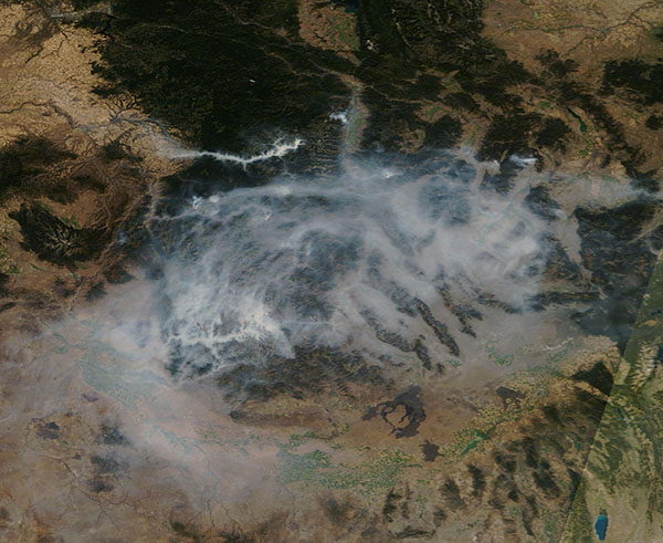
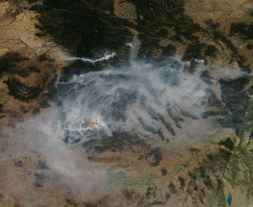
Dozens of small wildfires and several large ones were pumping heavy smoke into the sky in central Idaho in late August 2024. The Moderate Resolution Imaging Spectroradiometer (MODIS) on NASA’s Terra satellite acquired a true-color image of smoky skies over the Sawtooth Mountains northeast of Boise on August 31. Thick smoke fills the valleys while plumes from active blazes drift to the north.
Two of the largest fires contributing to the smoke in this image include the Wapiti Fire and the Middle Fork Complex. Near the time this image was acquired, the Wapiti fire, on the right side of the image, had reached about 95,500 acres and its perimeter was uncontained. Fires in the Middle Fork Complex, which spanned about 55,000 acres on this date, burn on the left side of the image.
On July 24, 2024, lightning ignited what became known as the Wapiti fire in central Idaho. Fire activity ramped up in late August, expanding its footprint to over 108,163 acres (438 square kilometers) by late on September 3. On August 5, 2024, a storm with lightning moved through the area with a series of ground strikes, igniting the Middle Fork Complex (consisting of the Bulldog Fire, Nellie Fire, and Anderson Fire). As of September 3, the Middle Fork Complex spanned 56,806 acres and was only fourteen percent contained. The Wapiti fire, located northeast of Boise, as well as the Middle Fork Complex fires burning northwest of Boise, have spurred evacuation orders and highway and public lands closures.
On the morning of August 31, a temperature inversion—a warm layer of air capping a cooler one—trapped smoke in low-lying areas. Inversions can suppress fire activity by preventing sunlight and heat from reaching the ground. According to InciWeb, forecasters expected the inversion to lift around noon, with the potential for fire behavior to increase after that.
On September 3, more fire weather was in store for the area. A red flag warning was in effect through the evening, with scattered thunderstorms and wind gusts up to 50 miles (80 kilometers) per hour in the forecast.
Image Facts
Satellite:
Terra
Date Acquired: 8/31/2024
Resolutions:
1km (89.2 KB), 500m (89.2 KB), 250m (841.7 KB)
Bands Used: 1,4,3
Image Credit:
MODIS Land Rapid Response Team, NASA GSFC
