
Images


September 5, 2024 - Typhoon Yagi Strengthens After Swiping the Philippines
 Tweet
Tweet
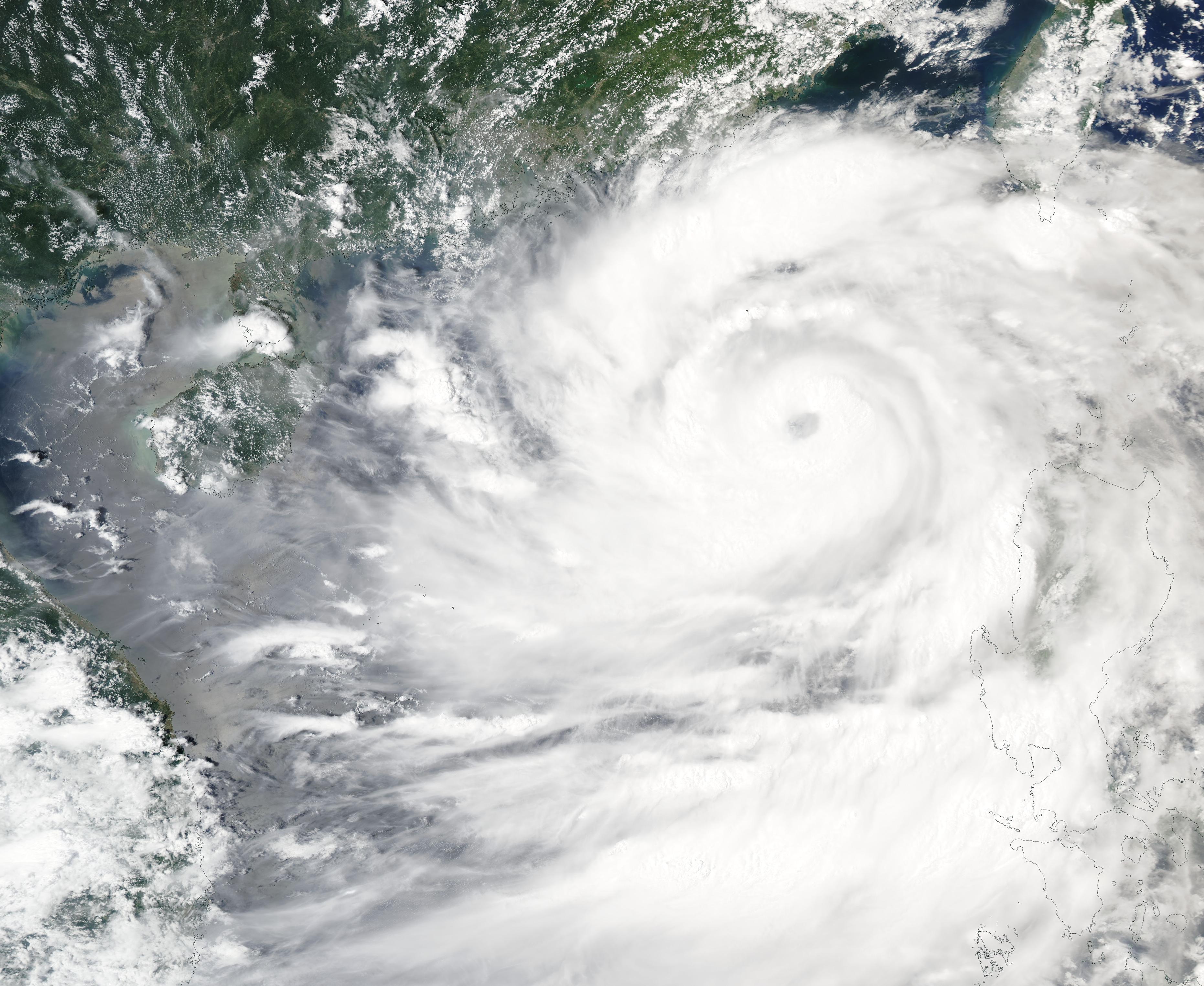
On September 4, 2024, the Moderate Resolution Imaging Spectroradiometer (MODIS) on NASA’s Aqua satellite acquired a true-color image of Typhoon Yagi strengthening over the South China Sea as it was heading towards Hainan, China.
Near the time this image was captured, Yagi’s maximum sustained winds were estimated at 125 miles per hour (201 km/h), which is the equivalent of Category 3 storm on the Saffir-Simpon Hurricane Scale. At 2100 UTC (5:00 p.m. EDT) on September 4, the Joint Typhoon Warning Center (JTWC) reported that maximum sustained winds had increased to 138 miles per hour (222 km/h). That is the equivalent of a Category 4 hurricane. It was located about 253 miles (407 km) south-southeast of Hong Kong. It was moving westward and was continuing to strengthen.
The JTWC forecast that Typhoon Yagi is expected to track west-northwestward and pass over the Leizhou Peninsula just north of Hainan between September 5 and 6. It will then track over the Gulf of Tonkin and make landfall over northern Vietnam, likely just north of Hanoi. It is moving in a highly favorable environment, so it is expected to continue to intensify to Super Typhoon strength with maximum sustained winds at 150 mph (244 km/h) and possibly stronger before landfall on September 5. After that, weakening is expected.
On September 2, prior to threatening China and Vietnam, Typhoon Yagi made landfall in Casiguran, Aurora in the Philippines as a tropical cyclone. According to a report published on ReliefWeb, Yagi continued to traverse mainland Luzon, weakening slightly. It then took aim at China and began to intensify to typhoon strength.
The western section of Luzon was already under the rain-soaked influence of the Southwest Monsoon. Widespread damage had been reported from the wind and additional rain from Yagi’s passage combined with the monsoonal rains. ReliefWeb quoted a Philippine government report from September 4 which stated that there had been 228 reports of flooding, with 12 deaths, 11 injuries, and 7 people missing. In addition, there were 64,000 people displaced with a total of 547,000 people affected and 589 homes damaged along with 79 sections of roads and 19 bridges.
Image Facts
Satellite:
Aqua
Date Acquired: 9/4/2024
Resolutions:
1km (393.2 KB), 500m (1.2 MB), 250m (3.3 MB)
Bands Used: 1,4,3
Image Credit:
MODIS Land Rapid Response Team, NASA GSFC
