
Images


September 8, 2024 - Lesser Sunda Islands, Indonesia
 Tweet
Tweet
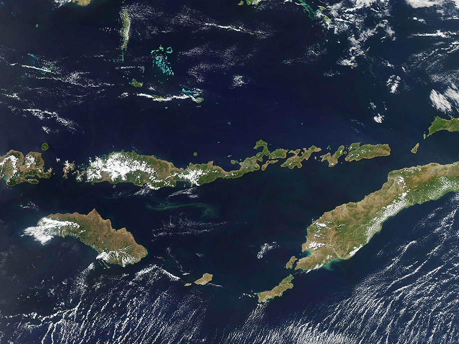
The Lesser Sunda Islands stretch more than 1200 kilometers (746 miles) across the Indian Ocean, from Bali in the west to the island of Timor in the east. The volcanic archipelago is biologically diverse, providing habitat for a wide range of flora and fauna. It has been estimated that the islands host 51 species of mammals in this region. Five are endemics (found nowhere else on Earth) including the Flores shrew, which is critically endangered. More than 270 bird species are found on the islands and the Komodo dragon—the largest lizard species on Earth—only lives on five of the islands.
The Lesser Sunda Islands have lost much of their native forest to agriculture, fire, logging, and volcanic activity. This widespread habitat loss has increasingly threatened the welfare of many species. Only about ten percent of the habitat has been protected and most protected areas are small. Nonetheless, discoveries of new species continue to be made in some of the more remote areas.
In June 2024, researchers published a paper in Ibis International Journal of Avian Science confirming a new species of nightjar, a secretive nocturnal bird, on Timor and Wetar islands. Called Caprimulgus ritae, the bird’s unique vocalizations and study of museum specimens allowed it to be separated from six similar-appearing species. This follows the discovery of several new species of birds, called “sunbirds” by zoologists from the Trinity College of Dublin in 2022. The sunbirds species survive on the Wakatobi Islands which are located north of Flores, the longest of the Lesser Sunda Islands.
The Moderate Resolution Imaging Spectroradiometer (MODIS) on NASA’s Aqua satellite acquired a true-color image of the Lesser Sunda Islands on September 4, 2024. The larger islands in the image include Flores, stretching across an east-west axis near the center, Sumba in the southwest, and Timor in the southeast.
Image Facts
Satellite:
Aqua
Date Acquired: 9/4/2024
Resolutions:
1km (221.6 KB), 500m (569.4 KB), 250m (1.3 MB)
Bands Used: 1,4,3
Image Credit:
MODIS Land Rapid Response Team, NASA GSFC
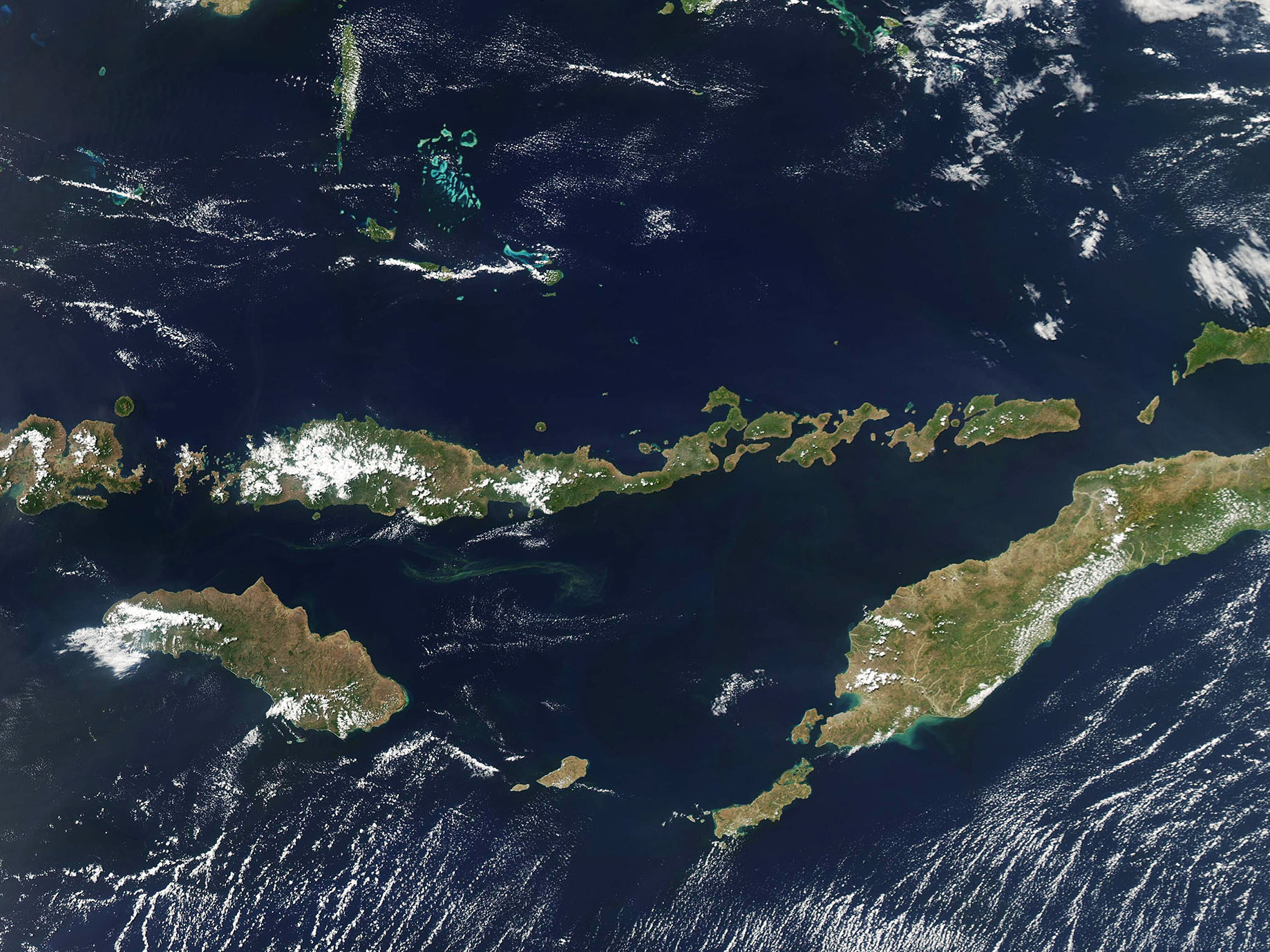
