
Images


September 30, 2024 - Snow in Lesotho
 Tweet
Tweet
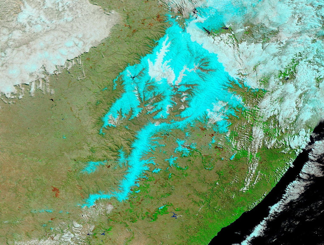
The first day of spring 2024 looked more like winter in some parts of southern Africa after a late-season storm dropped snow on Lesotho and several nearby provinces of South Africa. The storm halted traffic on a major highway that links the coastal city of Durban with Johannesburg and brought several feet of fresh powder to Lesotho’s only ski resort.
Much of the snow fell in the Maloti–Drakensberg mountains, which span about 40,000 square kilometers (15,000 square miles) across Lesotho and South Africa. According to Jennifer Fitchett, a scientist at the University of the Witwatersrand, the range’s higher elevations—primarily in Lesotho—see about eight snowfall events per year, which can occur as late as November. “However, snow of this geographic extent and depth is indeed very unusual in general, and for this time of the year.”
The Moderate Resolution Imaging Spectroradiometer (MODIS) on NASA’s Terra satellite acquired this false-color image that shows the extent of the region’s snowfall on September 22. This type of false-color image is used to help differentiate between areas of snow and ice (blue) and water clouds (white). Note that some of the clouds contain ice and appear light blue. The dark brown patches are burned areas from past fires.
The heavy snow was fueled by a strong low-pressure system that became cut off from the main flow of air, also known as a cut-off low. Fitchett used NOAA’s air mass back-trajectory model to show that this snowfall event originated over the Southern Ocean and moved northeast, then curved northwest toward southern Africa. While past storms have followed similar trajectories, most snow-bearing air masses approach Lesotho from inland areas, according to Fitchett’s analysis of the region’s snowfall events between 2017 and 2022.
The mountainous regions of South Africa and Lesotho, despite only comprising around 8 percent of the total land area, provide roughly half of the water supply for the region. This water—some of which comes from melting snow—helps sustain the region’s ecosystem and is used by people for irrigation and drinking water.
Image Facts
Satellite:
Terra
Date Acquired: 9/22/2024
Resolutions:
1km (357.3 KB), 500m (357.3 KB), 250m (609.3 KB)
Bands Used: 7,2,1
Image Credit:
MODIS Land Rapid Response Team, NASA GSFC
