Images
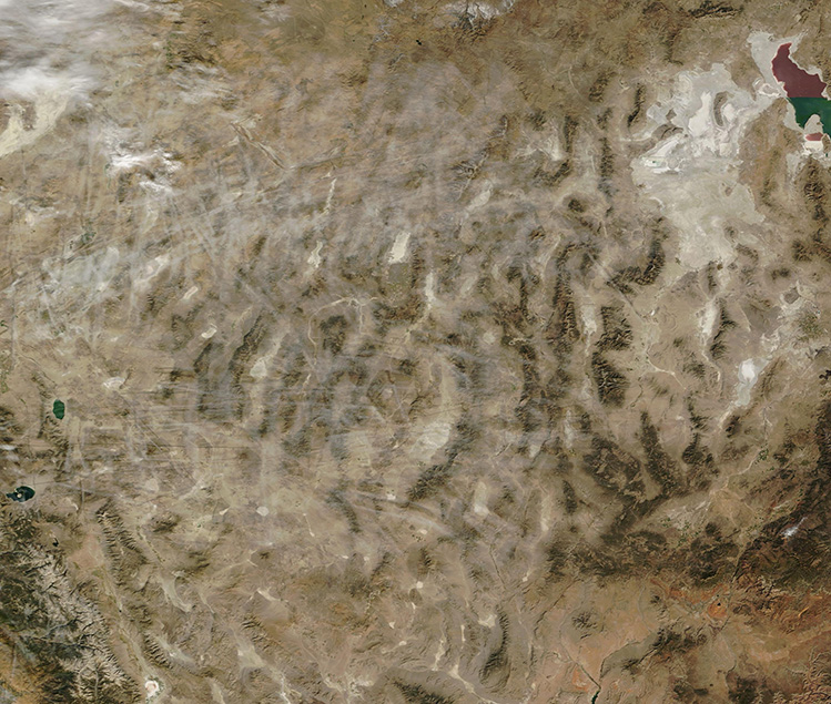
October 29, 2024 - Contrails over Nevada
Tweet
Dozens of contrails crisscrossed the skies over Nevada on October 25, 2024, when the Moderate Resolution Imaging Spectroradiometer (MODIS) acquired this true-color image. Almost all of the long, thin, clouds—which are created by the passage of airplanes—hang over the dry desert of Nevada but a few also can be seen over Utah, in the east. Utah’s Great Salt Lake can be seen in the upper right corner of the image.
When the hot, humid air from a jet engine mixes with colder, drier air in the surrounding environment, condensation trails, or “contrails,” are formed. The composition of contrails is nearly identical to naturally-forming cirrus clouds and both are caused by high levels of water vapor in the air. Cirrus clouds form naturally in areas of high humidity. Contrails form behind airplanes as the engines inject extra water vapor into the atmosphere through their exhaust. Contrails only form at high altitudes where air temperatures are very cold—about -38°F (-39°C).
Image Facts
Satellite:
Terra
Date Acquired: 10/25/2024
Resolutions:
1km (287.3 KB), 500m (700.7 KB), 250m (978.9 KB)
Bands Used: 1,4,3
Image Credit:
MODIS Land Rapid Response Team, NASA GSFC


