
Images


February 5, 2025 - Summer in South Africa


January 28, 2025
July 21, 2024
Tweet
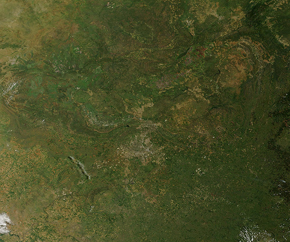
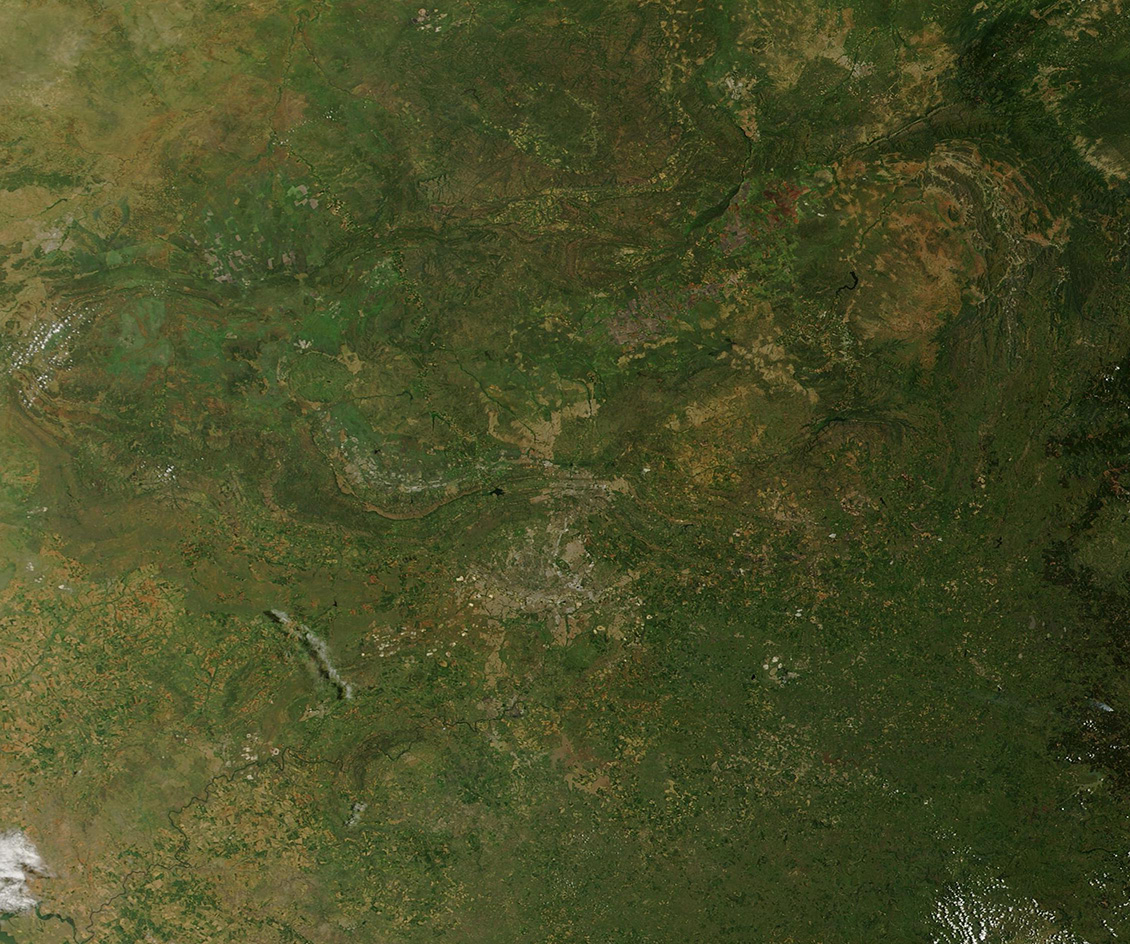
Summertime in northeastern South Africa is the rainy season—a time when near-daily precipitation and warm temperatures turns on vegetative growth and greens the landscape. This rainy season typically begins in October and ends in March, with a short springtime wedged between summer rains and the dry winter season that begins in June. The dryness of winter can often be compared to short-term drought, resulting in parched soil and wilting vegetation.
On January 28, 2025, the Moderate Resolution Imaging Spectroradiometer (MODIS) on board NASA’s Terra satellite acquired a true-color image of summer in northeastern South Africa. A second Terra MODIS image was acquired of the same area on July 21, 2024, when the landscape was gripped by winter. The images can be compared by clicking on the dates.
On January 21, the vast expanse of green is broken in the southcentral section of the image by a blotch of gray pixels. This marks the city of Johannesburg and, just to the northeast, bits of gray also show the location of the city of Pretoria, the capital of South Africa. Clicking on the July 21 image shows a starkly different picture of the same area. The overall impression is of arid exposed soils with rugged, rocky outcroppings and only a few patches of dark green vegetation. Even the gray tones of the cites seem to fade into the dry Earth.
Image Facts
Satellite:
Terra
Date Acquired: 1/28/2025
Resolutions:
1km (168.6 KB), 500m (512.8 KB), 250m (634.5 KB)
Bands Used: 1,4,3
Image Credit:
MODIS Land Rapid Response Team, NASA GSFC
January 28, 2025 July 21, 2024
Summertime in northeastern South Africa is the rainy season—a time when near-daily precipitation and warm temperatures turns on vegetative growth and greens the landscape. This rainy season typically begins in October and ends in March, with a short springtime wedged between summer rains and the dry winter season that begins in June. The dryness of winter can often be compared to short-term drought, resulting in parched soil and wilting vegetation.
On January 28, 2025, the Moderate Resolution Imaging Spectroradiometer (MODIS) on board NASA’s Terra satellite acquired a true-color image of summer in northeastern South Africa. A second Terra MODIS image was acquired of the same area on July 21, 2024, when the landscape was gripped by winter. The images can be compared by clicking on the dates.
On January 21, the vast expanse of green is broken in the southcentral section of the image by a blotch of gray pixels. This marks the city of Johannesburg and, just to the northeast, bits of gray also show the location of the city of Pretoria, the capital of South Africa. Clicking on the July 21 image shows a starkly different picture of the same area. The overall impression is of arid exposed soils with rugged, rocky outcroppings and only a few patches of dark green vegetation. Even the gray tones of the cites seem to fade into the dry Earth.
Image Facts
Satellite:
Terra
Date Acquired: 1/28/2025
Resolutions:
1km (168.6 KB), 500m (512.8 KB), 250m (634.5 KB)
Bands Used: 1,4,3
Image Credit:
MODIS Land Rapid Response Team, NASA GSFC
