
Images


March 27, 2025 - Outbreak of Wildland Fires in Chile
 Tweet
Tweet
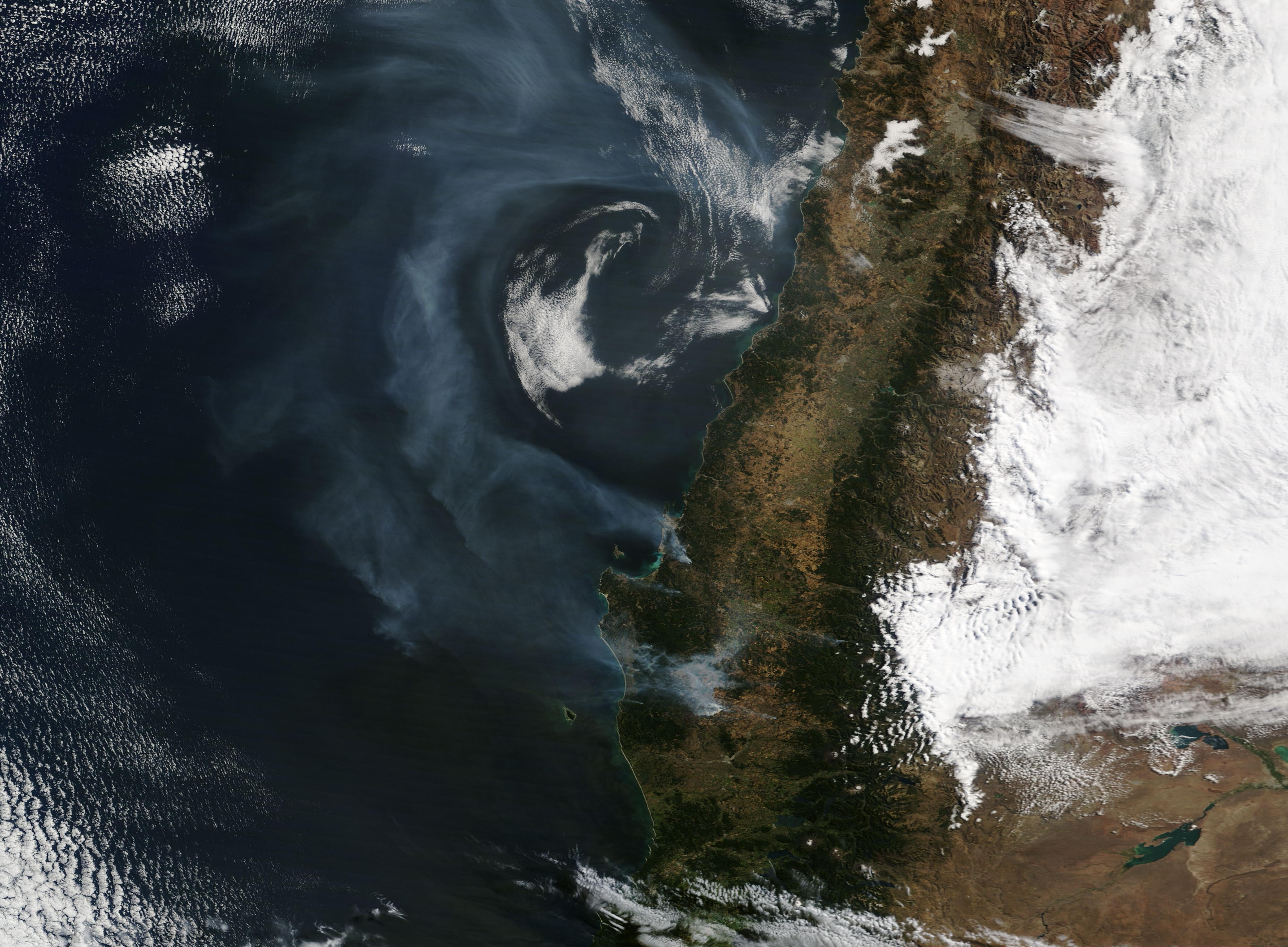
Multiple wildfires burning across central Chile pumped plentiful smoke over the South Pacific Ocean in late March 2025. When the Moderate Resolution Imaging Spectroradiometer (MODIS) on NASA’s Terra satellite acquired this true-color image on March 24, the thick smoke had been caught in the winds of a low pressure system, creating a remarkable swirling pattern.
According to information published by ReliefWeb on March 24, at least 19 wildfires have been affecting Biobío-Ñuble and La Araucanía regions, in central Chile, resulting in evacuations and damage. The International Federation of Red Cross and Red Crescent Societies (IFRC), reported that, as of 23 March, at least 2,050 people have been displaced across seven shelters, 36,660 people were affected, and several classes have been suspended in Biobío-Ñuble and La Araucanía regions. Local media said that more than 15,000 hectares had burnt by March 25.
Prensa Latina, Latin American News Agency stated that, “According to the meteorologists, the fire is being enhanced by the Puelche wind, a word which in the Mapudungun language means ‘people of the east’, due to the direction in which it is blowing. These are gusts that come from the Argentine pampas, reach the Andes mountain range and descend to the Chilean valleys, where the air heats up as it descends.”
Image Facts
Satellite:
Terra
Date Acquired: 3/24/2025
Resolutions:
1km (310.8 KB), 500m (795.5 KB), 250m (1.7 MB)
Bands Used: 1,4,3
Image Credit:
MODIS Land Rapid Response Team, NASA GSFC
