
Images


March 29, 2025 - Beautiful Clouds off of Baja California
 Tweet
Tweet
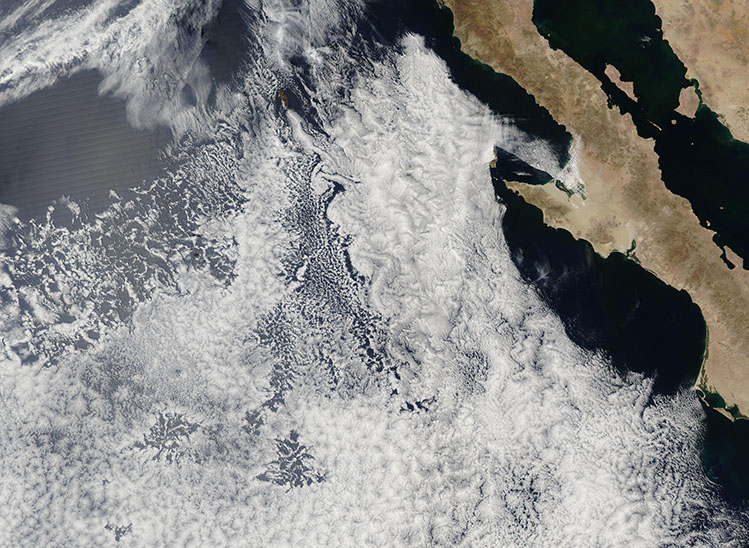
On March 27, 2025, the Moderate Resolution Imaging Spectroradiometer (MODIS) on NASA’s Aqua satellite acquired this true-color image of a striking cloud formation off the west coast of Mexico’s Baja California Peninsula. The swirling pattern is known as a von Kármán vortex, a phenomenon named after Theodore von Kármán, the aerospace engineer at NASA’s Jet Propulsion Laboratory who first described how this pattern is formed.
Von Kármán vortices typically form when the prevailing wind strikes a tall, immobile object, such as islands with high mountains or volcanoes. The forward motion of the air stops abruptly when it strikes the object, then splits and pushes around the object, creating turbulence on the lee side. Various types of turbulent patterns can result, depending on features such as wind speed, direction, and the shape of the immobile object. Only these neat, symmetric, spiraling eddies are known as a von Kármán vortex.
In this case, the pattern is caused by wind striking Guadalupe Island, which is located in the Pacific Ocean about 150 miles (241 km) off of Baja California. The island is home to two large, extinct, shield volcanoes that sit atop a mountain ridge. Mount August, the largest volcano, rises to 4,259 feet (1,298 meters) above sea level (asl) at the northern end of the mountain chain. The smaller volcano, known as El Picacho, rises to 3,199 feet (975 meters) asl near the southern end. Both make formidable blocks for wind flow.
Image Facts
Satellite:
Aqua
Date Acquired: 3/27/2025
Resolutions:
1km (427.7 KB), 500m (1.1 MB), 250m (2.4 MB)
Bands Used: 1,4,3
Image Credit:
MODIS Land Rapid Response Team, NASA GSFC
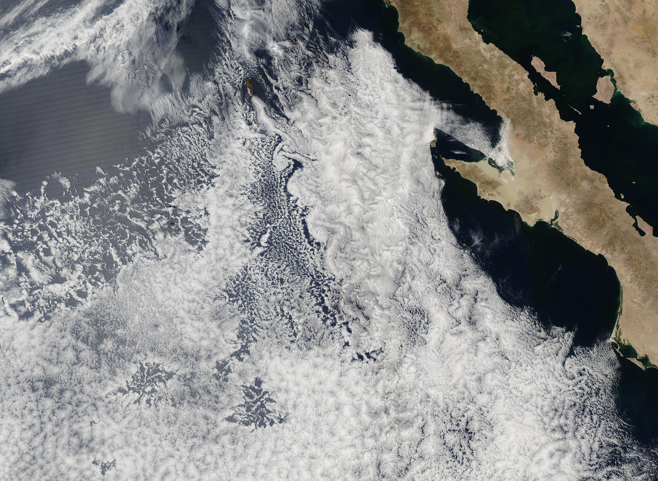
