
Images


April 28, 2025 - Clouds on the Black Sea
 Tweet
Tweet
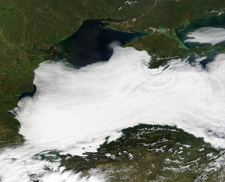
In late April 2025, a broad bank of cloud shrouded most of the Black Sea, hiding all but the northern-most section from satellite view. The Moderate Resolution Imaging Spectroradiometer (MODIS) on NASA’s Terra satellite acquired this true-color image of the scene on April 24.
The clouds are most likely primarily low cloud, otherwise known as fog, although in the eastern half of the image the cloud rises high enough to be twirled into a spiral by wind currents. A thin expanse of cloud that has the fine ground-glass appearance typical of fog also hangs over the Sea of Azov, in the upper right.
A study by Hakki Baltaci, Ph.D. et. al., published in the International Journal of Climatology in 2020, looked at fog in Türkiye, including fog events over the Black Sea. One finding discussed was that marine fog events were frequent in the spring. In the eastern Black Sea, this can create a “Black Sea-effect marine fog event” over the coastal regions as winds carry relatively cold and humid air over the warmer land mass along the eastern shoreline.
According to the U.S. National Weather Service, fog that forms over water (known as sea fog or lake fog) forms when warm, moist air flows over relatively colder waters. When conditions are right, such fog is common over lakes and oceans and nearby coastal areas. Since fog is simply clouds that lie close to the ground, sea fog can greatly reduce visibility and create hazards for boating traffic.
Image Facts
Satellite:
Terra
Date Acquired: 4/24/2025
Resolutions:
1km (959.8 KB), 500m (2.4 MB), 250m (4.7 MB)
Bands Used: 1,4,3
Image Credit:
MODIS Land Rapid Response Team, NASA GSFC
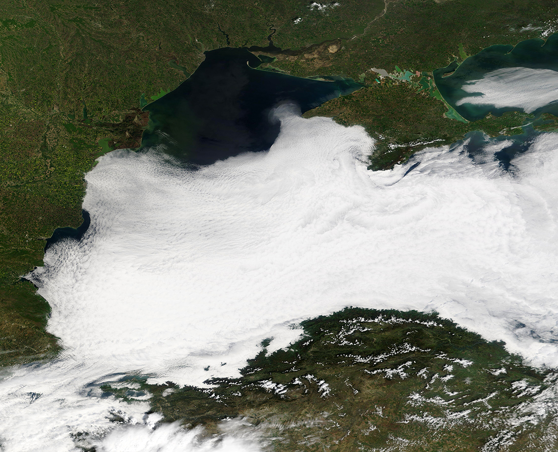
